- National Register of Historic Places listings in St. Joseph County, Indiana
-
 Location of St. Joseph County in Indiana
This is a list of the National Register of Historic Places listings in St. Joseph County, Indiana.
This is intended to be a complete list of the properties and districts on the National Register of Historic Places in St. Joseph County, Indiana, United States. Latitude and longitude coordinates are provided for many National Register properties and districts; these locations may be seen together in a Google map.[1]
There are 87 properties and districts listed on the National Register in the county, including 1 National Historic Landmark.
-
- This National Park Service list is complete through NPS recent listings posted November 10, 2011.[2]
Current listings
[3] Landmark name [4] Image Date listed Location City or town Summary 1 All American Bank Building June 5, 1985 111 W. Washington
41°40′36″N 86°15′02″W / 41.676667°N 86.250556°WSouth Bend 2 Battell Park Historic District January 11, 1996 Mishawaka Ave.
41°39′56″N 86°11′14″W / 41.665556°N 86.187222°WMishawaka 3 Beiger House August 28, 1973 317 E. Lincolnway
41°39′40″N 86°10′40″W / 41.661111°N 86.177778°WMishawaka 4 W.N. Bergan-J.C. Lauber Co. Building February 18, 1999 502-504 E. La Salle St.
41°40′44″N 86°14′40″W / 41.678889°N 86.244444°WSouth Bend 5 Berteling Building June 5, 1985 228 W. Colfax
41°40′39″N 86°15′12″W / 41.6775°N 86.253333°WSouth Bend 6 Blackstone-State Theater June 5, 1985 212 S. Michigan
41°40′28″N 86°15′00″W / 41.674444°N 86.25°WSouth Bend 7 Cathedral of St. James and Parish Hall June 5, 1985 115 and 117 N. Lafayette
41°40′36″N 86°15′13″W / 41.676667°N 86.253611°WSouth Bend 8 Central High School & Boys Vocational School June 5, 1985 115 N. James Court
41°40′37″N 86°15′17″W / 41.676944°N 86.254722°WSouth Bend 9 Chapin Park Historic District February 4, 1982 Roughly bounded by the St. Joseph River, Main, Madison, Rex, Lindsey, and William Sts., and Leland and Portage Aves.
41°41′06″N 86°15′19″W / 41.685°N 86.255278°WSouth Bend 10 Horatio Chapin House August 11, 1980 601 Park Ave.
41°41′00″N 86°15′19″W / 41.683333°N 86.255278°WSouth Bend 11 Children's Dispensary December 24, 1997 1045 W. Washington
41°40′35″N 86°15′58″W / 41.676389°N 86.266111°WSouth Bend 12 Citizens Bank June 5, 1985 112 W. Jefferson
41°40′29″N 86°15′03″W / 41.674722°N 86.250833°WSouth Bend 13 Colonial Gardens Commercial Historic District December 15, 1997 2919-3027 Mishawaka Ave.
41°39′57″N 86°12′19″W / 41.665833°N 86.205278°WSouth Bend 14 Commercial Building June 5, 1985 226 W. Colfax
41°40′39″N 86°15′11″W / 41.6775°N 86.253056°WSouth Bend 15 Dille-Probst House March 17, 1994 520 E. Colfax Ave.
41°40′39″N 86°14′36″W / 41.6775°N 86.243333°WSouth Bend 16 Dodge House September 8, 1978 415 E. Lincolnway
41°39′39″N 86°10′35″W / 41.660833°N 86.176389°WMishawaka 17 East Washington Street Historic District February 18, 1999 Roughly between E. Colfax and E. Washington Sts., St. Louis Ave., and Eddy St.
41°40′35″N 86°14′21″W / 41.676389°N 86.239167°WSouth Bend 18 Maurice Egan House February 18, 1999 1136 N. Notre Dame Ave.
41°41′27″N 86°14′18″W / 41.690833°N 86.238333°WSouth Bend 19 Eller-Hosford House January 27, 1983 722 E. Lincolnway
41°39′41″N 86°10′14″W / 41.661389°N 86.170556°WMishawaka 20 Ellis-Schindler House December 18, 1990 900 W. Lincolnway
41°39′39″N 86°11′30″W / 41.660833°N 86.191667°WMishawaka 21 Evergreen Hill April 25, 2001 59449 Keria Trail
41°37′51″N 86°16′05″W / 41.630833°N 86.268056°WSouth Bend 22 Farmers Security Bank 
June 5, 1985 133 S. Main St.
41°40′31″N 86°15′07″W / 41.675278°N 86.251944°WSouth Bend 23 Fire House No. 3 February 18, 1999 219 N. Hill St.
41°40′42″N 86°14′36″W / 41.678333°N 86.243333°WSouth Bend 24 Fire House No. 7 February 18, 1999 803 N. Notre Dame Ave.
41°41′10″N 86°14′18″W / 41.686111°N 86.238333°WSouth Bend 25 Former First Presbyterian Church June 5, 1985 101 S. Lafayette
41°40′34″N 86°15′13″W / 41.676111°N 86.253611°WSouth Bend 26 Hager House June 5, 1985 415 W. Wayne
41°40′26″N 86°15′20″W / 41.673889°N 86.255556°WSouth Bend 27 W.R. Hinkle and Co. June 5, 1985 225 N. Lafayette
41°40′43″N 86°15′14″W / 41.678611°N 86.253889°WSouth Bend 28 Martin Hoban House February 18, 1999 205 N. St. Louis Boulevard
41°40′41″N 86°14′30″W / 41.678056°N 86.241667°WSouth Bend 29 Hoffman Hotel June 5, 1985 120 W. LaSalle
41°40′44″N 86°15′04″W / 41.678889°N 86.251111°WSouth Bend 30 Howard Park Historic District February 18, 1999 Roughly between E. Jefferson and Wayne Sts., N. Eddy, and the St. Joseph River
41°40′25″N 86°14′32″W / 41.673611°N 86.242222°WSouth Bend 31 I&M Building June 5, 1985 220 W. Colfax
41°40′39″N 86°15′10″W / 41.6775°N 86.252778°WSouth Bend 32 I and M Electric Co. Building-Transformer House and Garage February 18, 1999 401 E. Colfax and 312 E. La Salle Sts.
41°40′44″N 86°14′42″W / 41.678889°N 86.245°WSouth Bend 33 J.M.S. Building June 5, 1985 108 N. Main
41°40′36″N 86°15′05″W / 41.676667°N 86.251389°WSouth Bend 34 James A. Judie House March 24, 1983 1515 E. Jefferson Boulevard
41°40′30″N 86°13′27″W / 41.675°N 86.224167°WSouth Bend 35 Kamm and Schellinger Brewery October 11, 1979 100 Center St.
41°39′45″N 86°11′25″W / 41.6625°N 86.190278°WMishawaka 36 Kelley-Fredrickson House and Office Building May 24, 1984 233 N. Lafayette Bouelvard and 314 W. LaSalle St.
41°40′44″N 86°15′13″W / 41.678889°N 86.253611°WSouth Bend 37 John G. Kerr Company June 5, 1985 121 W. Colfax
41°40′41″N 86°15′05″W / 41.678056°N 86.251389°WSouth Bend 38 Knights of Columbus-Indiana Club June 5, 1985 320 W. Jefferson
41°40′29″N 86°15′15″W / 41.674722°N 86.254167°WSouth Bend 39 Knights of Pythias Lodge June 5, 1985 224 W. Jefferson
41°40′29″N 86°15′11″W / 41.674722°N 86.253056°WSouth Bend 40 La Salle Street Bridge February 18, 1999 La Salle St., over the St. Joseph River
41°40′45″N 86°14′56″W / 41.679167°N 86.248889°WSouth Bend 41 Lakeville High School August 29, 1991 601 N. Michigan St.
41°31′52″N 86°16′25″W / 41.531111°N 86.273611°WLakeville 42 LaSalle Annex June 5, 1985 306 N. Michigan
41°40′46″N 86°15′00″W / 41.679444°N 86.25°WSouth Bend 43 LaSalle Hotel June 5, 1985 237 N. Michigan
41°40′44″N 86°15′02″W / 41.678889°N 86.250556°WSouth Bend 44 Chauncey N. Lawton House June 23, 1983 405 W. Wayne St.
41°40′26″N 86°15′17″W / 41.673889°N 86.254722°WSouth Bend 45 Leeper Park June 15, 2000 Roughly bounded by the St. Joseph River, Park Ln., and Bartlett St.
41°41′11″N 86°15′07″W / 41.686389°N 86.251944°WSouth Bend 46 Samuel Leeper Jr. House March 21, 1985 113 W. North Shore Dr.
41°41′20″N 86°15′03″W / 41.688889°N 86.250833°WSouth Bend 47 Charles McCormick Building February 25, 1999 526-532 E. Colfax Ave.
41°40′40″N 86°14′36″W / 41.677778°N 86.243333°WSouth Bend 48 Merrifield-Cass House June 16, 1983 816 E. Lincolnway
41°39′41″N 86°10′28″W / 41.661389°N 86.174444°WMishawaka 49 Mishawaka Carnegie Library August 14, 1998 122 North Hill
41°39′41″N 86°11′04″W / 41.661389°N 86.184444°WMishawaka 50 Mishawaka Reservoir Caretaker's Residence August 14, 1998 16581 Chandler Boulevard
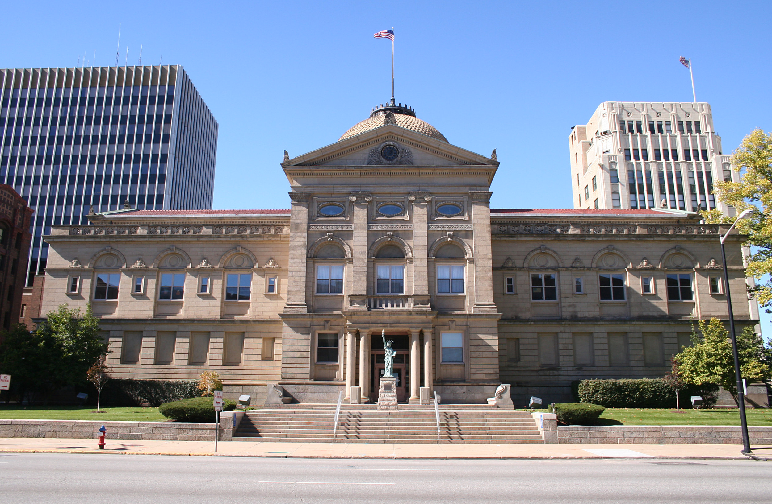
41°38′19″N 86°11′04″W / 41.638611°N 86.184444°WMishawaka 51 Morey House June 5, 1985 110-112 Franklin Pl.
41°40′33″N 86°15′16″W / 41.675833°N 86.254444°WSouth Bend 52 Morey-Lampert House June 5, 1985 322 Washington
41°40′34″N 86°15′16″W / 41.676111°N 86.254444°WSouth Bend 53 Muessel-Drewry's Brewery December 28, 2000 1408 Elwood Ave.
41°41′37″N 86°16′19″W / 41.693611°N 86.271944°WSouth Bend 54 New Carlisle Historic District 
December 14, 1992 Roughly bounded by Front, Arch, Chestnut, and Bray Sts.
41°42′22″N 86°30′37″W / 41.706111°N 86.510278°WNew Carlisle 55 Normain Heights Historic District March 20, 2002 Roughly 2300-2900 N. Main, 2300-2800 Normandy, and the 100-200 blocks of E. Ardennes, Palau, Bastogne, Leyte, Saint Lo, and Guam
41°41′03″N 86°10′47″W / 41.684167°N 86.179722°WMishawaka 56 North Liberty Park March 29, 2007 309 N. Jefferson St. North Liberty 57 North Pumping Station January 2, 1997 830 N. Michigan Ave.
41°41′10″N 86°15′01″W / 41.686111°N 86.250278°WSouth Bend 58 Northern Indiana Gas and Electric Company Building June 5, 1985 221 N. Michigan
41°40′43″N 86°15′02″W / 41.678611°N 86.250556°WSouth Bend 59 Northside Boulevard Riverwall September 27, 2006 600-1100 Northside Boulevard
41°40′07″N 86°14′20″W / 41.668611°N 86.238889°WSouth Bend 60 O'Brien Electric Priming Company December 28, 1983 2001 W. Washington St.
41°40′39″N 86°16′41″W / 41.6775°N 86.278056°WSouth Bend 61 Old Courthouse (Second St. Joseph County Courthouse) 
September 4, 1970 112 S. Lafayette Boulevard
41°38′58″N 86°15′00″W / 41.649444°N 86.25°WSouth Bend 62 Joseph D. Oliver House August 28, 1973 808 W. Washington Ave.
41°40′33″N 86°15′42″W / 41.675833°N 86.261667°WSouth Bend 63 Palace Theater June 5, 1985 211 N. Michigan
41°40′42″N 86°15′02″W / 41.678333°N 86.250556°WSouth Bend 64 Palais Royale Building July 21, 1983 113-105 W. Colfax Ave. and 201-209 N. Michigan St.
41°40′40″N 86°15′01″W / 41.677778°N 86.250278°WSouth Bend 65 St. Casimir Parish Historic District January 16, 1997 Roughly bounded by Arnold and W. Sample Sts. and the former Conrail tracks
41°40′01″N 86°16′16″W / 41.666944°N 86.271111°WSouth Bend 66 St. Joseph County Infirmary June 15, 2000 3016 Portage Ave.
41°43′11″N 86°16′45″W / 41.719722°N 86.279167°WSouth Bend 67 St. Joseph School February 18, 1999 210 N. Hill St.
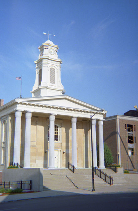
41°40′41″N 86°14′33″W / 41.678056°N 86.2425°WSouth Bend 68 Second St. Joseph Hotel June 5, 1985 117-119 W. Colfax
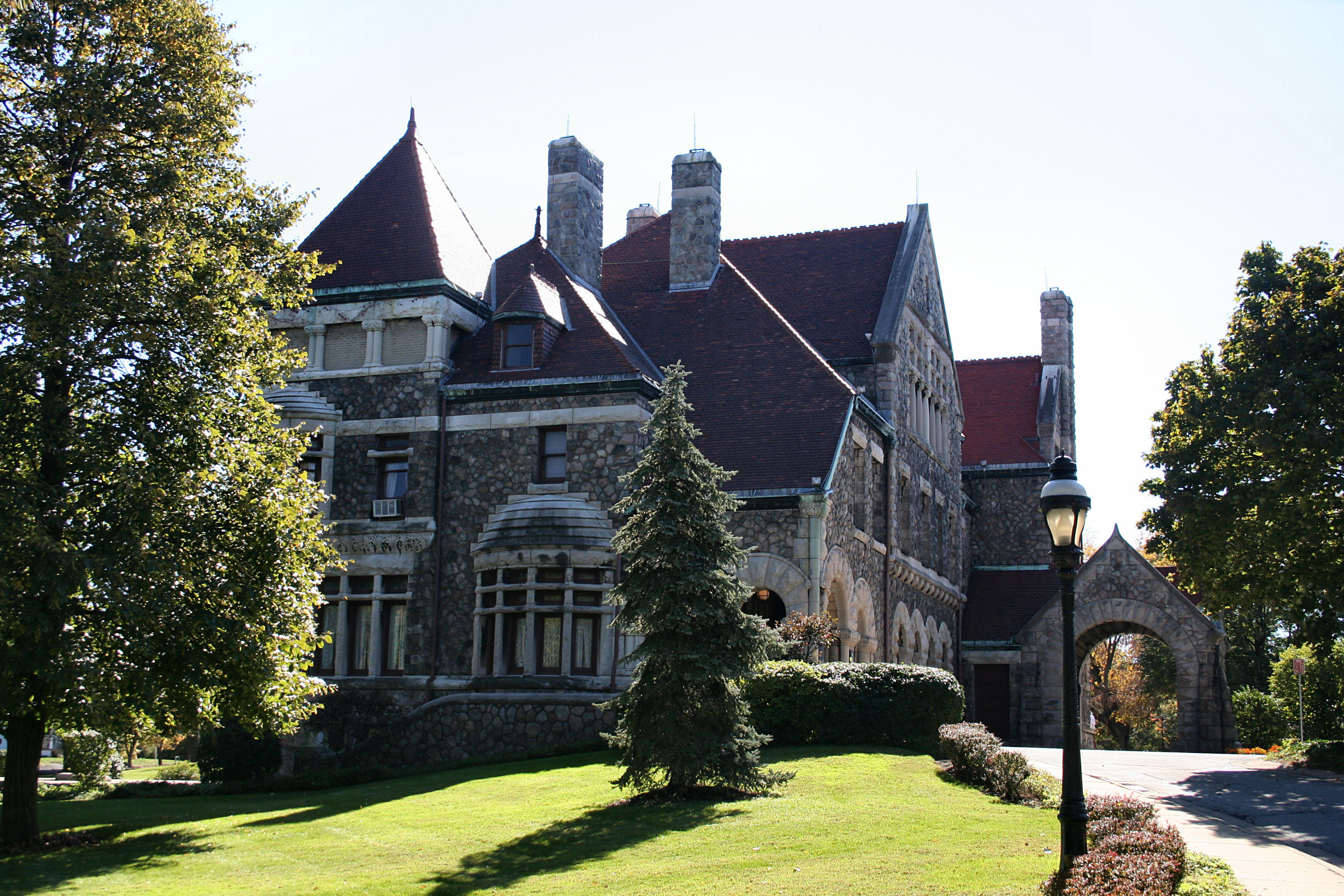
41°40′41″N 86°15′04″W / 41.678056°N 86.251111°WSouth Bend 69 Jeremiah H. Service House March 15, 2000 302 E. Michigan St.
41°42′22″N 86°30′16″W / 41.706111°N 86.504444°WNew Carlisle 70 Singer Manufacturing-South Bend Lathe Co. Historic District February 18, 1999 Madison St. between N. Niles Ave. and the St. Joseph River
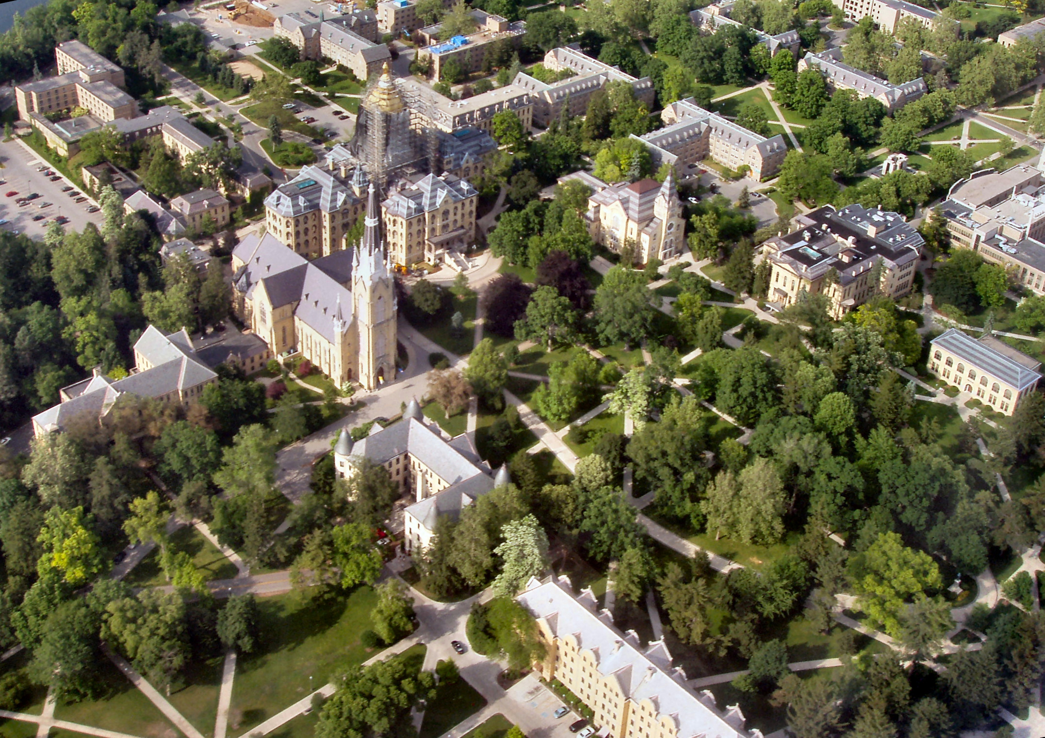
41°40′56″N 86°14′46″W / 41.682222°N 86.246111°WSouth Bend 71 Sommerer House February 18, 1999 415 Parry St.
41°40′19″N 86°14′10″W / 41.671944°N 86.236111°WSouth Bend 72 South Bend Brewing Association September 16, 2001 1636 W. Lincolnway
41°41′08″N 86°16′32″W / 41.685556°N 86.275556°WSouth Bend 73 South Bend Remedy Company June 5, 1985 220 W. LaSalle
41°40′44″N 86°15′10″W / 41.678889°N 86.252778°WSouth Bend 74 South Bend Remedy Company Building September 16, 2001 501 W. Colfax
41°40′41″N 86°16′07″W / 41.678056°N 86.268611°WSouth Bend 75 South Michigan Street Historic District December 15, 1997 Roughly along the junction of Monroe and Michigan Sts.
41°40′15″N 86°15′00″W / 41.670833°N 86.25°WSouth Bend 76 Stephenson Underwear Mill September 28, 1995 322 E. Colfax Ave.
41°40′39″N 86°14′55″W / 41.6775°N 86.248611°WSouth Bend 77 Studebaker Clubhouse and Tree Sign September 18, 1985 32132 State Road 2 (in Bendix Woods County Park)
41°40′08″N 86°29′25″W / 41.668889°N 86.490278°WNew Carlisle 78 Summers-Longley House-Building June 5, 1985 312-314 W. Colfax
41°40′39″N 86°15′14″W / 41.6775°N 86.253889°WSouth Bend 79 Third St. Joseph County Courthouse 
June 5, 1985 105 S. Main St.
41°40′33″N 86°15′08″W / 41.675833°N 86.252222°WSouth Bend 80 Tippecanoe Place 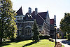
July 2, 1973 620 W. Washington Ave.
41°40′33″N 86°15′34″W / 41.675833°N 86.259444°WSouth Bend 81 Tower Building June 5, 1985 216 W. Washington
41°40′34″N 86°15′10″W / 41.676111°N 86.252778°WSouth Bend 82 University of Notre Dame: Main and South Quadrangles 
May 23, 1978 Off Interstates 80/90
41°42′07″N 86°14′26″W / 41.701944°N 86.240556°WNotre Dame 83 Walker Field Shelterhouse September 27, 2006 1305 Ewing Ave.
41°39′02″N 86°16′10″W / 41.650556°N 86.269444°WSouth Bend 84 Water Street/Darden Road Bridge March 21, 1985 Over the St. Joseph River at Darden Rd.
41°43′49″N 86°16′07″W / 41.730278°N 86.268611°WSouth Bend 85 Martin Wenger Farmhouse June 22, 2000 701 E. Pennsylvania
41°39′41″N 86°14′27″W / 41.661389°N 86.240833°WSouth Bend 86 Wertz-Bestle Farm April 12, 2001 51387 Portage Rd.
41°44′46″N 86°18′03″W / 41.746111°N 86.300833°WSouth Bend 87 West Washington Historic District January 17, 1975 Irregular pattern roughly bounded by Main St., Western Ave., W. LaSalle Ave., and McPherson St.
41°40′32″N 86°15′30″W / 41.675556°N 86.258333°WSouth Bend See also
- List of National Historic Landmarks in Indiana
- National Register of Historic Places listings in Indiana
References
- ^ The latitude and longitude information provided in this table was derived originally from the National Register Information System, which has been found to be fairly accurate for about 99% of listings. For about 1% of NRIS original coordinates, experience has shown that one or both coordinates are typos or otherwise extremely far off; some corrections may have been made. A more subtle problem causes many locations to be off by up to 150 yards, depending on location in the country: most NRIS coordinates were derived from tracing out latitude and longitudes off of USGS topographical quadrant maps created under the North American Datum of 1927, which differs from the current, highly accurate WGS84 GPS system used by Google maps. Chicago is about right, but NRIS longitudes in Washington are higher by about 4.5 seconds, and are lower by about 2.0 seconds in Maine. Latitudes differ by about 1.0 second in Florida. Some locations in this table may have been corrected to current GPS standards.
- ^ "National Register of Historic Places: Weekly List Actions". National Park Service, United States Department of the Interior. Retrieved on November 10, 2011.
- ^ Numbers represent an ordering by significant words. Various colorings, defined here, differentiate National Historic Landmark sites and National Register of Historic Places Districts from other NRHP buildings, structures, sites or objects.
- ^ "National Register Information System". National Register of Historic Places. National Park Service. . http://nrhp.focus.nps.gov/natreg/docs/All_Data.html.
U.S. National Register of Historic Places Topics Lists by states Alabama • Alaska • Arizona • Arkansas • California • Colorado • Connecticut • Delaware • Florida • Georgia • Hawaii • Idaho • Illinois • Indiana • Iowa • Kansas • Kentucky • Louisiana • Maine • Maryland • Massachusetts • Michigan • Minnesota • Mississippi • Missouri • Montana • Nebraska • Nevada • New Hampshire • New Jersey • New Mexico • New York • North Carolina • North Dakota • Ohio • Oklahoma • Oregon • Pennsylvania • Rhode Island • South Carolina • South Dakota • Tennessee • Texas • Utah • Vermont • Virginia • Washington • West Virginia • Wisconsin • WyomingLists by territories Lists by associated states Other Municipalities and communities of St. Joseph County, Indiana Cities 
Towns Indian Village | Lakeville | New Carlisle | North Liberty | Osceola | Roseland | Walkerton
Townships CDPs Unincorporated
communitiesCategories:- National Register of Historic Places in St. Joseph County, Indiana
- National Register of Historic Places in Indiana by county
-


Wikimedia Foundation. 2010.