- National Register of Historic Places listings in Daviess County, Indiana
-
 Location of Daviess County in Indiana
This is a list of the National Register of Historic Places listings in Daviess County, Indiana.
This is intended to be a complete list of the properties and districts on the National Register of Historic Places in Daviess County, Indiana, United States. Latitude and longitude coordinates are provided for many National Register properties and districts; these locations may be seen together in a Google map.[1]
There are 12 properties and districts listed on the National Register in the county.
-
- This National Park Service list is complete through NPS recent listings posted November 10, 2011.[2]
Current listings
[3] Landmark name [4] Image Date listed Location City or town Summary 1 Magnus J. Carnahan House 
August 29, 1991 511 E. Main St.
38°39′23″N 87°10′11″W / 38.656389°N 87.169722°WWashington 2 County Bridge No. 45 
September 20, 2006 Carries County Road 150N over the White River
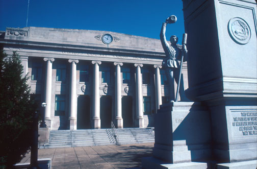
38°40′47″N 87°16′20″W / 38.679722°N 87.272222°WWheatland Extends into Knox County 3 Daviess County Courthouse 
September 17, 2008 200 E. Walnut St.
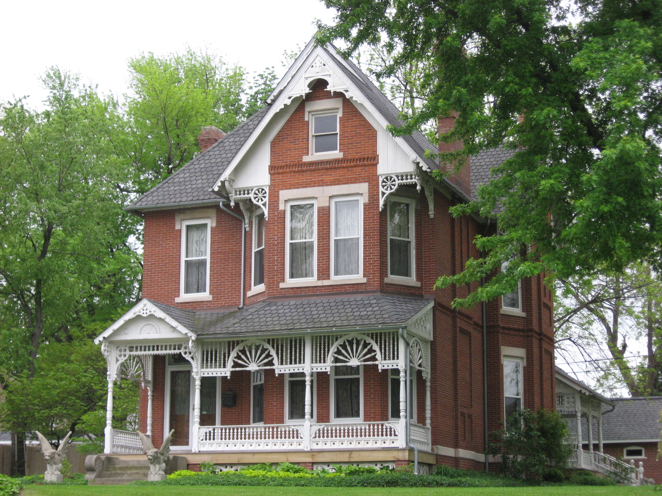
38°39′32″N 87°10′22″W / 38.658889°N 87.172778°WWashington 4 Thomas Faith House 
March 28, 1994 1208 Bedford Rd.
38°39′38″N 87°09′40″W / 38.660556°N 87.161111°WWashington 5 Glendale River Archaeological Site (12 Da 86) May 30, 1985 Address Restricted Hudsonville 6 Robert C. Graham House 
March 16, 1983 101 W. Maple St.
38°39′43″N 87°10′42″W / 38.661944°N 87.178333°WWashington 7 Jefferson Elementary School June 20, 1997 Donaldson Rd., 0.25 miles east of State Road 57
38°38′03″N 87°10′22″W / 38.634167°N 87.172778°WWashington 8 Old Union Church and Cemetery June 17, 2005 1125E, approximately 3/8 miles south of its junction with 700S
38°32′56″N 86°57′22″W / 38.548889°N 86.956111°WAlfordsville 9 Prairie Creek Site May 12, 1975 Southeastern bank of Prairie Creek, 1.5 kilometres (0.93 mi) below the western edge of the Thousand Acre Woods
38°43′4″N 87°9′55″W / 38.71778°N 87.16528°W[5]Washington 10 Dr. John A. Scudder House 
September 14, 1995 612 E. Main St.
38°39′26″N 87°10′05″W / 38.657222°N 87.168056°WWashington 11 Washington Commercial Historic District 
November 28, 1990 Roughly bounded by 4th, Hefron, and Meridian Sts. and the CSX railroad line
38°39′27″N 87°10′22″W / 38.6575°N 87.172778°WWashington 12 Dr. Nelson Wilson House 
June 27, 2008 103 E. National Highway
38°39′09″N 87°10′29″W / 38.652611°N 87.174611°WWashington See also
- List of National Historic Landmarks in Indiana
- National Register of Historic Places listings in Indiana
References
- ^ The latitude and longitude information provided in this table was derived originally from the National Register Information System, which has been found to be fairly accurate for about 99% of listings. For about 1% of NRIS original coordinates, experience has shown that one or both coordinates are typos or otherwise extremely far off; some corrections may have been made. A more subtle problem causes many locations to be off by up to 150 yards, depending on location in the country: most NRIS coordinates were derived from tracing out latitude and longitudes off of USGS topographical quadrant maps created under the North American Datum of 1927, which differs from the current, highly accurate WGS84 GPS system used by Google maps. Chicago is about right, but NRIS longitudes in Washington are higher by about 4.5 seconds, and are lower by about 2.0 seconds in Maine. Latitudes differ by about 1.0 second in Florida. Some locations in this table may have been corrected to current GPS standards.
- ^ "National Register of Historic Places: Weekly List Actions". National Park Service, United States Department of the Interior. Retrieved on November 10, 2011.
- ^ Numbers represent an ordering by significant words. Various colorings, defined here, differentiate National Historic Landmark sites and National Register of Historic Places Districts from other NRHP buildings, structures, sites or objects.
- ^ "National Register Information System". National Register of Historic Places. National Park Service. . http://nrhp.focus.nps.gov/natreg/docs/All_Data.html.
- ^ Location derived from Tomak, Curtis H. "Prairie Creek: A Stratified Site in Southwestern Indiana." Proceedings of the Indiana Academy of Science 84 (1974): 65-68. The NRIS lists the site as "Address Restricted".
U.S. National Register of Historic Places Topics Lists by states Alabama • Alaska • Arizona • Arkansas • California • Colorado • Connecticut • Delaware • Florida • Georgia • Hawaii • Idaho • Illinois • Indiana • Iowa • Kansas • Kentucky • Louisiana • Maine • Maryland • Massachusetts • Michigan • Minnesota • Mississippi • Missouri • Montana • Nebraska • Nevada • New Hampshire • New Jersey • New Mexico • New York • North Carolina • North Dakota • Ohio • Oklahoma • Oregon • Pennsylvania • Rhode Island • South Carolina • South Dakota • Tennessee • Texas • Utah • Vermont • Virginia • Washington • West Virginia • Wisconsin • WyomingLists by territories Lists by associated states Other Municipalities and communities of Daviess County, Indiana City 
Towns Alfordsville | Cannelburg | Crane | Elnora | Montgomery | Odon | Plainville
Townships Unincorporated
communitiesBlack Oak | Capehart | Cornettsville | Corning | Cumback | Epsom | Farlen | Glendale | Graham | Hudsonville | Jordan | Maysville | Pennyville | Raglesville | South Washington | Thomas | Waco
Categories:- Daviess County, Indiana
- National Register of Historic Places in Indiana by county
-


Wikimedia Foundation. 2010.