- National Register of Historic Places listings in Clinton County, Indiana
-
 Location of Clinton County in Indiana
This is a list of the National Register of Historic Places listings in Clinton County, Indiana.
This is intended to be a complete list of the properties and districts on the National Register of Historic Places in Clinton County, Indiana, United States. Latitude and longitude coordinates are provided for many National Register properties and districts; these locations may be seen together in a Google map.[1]
There are 10 properties and districts listed on the National Register in the county.
-
- This National Park Service list is complete through NPS recent listings posted November 10, 2011.[2]
Current listings
[3] Landmark name [4] Image Date listed Location City or town Summary 1 Christian Ridge Historic District June 22, 2003 Roughly bounded by Prairie Creek, Young and E. Washington Sts., and Harvard Terr.
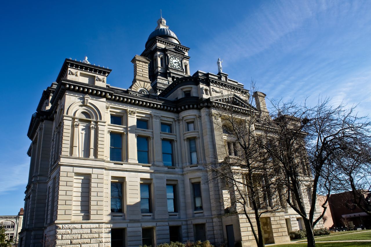
40°16′43″N 86°30′21″W / 40.278611°N 86.505833°WFrankfort 2 Clinton County Courthouse 
December 5, 1978 Public Square
40°16′52″N 86°30′40″W / 40.281111°N 86.511111°WFrankfort 3 Colfax Carnegie Library March 17, 1994 207 S. Clark St.
40°11′36″N 86°39′58″W / 40.193333°N 86.666111°WColfax 4 Charles H. and Emma Condon House 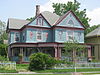
January 2, 1997 603 S. Jackson St.
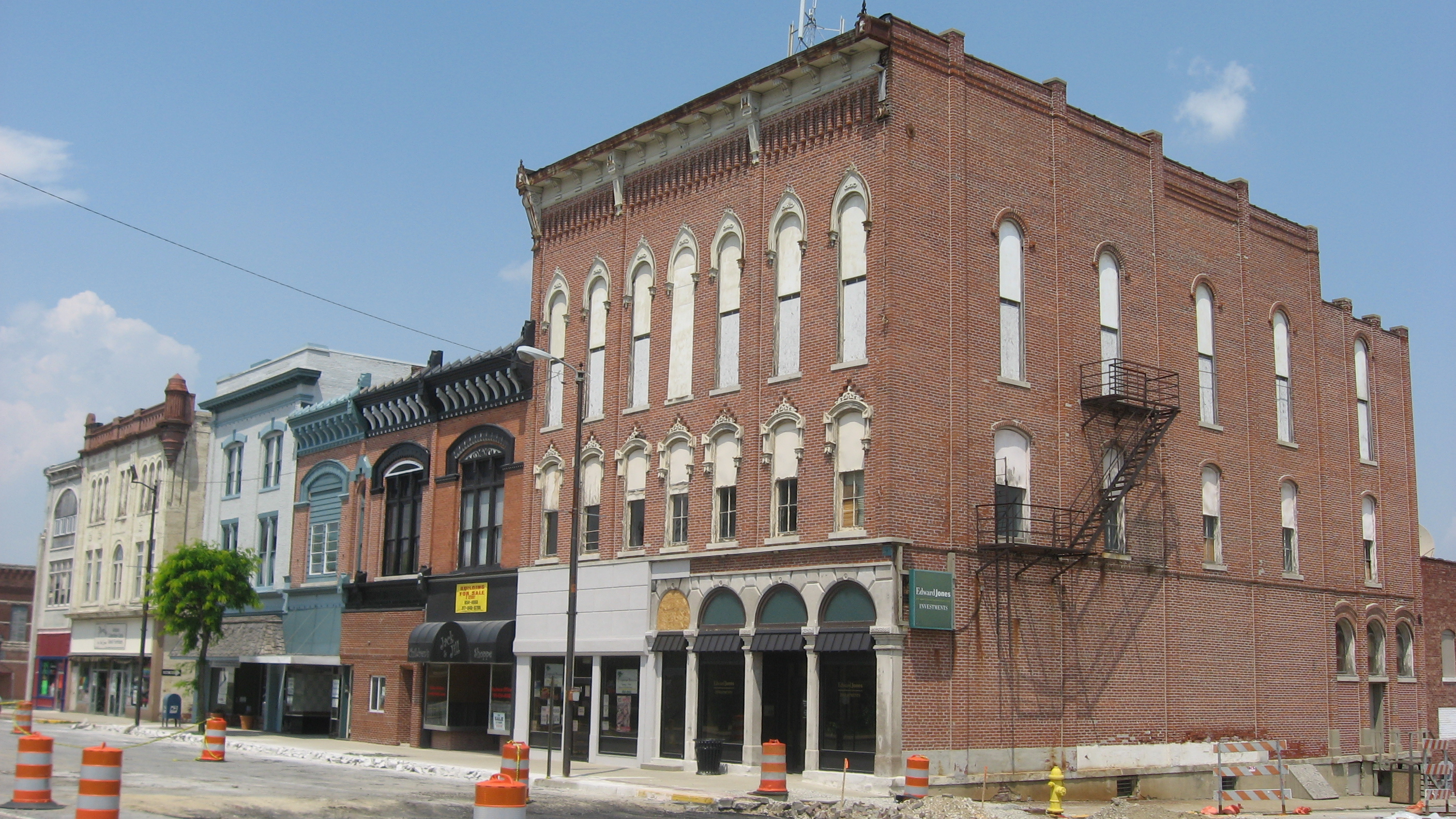
40°16′33″N 86°30′36″W / 40.275833°N 86.51°WFrankfort 5 Frankfort Commercial Historic District 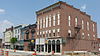
August 14, 1998 Roughly bounded by Walnut, Columbia, and Morrison Sts. and Prairie Creek
40°16′54″N 86°30′42″W / 40.281667°N 86.511667°WFrankfort 6 Kirklin Public Library March 3, 1995 115 N. Main St.
40°11′36″N 86°21′37″W / 40.193333°N 86.360278°WKirklin 7 Old Frankfort Stone High School 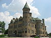
June 4, 1979 301 E. Clinton
40°16′48″N 86°30′32″W / 40.28°N 86.508889°WFrankfort 8 Rosenberger Building May 3, 1984 83 Old Main St.
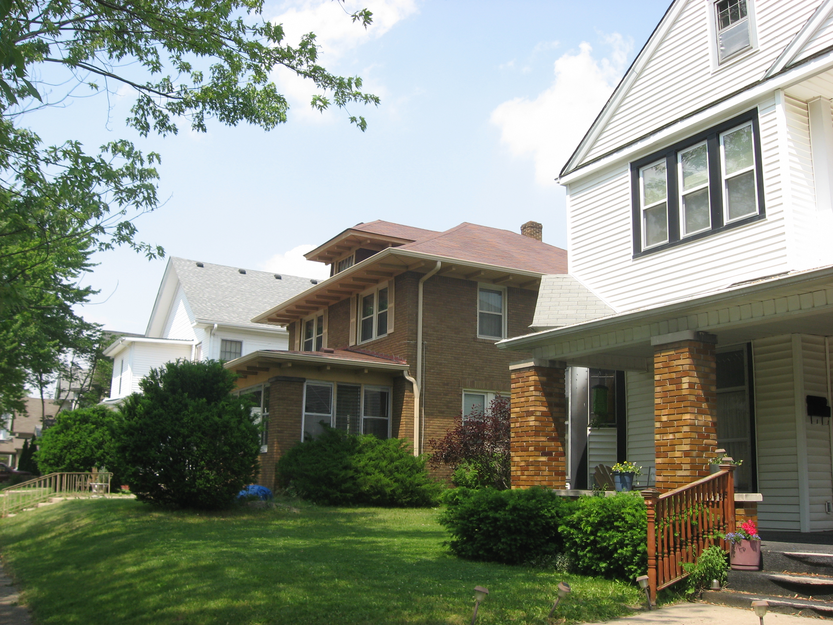
40°11′25″N 86°39′49″W / 40.190278°N 86.663611°WColfax 9 South Frankfort Historic District 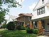
June 17, 2009 Roughly between Walnut St., Prairie Creek, and Meredith and Columbia Sts.
40°16′35″N 86°30′40″W / 40.276308°N 86.511225°WFrankfort 10 John Young House 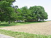
November 25, 1994 9665 N. County Road 250E
40°25′36″N 86°27′31″W / 40.426667°N 86.458611°WGeetingsville See also
- List of National Historic Landmarks in Indiana
- National Register of Historic Places listings in Indiana
References
- ^ The latitude and longitude information provided in this table was derived originally from the National Register Information System, which has been found to be fairly accurate for about 99% of listings. For about 1% of NRIS original coordinates, experience has shown that one or both coordinates are typos or otherwise extremely far off; some corrections may have been made. A more subtle problem causes many locations to be off by up to 150 yards, depending on location in the country: most NRIS coordinates were derived from tracing out latitude and longitudes off of USGS topographical quadrant maps created under the North American Datum of 1927, which differs from the current, highly accurate WGS84 GPS system used by Google maps. Chicago is about right, but NRIS longitudes in Washington are higher by about 4.5 seconds, and are lower by about 2.0 seconds in Maine. Latitudes differ by about 1.0 second in Florida. Some locations in this table may have been corrected to current GPS standards.
- ^ "National Register of Historic Places: Weekly List Actions". National Park Service, United States Department of the Interior. Retrieved on November 10, 2011.
- ^ Numbers represent an ordering by significant words. Various colorings, defined here, differentiate National Historic Landmark sites and National Register of Historic Places Districts from other NRHP buildings, structures, sites or objects.
- ^ "National Register Information System". National Register of Historic Places. National Park Service. . http://nrhp.focus.nps.gov/natreg/docs/All_Data.html.
U.S. National Register of Historic Places Topics Lists by states Alabama • Alaska • Arizona • Arkansas • California • Colorado • Connecticut • Delaware • Florida • Georgia • Hawaii • Idaho • Illinois • Indiana • Iowa • Kansas • Kentucky • Louisiana • Maine • Maryland • Massachusetts • Michigan • Minnesota • Mississippi • Missouri • Montana • Nebraska • Nevada • New Hampshire • New Jersey • New Mexico • New York • North Carolina • North Dakota • Ohio • Oklahoma • Oregon • Pennsylvania • Rhode Island • South Carolina • South Dakota • Tennessee • Texas • Utah • Vermont • Virginia • Washington • West Virginia • Wisconsin • WyomingLists by territories Lists by associated states Other Municipalities and communities of Clinton County, Indiana City 
Towns Colfax | Kirklin | Michigantown | Mulberry | Rossville
Townships Unincorporated
communitiesAntioch | Avery | Beard | Boyleston | Cambria | Cyclone | East Park | Edna Mills | Fickle | Forest | Geetingsville | Hamilton | Hillisburg | Jefferson | Kilmore | Manson | Mattix Corner | Middlefork | Moran | Pickard | Reagan | Risse | Scircleville | Sedalia | Wesley Manor | Woodside Park
Categories:- Clinton County, Indiana
- National Register of Historic Places in Indiana by county
-


Wikimedia Foundation. 2010.