- Michigantown, Indiana
-
Michigantown, Indiana — Town — Location of Michigantown in the state of Indiana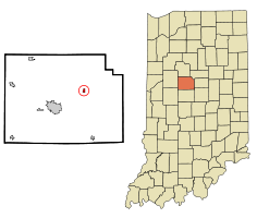
Coordinates: 40°19′41″N 86°23′32″W / 40.32806°N 86.39222°WCoordinates: 40°19′41″N 86°23′32″W / 40.32806°N 86.39222°W Country United States State Indiana County Clinton Township Michigan Founded 1830 Area - Total 0.3 sq mi (0.7 km2) - Land 0.3 sq mi (0.7 km2) - Water 0.0 sq mi (0.0 km2) Elevation 876 ft (267 m) Population (2010) - Total 467 - Density 1,533.6/sq mi (592.1/km2) Time zone Eastern (EST) (UTC-5) - Summer (DST) EDT (UTC-4) ZIP code 46057 Area code(s) 765 FIPS code 18-48816[1] GNIS feature ID 0439080[2] Michigantown is a town in Michigan Township, Clinton County, Indiana, United States. The population was estimated at 407 persons as of a 2009 population estimate by the U.S. Census Bureau. The town was named for the Michigan Road, an early thoroughfare through the area.[3]
Contents
History
Joseph Hill and Robert Edwards platted Michigantown in 1830 with lots on both sides of the Michigan Road; additions made in 1874 and 1876 by William Lowden added more lots to the north, bringing the edge of town up to what was then the Frankfort and Kokomo Railroad (later the Toledo, St. Louis and Western). In 1912 the Marion, Kokomo and Frankfort Electric Railroad built a line that paralleled the other through town.
Michigantown was incorporated in the early 1870s. The northern part of town was sometimes referred to as Lowdenville.[4]
Geography
Michigantown is located at 40°19′41″N 86°23′32″W / 40.32806°N 86.39222°W (40.328070, -86.392275)[5]. A Norfolk Southern Railway line crosses the northern edge of town and connects the cities of Frankfort and Kokomo.
According to the United States Census Bureau, the town has a total area of 0.3 square miles (0.78 km2), all of it land.
Demographics
As of the census[1] of 2000, there were 406 people, 155 households, and 117 families residing in the town. The population density was 1,533.6 people per square mile (602.9/km²). There were 164 housing units at an average density of 619.5 per square mile (243.5/km²). The racial makeup of the town was 99.26% White, 0.25% Native American, 0.25% from other races, and 0.25% from two or more races. Hispanic or Latino of any race were 0.74% of the population.
There were 155 households out of which 41.3% had children under the age of 18 living with them, 54.8% were married couples living together, 18.1% had a female householder with no husband present, and 24.5% were non-families. 22.6% of all households were made up of individuals and 14.2% had someone living alone who was 65 years of age or older. The average household size was 2.62 and the average family size was 3.03.
In the town the population was spread out with 30.0% under the age of 18, 6.7% from 18 to 24, 31.3% from 25 to 44, 16.5% from 45 to 64, and 15.5% who were 65 years of age or older. The median age was 34 years. For every 100 females there were 88.8 males. For every 100 females age 18 and over, there were 79.7 males.
The median income for a household in the town was $37,500, and the median income for a family was $45,625. Males had a median income of $32,656 versus $23,750 for females. The per capita income for the town was $21,102. About 2.5% of families and 5.0% of the population were below the poverty line, including 5.0% of those under age 18 and none of those age 65 or over.
References
- ^ a b "American FactFinder". United States Census Bureau. http://factfinder.census.gov. Retrieved 2008-01-31.
- ^ "US Board on Geographic Names". United States Geological Survey. 2007-10-25. http://geonames.usgs.gov. Retrieved 2008-01-31.
- ^ Claybaugh, Joseph (1913). History of Clinton County, Indiana. Indianapolis: A. W. Bowen & Company. pp. 31.
- ^ Claybaugh, Joseph (1913). "Michigan Township". History of Clinton County, Indiana. Indianapolis: A. W. Bowen & Company.
- ^ "US Gazetteer files: 2010, 2000, and 1990". United States Census Bureau. 2011-02-12. http://www.census.gov/geo/www/gazetteer/gazette.html. Retrieved 2011-04-23.
Municipalities and communities of Clinton County, Indiana County seat: Frankfort City 
Towns Townships Unincorporated
communitiesAntioch | Avery | Beard | Boyleston | Cambria | Cyclone | East Park | Edna Mills | Fickle | Forest | Geetingsville | Hamilton | Hillisburg | Jefferson | Kilmore | Manson | Mattix Corner | Middlefork | Moran | Pickard | Reagan | Risse | Scircleville | Sedalia | Wesley Manor | Woodside Park
Categories:- Populated places in Clinton County, Indiana
- Towns in Indiana
- Populated places established in 1830

Wikimedia Foundation. 2010.