- Rossville, Indiana
Infobox Settlement
official_name = Rossville, Indiana
settlement_type =Town
nickname =
motto =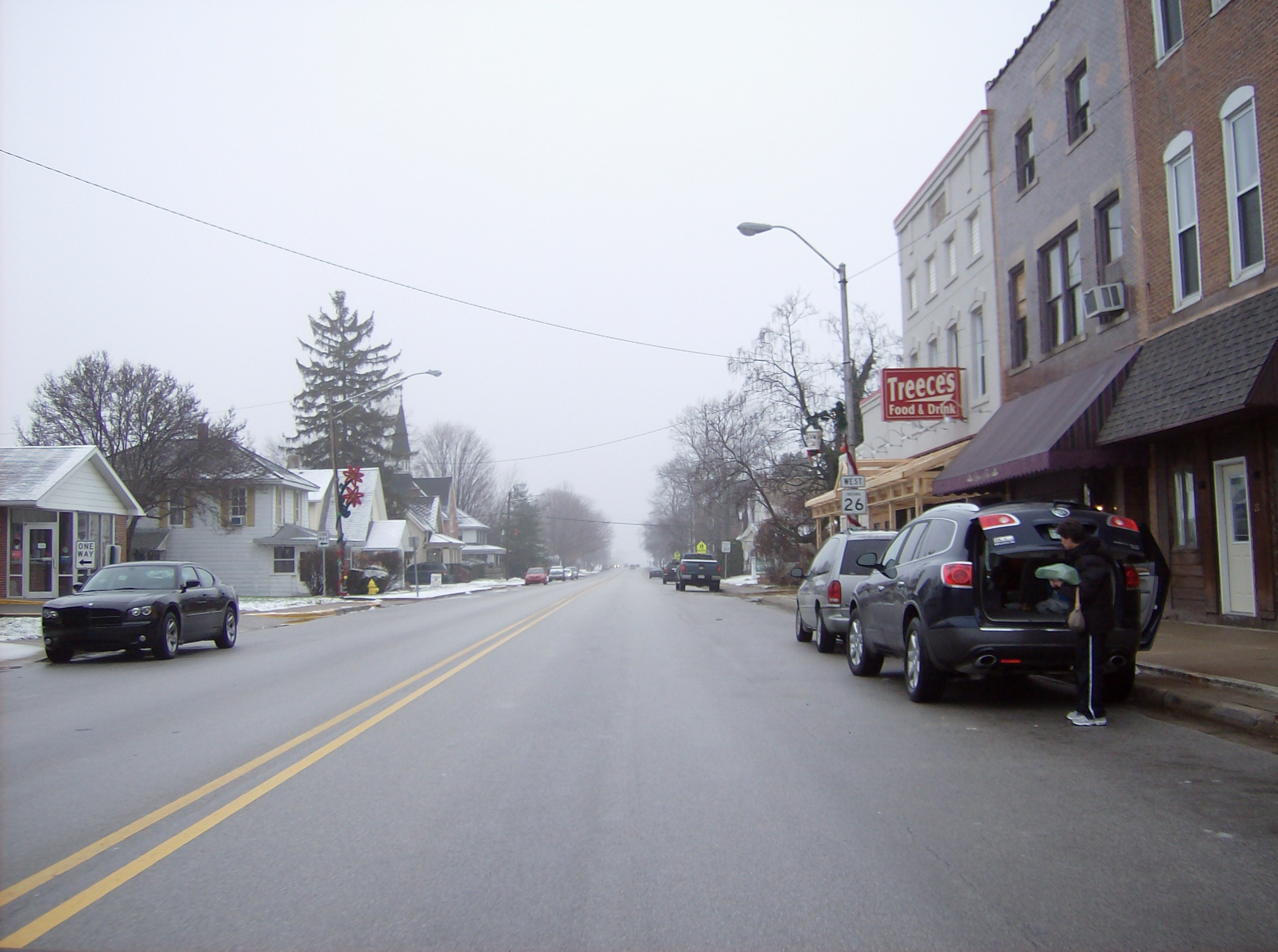
imagesize = 250px
image_caption = Westbound along Main Street in downtown Rossville
image_
image_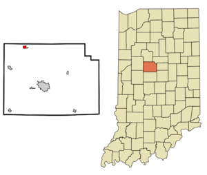
mapsize = 250px
map_caption = Location of Rossville in the state ofIndiana
mapsize1 =
map_caption1 =subdivision_type = Country
subdivision_name =United States
subdivision_type1 = State
subdivision_name1 =Indiana
subdivision_type2 = County
subdivision_name2 = Clinton
subdivision_type3 = Township
subdivision_name3 = Ross
government_footnotes =
government_type =
leader_title =
leader_name =
leader_title1 =
leader_name1 =
established_title = Founded
established_date =1832
established_title2 = Incorporated
established_date2 =1870
named_for = John Ross, settlerarea_footnotes =
unit_pref = Imperial
area_magnitude =
area_total_km2 = 1.3
area_land_km2 = 1.3
area_water_km2 = 0.0
area_total_sq_mi = 0.5
area_land_sq_mi = 0.5
area_water_sq_mi = 0.0population_as_of = 2000
population_footnotes =
population_total = 1513
population_density_km2 = 1131.2
population_density_sq_mi = 2929.8timezone = Eastern (EST)
utc_offset = -5
timezone_DST = EDT
utc_offset_DST = -4
elevation_footnotes =
elevation_m = 221
elevation_ft = 725
latd = 40 |latm = 25 |lats = 9 |latNS = N
longd = 86 |longm = 35 |longs = 47 |longEW = Wpostal_code_type =
ZIP code
postal_code = 46065
area_code = 765
blank_name = FIPS code
blank_info = 18-66150GR|2
blank1_name = GNIS feature ID
blank1_info = 0442329GR|3
website =
footnotes =Rossville is a town in Ross Township, Clinton County,
Indiana ,United States . The population was 1,513 at the 2000 census. The town is named for John Ross, a pioneer settler and associate county judge.cite book
last=Claybaugh
first=Joseph
title=History of Clinton County, Indiana
year=1913
publisher=A. W. Bowen & Company
location=Indianapolis
pages=p. 31]History
In 1832, Thomas Ewing with his wife and infant child came to Clinton County and located on the site of Rossville, entering 160 acres of land north of what is now Main Street. In 1834, Mr. Ewing and Thomas Smith platted the town of Rossville with the intention of starting a blacksmith shop at the location. The town grew steadily and gained a store operated by William Seawright, a saddler (John H. Smith) and a physician (Dr. James Wilson).
A petition to incorporate the town was filed on October 22, 1870, at which time the town has 339 residents and 66 families. The incorporation election, held November 5, passed with a vote of 35 to 19 and on December 1, 1870, Rossville was incorporated.
The
Monon Railroad was completed through Rossville in 1883.cite book
last=Claybaugh
first=Joseph
title=History of Clinton County, Indiana
year=1913
publisher=A. W. Bowen & Company
location=Indianapolis
chapter=Ross Township]Geography
Rossville is located at coor dms|40|25|9|N|86|35|47|W|city (40.419138, -86.596466)GR|1.
According to the
United States Census Bureau , the town has a total area of 0.5square mile s (1.3km² ), all of it land.Demographics
As of the
census GR|2 of 2000, there were 1,513 people, 555 households, and 411 families residing in the town. Thepopulation density was 2,929.8 people per square mile (1,123.4/km²). There were 586 housing units at an average density of 1,134.7/sq mi (435.1/km²). The racial makeup of the town was 98.88% White, 0.53% African American, 0.13% Asian, 0.07% from other races, and 0.40% from two or more races. Hispanic or Latino of any race were 0.33% of the population.There were 555 households out of which 38.7% had children under the age of 18 living with them, 64.3% were married couples living together, 7.2% had a female householder with no husband present, and 25.8% were non-families. 22.5% of all households were made up of individuals and 9.9% had someone living alone who was 65 years of age or older. The average household size was 2.58 and the average family size was 3.04.
In the town the population was spread out with 27.8% under the age of 18, 5.9% from 18 to 24, 31.9% from 25 to 44, 16.7% from 45 to 64, and 17.7% who were 65 years of age or older. The median age was 36 years. For every 100 females there were 80.3 males. For every 100 females age 18 and over, there were 81.7 males.
The median income for a household in the town was $48,333, and the median income for a family was $50,694. Males had a median income of $45,000 versus $23,819 for females. The
per capita income for the town was $19,765. About 2.3% of families and 3.7% of the population were below thepoverty line , including 2.8% of those under age 18 and 8.7% of those age 65 or over.References
External links
* [http://www.rossville.net/ Town of Rossville]
Wikimedia Foundation. 2010.