- Cuyahoga Falls, Ohio
-
City of Cuyahoga Falls — City — 
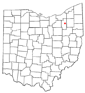
SealLocation within the state of Ohio Location within Summit County, Ohio
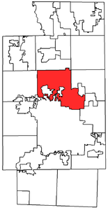
Coordinates: 41°8′44″N 81°29′48″W / 41.14556°N 81.49667°WCoordinates: 41°8′44″N 81°29′48″W / 41.14556°N 81.49667°W Country United States State Ohio County Summit Government - Mayor Don L. Robart Area - Total 25.6 sq mi (66.4 km2) - Land 25.5 sq mi (66.1 km2) - Water 0.1 sq mi (0.20 km2) Elevation 1,024 ft (312 m) Population (2010) - Total 49,652 - Density 1,933.2/sq mi (746.4/km2) Time zone EST (UTC-5) - Summer (DST) EDT (UTC-4) ZIP codes 44221-44224 Area code(s) 330 and 234 FIPS code 39-19778[1] GNIS feature ID 1048646[2] Website http://www.ci.cuyahoga-falls.oh.us/ Cuyahoga Falls is a city in Summit County, Ohio, United States. As of the 2010 census, the city population was 49,652.[3] It is currently the second largest city in Summit County. It is a suburb of Akron and Cleveland [4] and part of the Akron Metropolitan Statistical Area and the Cleveland-Akron-Elyria Combined Statistical Area. Actually older than Akron, the city was founded in 1812 by William Wetmore and was originally named Manchester. Cuyahoga Falls is named after the Cuyahoga River (which flows into Lake Erie) and the series of waterfalls that run along the southern boundary of the city.
Cuyahoga Falls is bordered by Akron to the south and the Cuyahoga Valley National Park to the northwest.
Contents
History
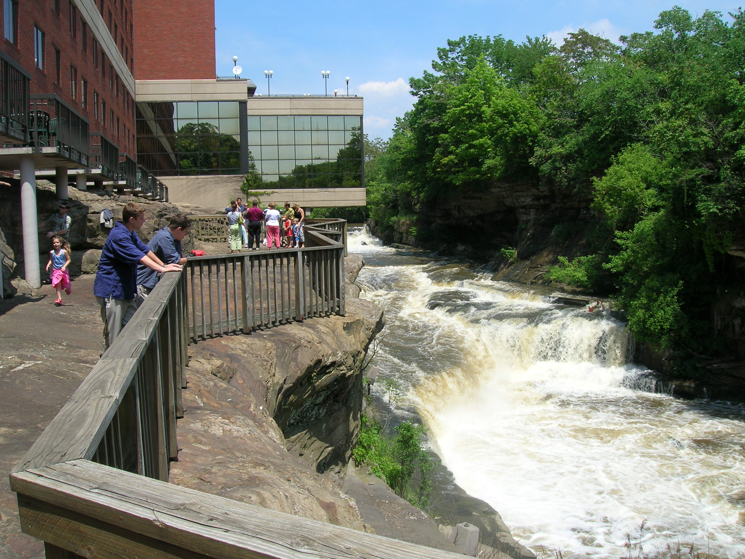
Cuyahoga Falls was formed in 1812[5] near the junction of what was then Northampton, Stow, Tallmadge, and Portage townships. The focus was the series of Cuyahoga River waterfalls that provided power for manufacturing.
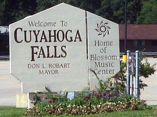
 "Welcome to Cuyahoga Falls"
In 1812 Kelsey and Wilcox built a dam on the Cuyahoga River at a place where a railroad bridge crossed it in 1876. They then built a flour mill, an oil mill, and a saw mill. This led to the construction of a number of houses. This area was known as the old village. Development moved downstream, though, when it was discovered that the power was better there. The old village was eventually destroyed in 1826 when a dam built by William Wetmore flooded the dam at the old village and its mills were torn down.[6]
The earliest settler of Cuyahoga Falls included Joshua Stow and William Wetmore. In 1815 a saw-mill was operating near Gaylord's Grove, using power generated by a dam on the Cuyahoga River there.[7]
The town was initially called Manchester but was renamed Cuyahoga Falls at the request of the Post Office since there were already several other Manchesters in Ohio.[8]
The village proper was first laid out in 1826 by Judge Richardson.[8]
The town was incorporated in 1836, occupying 240 rods out of Stow and Tallmadge townships. In 1853, seeing that the village and township of Cuyahoga Falls occupied the same territory, the village council disbanded and the community was only a township until 1868.[8]
In 1841 the Summit County Board of Commissioners named Cuyahoga Falls the county seat. The state legislature then intervened and put the location of the county seat up to a popular vote. Akron won and has been the county seat ever since. In spite of being named the county seat Cuyahoga Falls never really functioned as such.[7]
In March 1851 the township of Cuyahoga Falls was created out of the village limits. They covered the same territory so the village council voted to adjourn sine die, letting the village be run under township jurisdiction until June 3, 1868 when the municipal government returned.[8]
On July 3, 1940 the Doodlebug Disaster train wreck killed 43 people; the worst disaster in the history of the city[9]
In 1984, a referendum of merger between the city and neighboring Northampton Township was placed on the ballots of, and approved by, local voters. In 1985, Cuyahoga Falls merged with Northampton Township, the first merger of a city and township in Ohio.
Cuyahoga Falls had been founded as an industrial city, taking advantage of the river power. By the 1970s, though, it had become a residential community. This changed, though, when Don Robart became mayor. He had been in favor of the merger with Northampton Township because of the additional land that could be used for development. Parts of that area have since been used for industrial development. Commercial development has also picked up, especially on the Howe Avenue area at the southern border of the city.
The city had one professional sports team, the Cuyahoga Falls Cougars, of the International Basketball League. They moved to Akron in 2006 and became the Akron Cougars.
The Cathedral of Tomorrow, founded by televangelist Rex Humbard in 1958, is located in Cuyahoga Falls. It is now the church of Christian pastor/evangelist Ernest Angley and was renamed Grace Cathedral.
Geography
Cuyahoga Falls is located at 41°8′44″N 81°29′48″W / 41.14556°N 81.49667°W (41.145556, -81.496685)[10].
According to the United States Census Bureau, the city has a total area of 25.6 square miles (66 km2), of which, 25.5 square miles (66 km2) of it is land and 0.1 square miles (0.26 km2) of it (0.35%) is water.
Demographics
Historical populations Census Pop. %± 1860 1,516 — 1870 1,861 22.8% 1880 2,294 23.3% 1890 2,614 13.9% 1900 3,186 21.9% 1910 4,020 26.2% 1920 10,200 153.7% 1930 19,797 94.1% 1940 20,546 3.8% 1950 29,195 42.1% 1960 47,922 64.1% 1970 49,678 3.7% 1980 43,708 −12.0% 1990 48,950 12.0% 2000 49,374 0.9% 2010 49,652 0.6% As of the census[1] of 2000, there were 49,374 people, 21,655 households, and 13,317 families residing in the city. The population density was 1,932.9 people per square mile (746.4/km²). There were 22,727 housing units at an average density of 889.7 per square mile (343.6/km²). The racial makeup of the city was 95.80% White, 1.87% African American, 0.20% Native American, 1.05% Asian, 0.01% Pacific Islander, 0.15% from other races, and 0.91% from two or more races. Hispanic or Latino of any race were 0.63% of the population.
There were 21,655 households out of which 27.0% had children under the age of 18 living with them, 48.3% were married couples living together, 10.1% had a female householder with no husband present, and 38.5% were non-families. 32.6% of all households were made up of individuals and 12.3% had someone living alone who was 65 years of age or older. The average household size was 2.26 and the average family size was 2.90.
In the city the population was spread out with 22.5% under the age of 18, 7.9% from 18 to 24, 32.0% from 25 to 44, 21.5% from 45 to 64, and 16.1% who were 65 years of age or older. The median age was 37 years. For every 100 females there were 90.3 males. For every 100 females age 18 and over, there were 86.5 males.
The median income for a household in the city was $42,263, and the median income for a family was $52,372. Males had a median income of $40,301 versus $28,459 for females. The per capita income for the city was $22,550. About 4.5% of families and 6.1% of the population were below the poverty line, including 8.0% of those under age 18 and 4.2% of those age 65 or over.
The July 1, 2003 Census Bureau estimate for Cuyahoga Falls puts the population at 50,375.
Sites of interest
- Blossom Music Center
- Cuyahoga Valley National Park
- Mary Campbell Cave
- Gorge Metro Park
- The River Front
- Brookledge Golf Course

- Indian Head - Trail of The Whispering Giants
- The Natatorium
- Riverfront YMCA
- Water Works Aquatic Center
- Waterworks park
- Falls River Cruise
- Downview Sports Center
City mayors
During incorporation
- Henry Newberry, 1837
- Charles W. Wetmore, 1838
- Hosea Paul, 1839
- Charles W. Wetmore, 1840 to 1843
- Birdseye Booth, 1844 to 1845
- Hosea Paul, 1846
- Oliver B. Beebe, 1847 to 1848
- Charles W. Wetmore, 1849 to 1852
Municipal government resumed (Village of Cuyahoga Falls)
- William A. Hanford, 1868
- Richard Blood, 1869
- C. P. Humphrey, 1870 to 1871
- Joshua L'Hommidieu, 1872 to 1873
- Horace B. Camp, 1874 to 1875
- George W. Rice, 1876 to 1877
- John I Jones, 1878 to 1879
- W. A. Hanford, 1880 to 1881
- J. C. Castle, 1882 to 1883
- A. B. Curtis, 1884
- Samuel Higgs, 1885
- Thomas H. Walsh, 1886
- John I. Jones, 1887 to 1889
- Samuel Higgs, 1890 to 1893
- D. F. Felmly, 1894 to 1899
- C. N. Russel, 1900 to 1902
- E. M. Young, 1903 to 1904
- Charles A. Davis, 1905 to 1908
- C. N. Russel, 1909 to 1911
- W. H. Taylor, 1912 to 1921
City of Cuyahoga Falls
- George Herdman, 1922 to 1923
- Charles Gray, 1924 to 1927
- George Porter, 1928 to 1933
- J. W. Haines, 1934 to 1943
- Joseph W. Harding, 1944 to 1949
- George A. Anderson, 1950 to 1951
- Harding A. Wichert, 1952 to 1953
- Elmer Wolf, 1954 to 1955
- Emmet R. Wolfe, 1956 to 1961
- David Sanders, 1962 to 1965
- Delbert Ackerman, 1966 to 1968
- Bruce Thomas, 1968 to 1969
- William Coleman, 1970 to 1973
- Robert J. Quirk, 1974 to 1985
- Don L. Robart, 1986 to present
Notable natives
- John Jacobs (Formerly of The Power Team)
- Jim Jarmusch (Film Director)
- Gates McFadden (Actress)
- Michael Morell (Deputy Director of the CIA)
- Jim Ballard (Former Arena Football League Quarterback)
- Bob Lewis (founder of Devo)
- Mark Mothersbaugh Devo
References
- ^ a b "American FactFinder". United States Census Bureau. http://factfinder.census.gov. Retrieved 2008-01-31.
- ^ "US Board on Geographic Names". United States Geological Survey. 2007-10-25. http://geonames.usgs.gov. Retrieved 2008-01-31.
- ^ "American FactFinder2". http://factfinder2.census.gov/faces/nav/jsf/pages/index.xhtml. Retrieved 2010-03-20.
- ^ Cleveland Magazine, "Rating the Suburbs," June 2010.
- ^ Information Services Department, City of Cuyahoga Falls, Ohio (2005). History. Retrieved May 7, 2005.
- ^ Fairchild, Rev. T.B. (1876). A History of the Town of Cuyahoga Falls. Akron: The Old Book Store. ISBN.
- ^ a b Doyle, William B, LL.B. (1908). Centennial History of Summit County, Ohio and Representative Citizens. Chicago: Biographical Publishing Company. ISBN.
- ^ a b c d Akron Map and Atlas Co. Illustrated Summit County, Ohio. Akron: Akron Map and Atlas Co. 1891
- ^ http://cuyahogafallshistory.com/doodlebug.htm Cuyahoga Falls History: The Doodlebug
- ^ "US Gazetteer files: 2010, 2000, and 1990". United States Census Bureau. 2011-02-12. http://www.census.gov/geo/www/gazetteer/gazette.html. Retrieved 2011-04-23.
External links
- The City of Cuyahoga Falls, Ohio Official Website
- Cuyahoga Falls City Schools Website
- Cuyahoga Falls Library Website
- Cuyahoga Falls History
Municipalities and communities of Summit County, Ohio Cities 
Villages Boston Heights | Clinton | Lakemore | Mogadore‡ | Northfield | Peninsula | Reminderville | Richfield | Silver Lake
Townships Bath | Boston | Copley | Coventry | Northfield Center | Richfield | Sagamore Hills | Springfield | Twinsburg
CDPs Unincorporated
communitiesFootnotes ‡This populated place also has portions in an adjacent county or counties
Categories:- Cities in Ohio
- Populated places in Summit County, Ohio
- Populated places established in 1812
- Akron metropolitan area


Wikimedia Foundation. 2010.