- Bellefontaine, Ohio
Infobox Settlement
official_name = Bellefontaine, Ohio
settlement_type =City
nickname = The Peak of Ohio
motto =
imagesize =
image_caption =
image_
mapsize = 250px
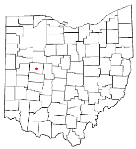
map_caption = Location of Bellefontaine, Ohio
mapsize1 =
map_caption1 =subdivision_type = Country
subdivision_name =United States
subdivision_type1 = State
subdivision_name1 =Ohio
subdivision_type2 = County
subdivision_name2 = Logangovernment_footnotes =
government_type =
leader_title =Mayor
leader_name = Adam Brannon
leader_title1 =
leader_name1 =
established_title = Founded
established_date = 1820unit_pref = Imperial
area_footnotes =area_magnitude =
area_total_km2 = 22.7
area_land_km2 = 22.7
area_water_km2 = 0.0
area_total_sq_mi = 8.8
area_land_sq_mi = 8.8
area_water_sq_mi = 0.0population_as_of = 2000
population_footnotes =
population_total = 13069
population_density_km2 = 575.8
population_density_sq_mi = 1491.3
population_metro = 46,005timezone = Eastern (EST)
utc_offset = -5
timezone_DST = EDT
utc_offset_DST = -4
elevation_footnotes = GR|3
elevation_m = 379
elevation_ft = 1243
latd = 40 |latm = 21 |lats = 39 |latNS = N
longd = 83 |longm = 45 |longs = 29 |longEW = Wpostal_code_type =
ZIP code
postal_code = 43311
area_code = 937
blank_name = FIPS code
blank_info = 39-05130GR|2
blank1_name = GNIS feature ID
blank1_info = 1064407GR|3
website = [http://www.ci.bellefontaine.oh.us ci.bellefontaine.oh.us]
footnotes =Bellefontaine (pronounced bell-FOUN-tin; IPAEng|bɛlˈfaʊntɨn) is a city in and the
county seat of Logan County,Ohio ,United States .GR|6 The population was 13,069 at the 2000 census. It is the center of the Bellefontaine Micropolitan Statistical Area, as defined by theUnited States Census Bureau in 2003. The highest point in Ohio, Campbell Hill, is within the city limits of Bellefontaine.History
The name Bellefontaine means "beautiful spring" in French, and is purported to refer to several springs in the area. [ [http://www.ohiohistorycentral.org/entry.php?rec=1897 Ohio History Central] ]
Blue Jacket's Town
Around 1777, the Shawnee war leader
Blue Jacket (Weyapiersenwah) built a settlement here, known as Blue Jacket's Town. Blue Jacket and his band had previously occupied a village along theScioto River , but with the coming of theAmerican Revolutionary War to theOhio Country , Blue Jacket and other American Indians who took up arms against the American revolutionaries relocated in order to be closer to their British allies atDetroit . Blue Jacket's Town was destroyed inLogan's Raid , conducted by Kentucky milita in 1786 at the outset of theNorthwest Indian War . The expedition was led byBenjamin Logan , namesake of Logan County. Blue Jacket and his followers relocated further northwest to theMaumee River . [http://publications.ohiohistory.org/ohstemplate.cfm?action=detail&Page=0012169.html&StartPage=167&EndPage=179&volume=12&newtitle=Volume%2012%20Page%20167 Ohio History, Vol. 12, pg 169] ]Beginning in the 1800s,
Revolutionary War veterans and others fromVirginia and elsewhere began settling in the area of Blue Jacket's Town. Bellefontaine is on or near the edge of theVirginia Military District , and theTreaty of Greenville delineating lands to be held by Americans from those to be held by natives was poorly administered in the area.Holland Theater
The
Holland Theater is a theater in Bellefontaine that is listed on theNational Register of Historic Places . It opened in the 1930's as a live theater, but was later converted to a 5 screen megaplex before closing in 1998. In recent years, it has been reopened for events and performances for Bellefontaine and the surrounding area.The railroads
In 1820, the town of Bellefontaine was officially laid out. In 1837, the Mad River & Lake Erie Railroad built the first railroad in Bellefontaine. This began Bellefontaine's reputation as a railroading town. This reputation was cemented in the 1890s, when the
Cleveland, Cincinnati, Chicago and St. Louis Railroad (also called theBig Four Railroad) built a main terminal here. This terminal also boasted the largest roundhouse between New York and Saint Louis. [cite book |last=Trostel |first=Scott D. |title=The Columbus Avenue Miracle: Bellefontaine, Ohio's WW II Serviceman's Free Canteen |year=2005 |publisher=Cam-Tech Publishing |isbn=092543650X ]Though railroading hit hard times in the late 20th century, and the Big Four terminal ceased operations in 1983, Bellefontaine remains a landmark on America's railways. The city is at the junction of
CSX lines going to Cleveland, Indianapolis, and Dayton.Automotive transportation
In 1891, Bellefontaine became the location of the first
concrete street in America.George Bartholomew invented a process for paving usingPortland cement , which until then had been used in stone construction. A small section of Main Street, on the west side of the Logan County Courthouse, was the first to be paved using that process. When that proved successful, Court Avenue, which runs along the south side of the courthouse, was then paved. While Main Street is now paved with asphalt, Court Avenue has retained its original concrete pavement for over 100 years. At its centennial, the street was closed and a statue of Bartholomew placed at its Main Street end, although since then one lane has been reopened for eastbound traffic.In 1979,
Honda began manufacturing motorcycles in nearbyMarysville, Ohio . Since that time, Honda's operations in the Bellefontaine area have greatly expanded, and Bellefontaine is now centrally located to Honda operations in Marysville, East Liberty, Russells Point, Anna, andTroy, Ohio . It follows, then, that Honda is presently Bellefontaine's largest employer.Today, Bellefontaine is centered at the intersection of
U.S. Route 68 with State Routes 47 and 540.U.S. Route 33 , afreeway that has interchanges with US 68 and SR 540, skirts the northern edge of the city.Campbell Hill and US military operations
To European settlers, Campbell Hill was first known as Hogue's Hill, perhaps a misspelling of the name of the person who first deeded the land in 1830, Solomon Rogue. In 1898, the land was sold to Charles D. Campbell, in whose name Campbell Hill is now known. Campbell sold the hill and surrounding land to August Wagner, who was the original brewer of Augustiner and Gambrinus beers. (These brands are now the trademarks of the
Gambrinus Company ofSan Antonio, Texas , though the company has stopped production of these beers.)In 1950, the family of August Wagner deeded Campbell Hill and the surrounding 57.5
acres to the U.S. government. The government then stationed the 664th Aircraft Control and Warning Squadron on the hill in 1951. This military unit was responsible for monitoring for possibleaerospace attacks from theSoviet Union during theCold War . The 664th AC&WS and similar military units were eventually superseded by theNorth American Aerospace Defense Command (or NORAD), and the base in Bellefontaine was closed in 1969.The Ohio Hi-Point Vocational-Technical District opened a school atop the hill in 1974. The school is now known as the
Ohio Hi-Point Career Center .Law and government
Bellefontaine has an elected
mayor andcity council style of government.Mayor
In November 2007, three candidates competed for the position of mayor: Democrat Adam Brannon, two-term incumbent Republican Robert C. Lentz, and independent Tim Barnett. Brannon defeated Lentz by a slim margin, while Barnett was a moderate distance behind them.Mast, Joel E. "Brannon elected: Newcomer Democrats take control of city administration, council", "Bellefontaine Examiner",
2007-11-07 , p. 1.]City council
The Bellefontaine City Council consists of one president, four ward council members, and three council members at-large. In November 2007, the following members were elected:
*Council President Richard Vicario (R), without opposition
*First Ward Councilman David Haw (D), incumbent, over Ernest Bailey (I)
*Second Ward Councilwoman Diane Hager (R), incumbent, without opposition
*Third Ward Councilman Brian Evans (D), incumbent, without opposition
*Fourth Ward Councilman Jerry Pitzer (D), incumbent, over Jonathan Kunze (R)
*Councilman at Large Mark Fissel (D)
*Councilman at Large David Henry (R), incumbent
*Councilman at Large Don Horn (R), incumbentFormer Councilwoman at Large Terri Knox (R) was defeated in this election.The first meeting of the council, composed of these members, was held on
8 January 2008 . David Haw was elected presidentpro tempore of the council. [Mast, Joel E. [http://www.examiner.org/news01.09.2.php Year’s first meeting over in 30 minutes] , "Bellefontaine Examiner",2008-01-09 . Accessed2008-01-10 .]Administration
In November 2007, the following administrators were elected:
*City Auditor Robert Storm (R), over Edward Loe (I)
*City Law Director Howard Traul (R), incumbent, without oppositionGeography
Bellefontaine is located at coor dms|40|21|39|N|83|45|29|W (40.360878, -83.758126).GR|1
According to the
United States Census Bureau , the city has a total area of 8.8square mile s (22.7km² ), all land.Demographics
As of the census of 2000, there were 13,069 people, 5,319 households, and 3,436 families residing in the city. The
population density was 1,491.3 people per square mile (576.0/km²). There were 5,722 housing units at an average density of 652.9/sq mi (252.2/km²). The racial makeup of the city was 90.82% White, 5.13% African American, 0.15% Native American, 0.93% Asian, 0.04% Pacific Islander, 0.53% from other races, and 2.40% from two or more races. 1.12% of the population were Hispanic or Latino of any race.There were 5,319 households out of which 34.1% had children under the age of 18 living with them, 45.7% were married couples living together, 14.4% had a female householder with no husband present, and 35.4% were non-families. 30.5% of all households were made up of individuals and 11.9% had someone living alone who was 65 years of age or older. The average household size was 2.43 and the average family size was 3.01.
In the city the population was spread out with 28.1% under the age of 18, 10.0% from 18 to 24, 29.1% from 25 to 44, 19.9% from 45 to 64, and 12.9% who were 65 years of age or older. The median age was 33 years. For every 100 females there were 90.9 males. For every 100 females age 18 and over, there were 86.4 males.
The median income for a household in the city was $36,029, and the median income for a family was $42,126. Males had a median income of $34,637 versus $22,849 for females. The
per capita income for the city was $17,781. 14.6% of the population and 12.9% of families were below thepoverty line . 20.7% of those under the age of 18 and 7.0% of those 65 and older were living below the poverty line.Micropolitan statistical area
Bellefontaine is the center of the Bellefontaine Micropolitan Statistical Area, as defined by the U.S. Census Bureau. This micropolis consists solely of
Logan County, Ohio . The 2000census GR|2 found 46,005 people in the micropolis, making it the 260th most populous such area in theUnited States . Among all U.S. statistical areas (CBSAs), the Bellefontaine micropolis ranks 622nd. InOhio , the Bellefontaine micropolis is the 37th most populous CBSA, and the 21st most populous micropolitan statistical area.By comparison, the least populous
metropolitan area in the United States,Carson City, Nevada , has 52,457 residents. The least populous metropolitan area in Ohio is Sandusky, with 79,555 residents. The Bellefontaine micropolis is not as populous as these, but does have a greater population than some micropolitan statistical areas traditionally considered to be small regional cities. (Examples:El Dorado, Arkansas ;Clovis, New Mexico ; andRed Wing, Minnesota .)Though official definitions of micropolitan statistical areas did not exist until 2003, the area now constituting the Bellefontaine micropolis grew in population by 8.7 percent between 1990 and 2000.
ites of interest
*McKinley Street — Whether or not this is the shortest street in the world is the point of some contention. The sign at the street's south end (at the intersection of Columbus Ave.) makes such a claim, although Ebenezer Place, in Wick,
Scotland , has held the official record since November 2006 [ [http://news.bbc.co.uk/1/hi/scotland/highlands_and_islands/6101968.stm BBC NEWS | Scotland | Highlands and Islands | Street measures up to new record ] ] . The [http://www.ci.bellefontaine.oh.us/html/history_of_bellefontaine.html City of Bellefontaine's website] places the length of McKinley Street at "about 20 feet", and while city's website does not make the claim of the world's shortest street, it does cite McKinley Street as "the shortest street in America".Also:
* Campbell Hill
*Court Avenue, the first concrete street in America
*First brokerage house ofEdward D. Jones , still houses an office of the brokerage he started.
*FirstUnited Methodist Church , whereNorman Vincent Peale got his start.
*TheHolland Theater , on theNational Register of Historic Places .Education
The Bellefontaine City Schools operate two elementary schools,one intermediate school one
middle school , and one high school in the area. [cite web |url=http://www.bellefontaine.k12.oh.us/index.php |title=Bellefontaine City Schools |accessdate=2007-09-21 |format= |work= ] These schools have a combined enrollment of 2,840. In addition, theOhio Hi-Point Career Center , located atop Campbell Hill, offers both secondary and post-secondary education. Enrolled at Ohio Hi-Point are 505 students. The neighboringBenjamin Logan Local School District campus also has a Bellefontaine address.Several colleges and universities operate satellite campuses in the Bellefontaine area. These include:
*Ohio State University
*Urbana University Bellefontaine Regional Airport
Bellefontaine has a Regional airport located about 5 miles from the downtown business district. The airport replaced the
Bellefontaine Municipal Airport in 2002. It is one of 2 new airports opened to the public inOhio in the past 30 years. TheBellefontaine Regional Airport is the only airport in the area that can cater to large planes. The closest airport that can compare in size is the Union County Airport inMarysville, Ohio .Fact|date=November 2007Media
*WBLL, AM radio station
*WPKO, FM radio station
*Bellefontaine Examiner , newspaperNotable natives
*
George Bartholomew , inventor
*Blue Jacket (Weyapiersenwah),Shawnee chief
*Bethany Dillon , singer; nominee for 2004Gospel Music Association New Artist of the Year award
*Allan W. Eckert , author
*Jim Flora , artist
*Melville J. Herskovits , anthropologist
*Kin Hubbard , cartoonist and journalist
*Edward D. Jones , investment banker
*Austin Eldon Knowlton , architect
* William Lawrence, Republican politician involved with the attempt to impeachAndrew Johnson , creating theUnited States Department of Justice , helping to create theAmerican Red Cross , and ratifying theGeneva Convention
*The Mills Brothers , entertainers
*Norman Vincent Peale , minister and authorReferences
External links
* [http://ci.bellefontaine.oh.us/ Official site]
* [http://www.co.logan.oh.us/html/county_map_-_large.html Detailed Logan County map]
Wikimedia Foundation. 2010.