- West Liberty, Ohio
Infobox Settlement
official_name = West Liberty, Ohio
settlement_type = Village
nickname =
motto =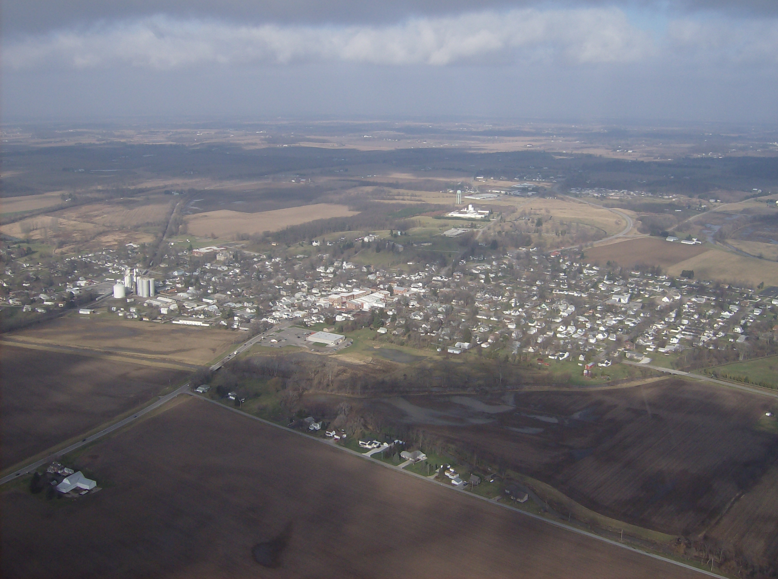
imagesize = 250px
image_caption = West Liberty from the southeast
image_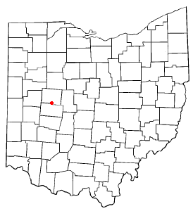
mapsize = 250px
map_caption = Location of West Liberty, Ohio
mapsize1 =
map_caption1 =subdivision_type = Country
subdivision_name =United States
subdivision_type1 = State
subdivision_name1 =Ohio
subdivision_type2 = Counties
subdivision_name2 = Logangovernment_footnotes =
government_type =
leader_title =
leader_name =
leader_title1 =
leader_name1 =
established_title =
established_date =unit_pref = Imperial
area_footnotes =area_magnitude =
area_total_km2 = 2.9
area_land_km2 = 2.9
area_water_km2 = 0.0
area_total_sq_mi = 1.1
area_land_sq_mi = 1.1
area_water_sq_mi = 0.0population_as_of = 2000
population_footnotes =
population_total = 1813
population_density_km2 = 630.6
population_density_sq_mi = 1637.7timezone = Eastern (EST)
utc_offset = -5
timezone_DST = EDT
utc_offset_DST = -4
elevation_footnotes =
elevation_m =
elevation_ft =
latd = 40 |latm = 15 |lats = 15 |latNS = N
longd = 83 |longm = 45 |longs = 27 |longEW = Wpostal_code_type =
ZIP code
postal_code = 43357
area_code = 419
blank_name =
blank_info =
blank1_name =
blank1_info =
website = http://www.westliberty.com/
footnotes =:"This article is on the Logan County village. For the village of Butler County formerly called West Liberty see
Poasttown, Ohio ."West Liberty is a village in Logan County,
Ohio ,United States . The population was 1,813 at the 2000 census.A branch of the
Logan County District Library serves the West Liberty community.Geography
West Liberty is located at coor dms|40|15|15|N|83|45|27|W|city (40.254169, -83.757452)GR|1.
According to the
United States Census Bureau , the village has a total area of 1.1square mile s (2.9km² ), all of it land.Flowing along the edge of town is the Mad River, a major source of running water in the area.
Demographics
As of the
census GR|2 of 2000, there were 1,813 people, 660 households, and 432 families residing in the village. Thepopulation density was 1,637.7 people per square mile (630.6/km²). There were 698 housing units at an average density of 630.5/sq mi (242.8/km²). The racial makeup of the village was 98.46% White, 0.17% African American, 0.28% Native American, 0.28% Asian, 0.11% Pacific Islander, and 0.72% from two or more races. Hispanic or Latino of any race were 0.17% of the population.There were 660 households out of which 31.8% had children under the age of 18 living with them, 54.2% were married couples living together, 8.8% had a female householder with no husband present, and 34.4% were non-families. 31.4% of all households were made up of individuals and 13.2% had someone living alone who was 65 years of age or older. The average household size was 2.36 and the average family size was 2.98.
In the village the population was spread out with 23.2% under the age of 18, 6.4% from 18 to 24, 23.5% from 25 to 44, 19.3% from 45 to 64, and 27.6% who were 65 years of age or older. The median age was 43 years. For every 100 females there were 76.2 males. For every 100 females age 18 and over, there were 70.2 males.
The median income for a household in the village was $38,819, and the median income for a family was $51,193. Males had a median income of $35,000 versus $26,518 for females. The
per capita income for the village was $19,083. About 4.9% of families and 5.3% of the population were below thepoverty line , including 6.7% of those under age 18 and 5.0% of those age 65 or over.Government
In the elections of November 2007, Rebecca Hamilton and Greg Hostetler were elected to the village council, and Brad Hudson and Dean King were elected to the village's board of public affairs. Cindee Boyd was elected clerk-treasurer without opposition. No candidate filed for the position of mayor. [Examiner Staff, The. "Village results", "Bellefontaine Examiner",
2007-11-07 , p. 2.]Transportation
U.S. Route 68 , known as "Detroit Street", forms the main street in West Liberty. Forming the main east-west street is State Route 245, and its intersection with US 68 is one of the primary intersections of the village. At the far northern end of the village, State Route 508 begins from an intersection with US 68 and heads westward to De Graff.Notable natives
*
Benjamin Piatt Runkle , founder ofSigma Chi Attractions
*
Ohio Caverns
*Piatt Castles References
External links
* [http://www.westliberty.com West Liberty home page]
* [http://www.co.logan.oh.us/html/county_map_-_large.html Detailed Logan County map]
* [http://www.piattcastles.org Piatt Castles home page]
* [http://cavern.com/ohiocaverns Ohio Caverns home page]
Wikimedia Foundation. 2010.