- Ohio State Route 287
-
State Route 287 Route information Maintained by ODOT Length: 13.69 mi[3][4] (22.03 km) Existed: 1931[1][2] – present Major junctions West end:  SR 245 near West Liberty
East end: 
 US 33 / SR 739 near North Lewisburg
Location Counties: Logan, Union Highway system Ohio highways
Interstates • U.S. Routes • State Routes←  SR 286
SR 288  →
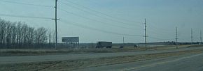
→ State Route 287 parallels U.S. Route 33 for a few miles, especially in Logan County's Zane Township.
State Route 287 (SR 287, OH 287) is a 13.69-mile (22.03 km) long east–west state highway in the western portion of the U.S. state of Ohio. The western terminus of SR 287 is at SR 245 nearly 1.75 miles (2.82 km) east of West Liberty. Its eastern terminus is at an interchange with U.S. Route 33 (US 33) about 5.25 miles (8.45 km) northeast of North Lewisburg that dually serves as the southern terminus of SR 739.
This two-lane state route was created in the early 1930s. Until an extension in the late 1990s, SR 739 was entirely within Logan County. The extension into Union County was formerly part of U.S. Route 33.
Contents
Route description
Along its way, SR 287 passes through the southeastern quadrant of Logan County and the extreme western portion of Union County. No section of this state highway is included within National Highway System (NHS). The NHS is a network of routes that are identified as being most important for the economy, mobility and defense of the nation.[5]
History
The debut of SR 287 took place in 1931. When it was inititally designated, it was routed along much of its current alignment from its western terminus at SR 245, at the time known as SR 275, to the T-intersection it has with the former two-lane alignment of US 33, now known as County Road 144 (CR 144), but originally designated as SR 32.[1] [2]
The highway would remain along this routing entirely within Logan County until 1999, when the freeway portion of US 33 was extended northwest from the Logan–Union County line to Bellefontaine. Consequently, the former two-lane portion of US 33 northwest of SR 287 was removed from the state highway system, and became known as CR 144. The portion southeast of that point became an extension of SR 287, which now followed the old routing of US 33 to the Stokes Road (CR 153) intersection, then turned northeast and followed Stokes Road a short distance to arrive at its present eastern terminus at a the interchange with the US 33 freeway that doubles as the southern terminus of SR 739.[6][7]
Major intersections
County Location Mile[3][4] Destinations Notes Logan Monroe Township 0.00  SR 245
Western terminus Zane Township 8.38  SR 559 south
T-intersection marking northern terminus of SR 559 Union Allen Township 13.69  US 33
US 33
 SR 739 east
Southern terminus at four-ramp interchange featuring parclo-B ramps on southwest side and diamond ramps on northeast side;
Interchange doubles as southern terminus of SR 7391.000 mi = 1.609 km; 1.000 km = 0.621 mi References
- ^ a b Ohio Department of Highways (1930) (MrSID). Map of Ohio Showing State Highway System (Map). Cartography by ODOH. http://www.dot.state.oh.us/Divisions/TransSysDev/Innovation/prod_services/Documents/StateMaps/otm1930a.sid. Retrieved 2011-05-05.
- ^ a b Ohio Department of Highways (1931) (MrSID). Map of Ohio Showing State Highway System (Map). Cartography by ODOH. http://www.dot.state.oh.us/Divisions/TransSysDev/Innovation/prod_services/Documents/StateMaps/otm1931a.sid. Retrieved 2011-05-05.
- ^ a b Ohio Department of Transportation. "Technical Services Straight Line Diagrams: SR 287, Logan County". http://www.odotonline.org/techservapps/SLD/pdf_files/logsr0287r.pdf. Retrieved 2010-08-17.
- ^ a b Ohio Department of Transportation. "Technical Services Straight Line Diagrams: SR 287, Union County". http://www.odotonline.org/techservapps/SLD/pdf_files/unisr0287r.pdf. Retrieved 2010-08-17.
- ^ Federal Highway Administration (December 2003) (PDF). National Highway System: Ohio (Map). http://www.fhwa.dot.gov/planning/nhs/maps/oh/oh_Ohio.pdf. Retrieved 2011-05-01.
- ^ Ohio Department of Transportation (1997) (MrSID). Official Ohio Highway Map (Map). Cartography by ODOT. http://www.dot.state.oh.us/Divisions/TransSysDev/Innovation/prod_services/Documents/StateMaps/otm1997a.sid. Retrieved 2011-05-05.
- ^ Ohio Department of Transportation (1999) (MrSID). Official Ohio Transportation Map (Map). Cartography by ODOT. http://www.dot.state.oh.us/Divisions/TransSysDev/Innovation/prod_services/Documents/StateMaps/otm1999a.sid. Retrieved 2011-05-05.
External links
Categories:- State highways in Ohio
- Logan County, Ohio
- Union County, Ohio
Wikimedia Foundation. 2010.

