- Springboro, Ohio
Infobox Settlement
official_name = Springboro, Ohio
settlement_type =City
nickname =
motto =
imagesize = 250px
image_caption = Central Springboro from the air
image_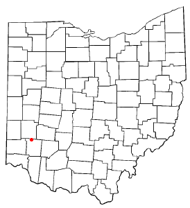
mapsize = 250px
map_caption = Location of Springboro, Ohio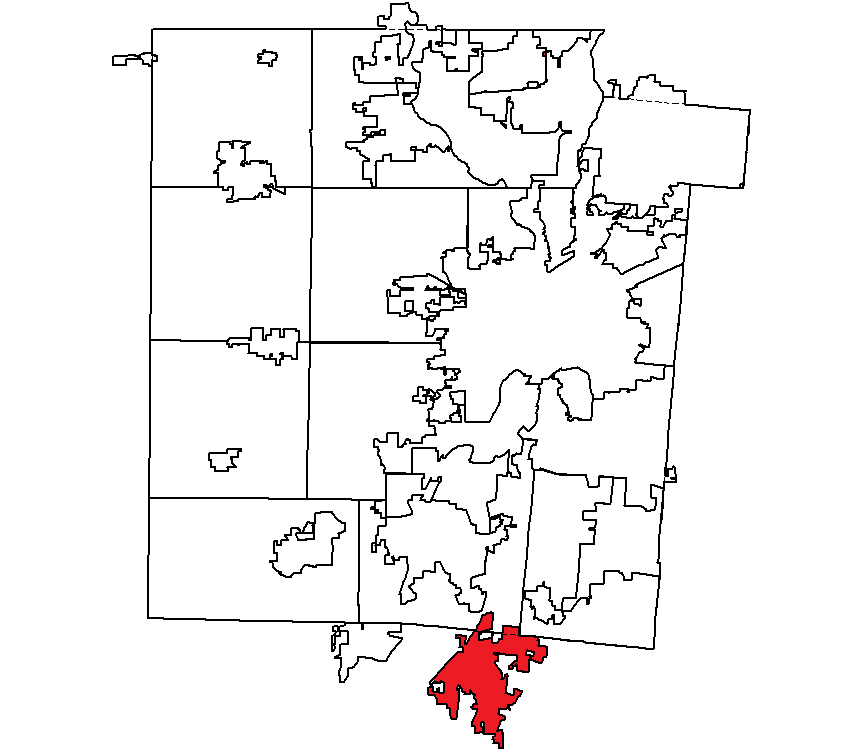
mapsize1 = 250x200px
map_caption1 = Location withinMontgomery County, Ohio subdivision_type = Country
subdivision_name =United States
subdivision_type1 = State
subdivision_name1 =Ohio
subdivision_type2 = Counties
subdivision_name2 = Warren, Montgomerygovernment_footnotes =
government_type =
leader_title =
leader_name =
leader_title1 =
leader_name1 =
established_title =
established_date =unit_pref = Imperial
area_footnotes =
area_magnitude =
area_total_km2 = 22.8
area_land_km2 = 22.8
area_water_km2 = 0.0
area_total_sq_mi = 8.8
area_land_sq_mi = 8.8
area_water_sq_mi = 0.0population_as_of = 2000
population_footnotes =
population_total = 12380
population_density_km2 = 542.5
population_density_sq_mi = 1405.1timezone = Eastern (EST)
utc_offset = -5
timezone_DST = EDT
utc_offset_DST = -4
elevation_footnotes = GR|3
elevation_m = 236
elevation_ft = 774
latd = 39 |latm = 33 |lats = 50 |latNS = N
longd = 84 |longm = 13 |longs = 41 |longEW = Wpostal_code_type =
ZIP code
postal_code = 45066
area_code = 937
blank_name = FIPS code
blank_info = 39-74076GR|2
blank1_name = GNIS feature ID
blank1_info = 1061205GR|3
website =
footnotes =Springboro is a city in Warren and Montgomery counties in the
U.S. state ofOhio . It is in Warren County's Clearcreek and Franklin Townships and Montgomery County's Miami Township. As of the 2000 census, the city had a population of 12,380, up from 6,574 in 1990 and 8,000 in 1980.The Warren County portion of Springboro is part of the Cincinnati–Middletown, OH-KY-IN Metropolitan Statistical Area, while the Montgomery County portion is part of the Dayton, OH Metropolitan Statistical Area.
Geography
Springboro is located at coor dms|39|33|50|N|84|13|41|W|city (39.563930, -84.228014)GR|1.
According to the
United States Census Bureau , the city has a total area of 8.8square mile s (22.8km² ), all of it land.History
Settled as early as 1796, Springboro was founded in 1815 by Jonathan Wright, a relative of the
Wright Brothers , as "Springborough." Jonathan Wright's father, Joel Wright, was a surveyor who plottedColumbus, Ohio . Springboro was predominantlyQuaker during its earlier years.Springboro is known largely for its historical significance during the hiding of
slaves through the system of theUnderground Railroad due to a large portion of its residents holding an Anti-Slavery opinion.Achilles Pugh , in fact, published a local paper during this time called "the Philanthropist" to enrich the belief of abolishingslavery .The city of Springboro is the first city to erect an Ohio Underground Railroad Historic Marker on
October 17 ,1999 . The dedication was part of the 4th Annual Ohio Underground Railroad Summit.As of the 2007 election, the current mayor of Springboro is John H. Agenbroad. Agenbroad was elected to another four year term.
Demographics
As of the
census GR|2 of 2000, there were 12,380 people, 4,261 households, and 3,600 families residing in the city. Thepopulation density was 1,405.1 people per square mile (542.6/km²). There were 4,423 housing units at an average density of 502.0/sq mi (193.8/km²). The racial makeup of the city was 96.00% White, 0.99% African American, 0.16% Native American, 1.60% Asian, 0.03% Pacific Islander, 0.29% from other races, and 0.92% from two or more races. Hispanic or Latino of any race were 1.00% of the population.There were 4,261 households out of which 48.2% had children under the age of 18 living with them, 74.8% were married couples living together, 7.3% had a female householder with no husband present, and 15.5% were non-families. 13.0% of all households were made up of individuals and 3.9% had someone living alone who was 65 years of age or older. The average household size was 2.90 and the average family size was 3.18.
In the city the population was spread out with 32.3% under the age of 18, 5.1% from 18 to 24, 34.0% from 25 to 44, 22.3% from 45 to 64, and 6.2% who were 65 years of age or older. The median age was 34 years. For every 100 females there were 95.8 males. For every 100 females age 18 and over, there were 93.9 males.
The median income for a household in the city was $72,316, and the median income for a family was $78,786. Males had a median income of $60,581 versus $36,790 for females. The
per capita income for the city was $31,257. About 2.4% of families and 3.0% of the population were below thepoverty line , including 3.8% of those under age 18 and 3.2% of those age 65 or over.The city is in the Springboro Community City and Franklin City School Districts. Telephone service is provided through the Springboro, Franklin, Centerville, and Miamisburg exchanges and Springboro telephone numbers have the Dayton 937 area code.
Recreation
*Wright-B Flyer Museum [http://www.wright-b-flyer.org/hangar.html] - Free museum, home to a flying replica of the Wright brothers' second airplane, where visitors get a chance to actually fly in the unique aircraft.
*La Comedia Dinner Theatre [http://www.lacomedia.com/] - A large dinner theater.bull run farms [www.bullrunfarms.com] - halloween hayrides and summer camp.Notable Residents
*
John C. Ainsworth - 1800s American pioneer and business owner
*Chad Balyo - Track champion forThe Ohio State University References
Further reading
*Elva R. Adams. "Warren County Revisited". [Lebanon, Ohio] : Warren County Historical Society, 1989.
*"The Centennial Atlas of Warren County, Ohio". Lebanon, Ohio: The Centennial Atlas Association, 1903.
*Josiah Morrow. "The History of Warren County, Ohio". Chicago: W.H. Beers, 1883. (Reprinted several times)
*"Ohio Atlas & Gazetteer". 6th ed.Yarmouth, Maine : DeLorme, 2001. ISBN 0-89933-281-1
*William E. Smith. "History of Southwestern Ohio: The Miami Valleys". New York: Lewis Historical Publishing, 1964. 3 vols.
*Warren County Engineer's Office. "Official Highway Map 2003". Lebanon, Ohio: The Office, 2003.External links
* [http://www.ci.springboro.oh.us City of Springboro official site]
* [http://www.springboroohio.org SpringboroOhio.org]
* [http://www.springboro.org Springboro Community City Schools]
Wikimedia Foundation. 2010.