- Franklin, Ohio
Infobox Settlement
official_name = Franklin, Ohio
other_name =
native_name =
nickname =
settlement_type =City
motto =
imagesize =
image_caption =
flag_size =
image_
seal_size =
image_shield =
shield_size =
image_blank_emblem =
blank_emblem_size =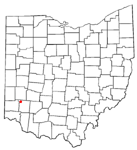
mapsize = 250px
map_caption = Location of Franklin, Ohio
mapsize1 =
map_caption1 =
image_dot_
dot_mapsize =
dot_map_caption =
dot_x =
dot_y =
pushpin_
pushpin_label_position =
pushpin_map_caption =
pushpin_mapsize =
subdivision_type = Country
subdivision_type1 = State
subdivision_type2 = County
subdivision_name =United States
subdivision_name1 =Ohio
subdivision_name2 = Warren
subdivision_type3 =
subdivision_name3 =
subdivision_type4 =
subdivision_name4 =
government_footnotes =
government_type = Council-city manager
leader_title =Mayor
leader_name = W. Hall
leader_title1 =City Manager
leader_name1 = James Lukas
leader_title2 =
leader_name2 =
leader_title3 =
leader_name3 =
leader_title4 =
leader_name4 =
established_title = Founded
established_date = 1796
established_title2 = town
established_date2 = 1814
established_title3 = city
established_date3 = 1951
area_magnitude =
unit_pref = Imperial
area_footnotes =
area_total_km2 = 24.1
area_land_km2 = 23.6
area_water_km2 = 0.5
area_total_sq_mi = 9.3
area_land_sq_mi = 9.1
area_water_sq_mi = 0.2
area_water_percent = 2.25
area_urban_km2 =
area_urban_sq_mi =
area_metro_km2 =
area_metro_sq_mi =
population_as_of = 11,396 (2000)
population_footnotes =
population_note =
population_total = 11396
population_density_km2 = 483
population_density_sq_mi = 1,251
population_metro =
population_density_metro_km2 =
population_density_metro_sq_mi =
population_urban =
population_density_urban_km2 =
population_density_urban_sq_mi =
population_blank1_title =
population_blank1 =
population_density_blank1_km2 =
population_density_blank1_sq_mi =
timezone = EST
utc_offset = -5
timezone_DST = EDT
utc_offset_DST = -4
latd = 39 |latm = 33 |lats = 41 |latNS = N
longd = 84 |longm = 18 |longs = 6 |longEW = W
elevation_footnotes =
elevation_m = 198
elevation_ft = 650
postal_code_type =ZIP code
postal_code = 45005
area_code = 937
blank_name = FIPS code
blank_info = 39-28476GR|2
blank1_name = GNIS feature ID
blank1_info = 1048758GR|3
website = http://www.franklinohio.org/
footnotes =Franklin is a city in Warren County,
Ohio ,United States . The population was 11,396 at the 2000 census.History
Franklin was founded by General William C. Schenck, in 1796. The settlement was named for
Benjamin Franklin . Franklin was incorporated in 1814 and became a city in 1951.One of the first four post offices in
Warren County, Ohio was established 1 April, 1805. TheFranklin Post Office still stands today though on a different site that it was originally built. The first postmaster was John N. C. Schenck, brother of General Schenck.Robert C. Schenck was born in Franklin4 October 1809 . He elected to Congress in 1843 and served several terms. He later was commissioned a Brigadier General and was a veteran of the Civil War. [http://www.civilwarhome.com/schenckbullrunor.htm] He died in 1890.John Brown was a leader of Franklin from 1835 to 1839. He was a horse breeder and land speculator and eventually went bankrupt. He moved on to other areas of Ohio. The first item associated with the nameBelmont in horseracing was a horse named Belmont who was born and bred in Franklin, Ohio and went to California in 1853. [http://www.instantactionsports.com/sportsbook/horse-racing/belmont-stakes-history.html] .One of the most famous horses raised in Franklin was "Nightingale", a chestnut
mare owned by D. M. Anderson. Nightingale was sired from Mambrino King-Minnequa Maid, and by Wood's Hambletonian. She held the 3 mile harness racing record at 6:55½.On
August 11 ,1971 the city opened what was considered the world's first Garbage Recycling Plant. The plant was designed and built by the Black Clawson Company. The plant was designed to recycle metals from the solid waste stream and remove paper products for further use. A fluidized bed incinerated what was left of the trash. The paper fibers removed became part of a paper used for roofing materials. ["The Franklin Chronicle, August 1971"]In 1989 Franklin was at the center of a Major League Baseball controversy when Alan Stratman, a lawyer for Ron Peters, owner of a restaurant named "Jonathans Cafe" claimed he was
Pete Rose 's "principal bookmaker". Some of the records kept by Ron Peters were used by the principal investigator,John Dowd , in his report to the commissioner of baseball. [http://www.baseball1.com/bb-data/rose/dowd/dowd_viid.html] [http://sportsillustrated.cnn.com/si_online/news/2002/12/10/rose_flashback/] The restaurant has since been torn down and replaced by a gas station.Franklin is the home of the Franklin campus of Southwestern College.
Geography
Franklin is located at coor dms|39|33|41|N|84|18|6|W|city (39.561250, -84.301575)GR|1.
According to the
United States Census Bureau , the city has a total area of 9.3square mile s (24.1km² ), of which, 9.1 square miles (23.6 km²) of it is land and 0.2 square miles (0.5 km²) of it (2.25%) is water.Demographics
As of the
census GR|2 of 2000, there were 11,396 people, 4,553 households, and 3,155 families residing in the city. Thepopulation density was 1,251.0 people per square mile (483.0/km²). There were 4,802 housing units at an average density of 527.1/sq mi (203.5/km²). The racial makeup of the city was 97.51% White, 0.82% African American, 0.12% Native American, 0.40% Asian, 0.32% from other races, and 0.82% from two or more races. Hispanic or Latino of any race were 0.71% of the population.Historic population figures
The city had 11,026 people in 1990, 10,711 in 1980, 10,075 in 1970, 7,917 in 1960, 5,388 in 1950, 4,511 in 1940, 3,071 in 1920, and 2,724 in 1900.
The city is in the Franklin City School Districts. Telephone service is provided through the Franklin exchange.
External links
* [http://www.franklinohio.org Official site]
References
*Elva R. Adams. "Warren County Revisited". [Lebanon, Ohio] : Warren County Historical Society, 1989.
*"The Centennial Atlas of Warren County, Ohio". Lebanon, Ohio: The Centennial Atlas Association, 1903.
*Mabel Eldridge and Dudley Bryant. "Franklin in the Great Miami Valley". Edited by Harriet E. Foley. Franklin, Ohio: Franklin Area Historical Society, 1982.
*Harriet E. Foley, editor. "Carlisle: The Jersey Settlement in Ohio, 1800–1990". 2nd ed. [Carlisle, Ohio?] : The Editor, 1990.
*Josiah Morrow. "The History of Warren County, Ohio". Chicago: W.H. Beers, 1883. (Reprinted several times)
*"Ohio Atlas & Gazetteer". 6th ed.Yarmouth, Maine : DeLorme, 2001. ISBN 0-89933-281-1
*William E. Smith. "History of Southwestern Ohio: The Miami Valleys". New York: Lewis Historical Publishing, 1964. 3 vols.
*Warren County Engineer's Office. "Official Highway Map 2003". Lebanon, Ohio: The Office, 2003.
Wikimedia Foundation. 2010.