- Union, Ohio
Infobox Settlement
official_name = Union, Ohio
settlement_type =City
nickname =
motto =
website = http://www.union.oh.us
image_caption = Union Municipal Building.
imagesize = 250px
image_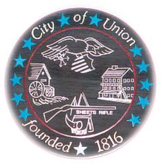
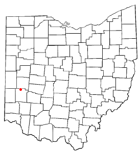
mapsize = 250px
map_caption = Location inOhio
mapsize1 =
map_caption1 =
subdivision_type = Country
subdivision_type1 = State
subdivision_type2 = Counties
subdivision_name =United States
subdivision_name1 =Ohio
subdivision_name2 = Montgomery, Miami
established_title = Founded
established_date = 1806
established_title2 = Named
established_date2 = "Union" in 1816 [ http://www.union.oh.us/hist.html City history. Retrieved 16 November, 2006. ]
established_title3 = Incorporated
established_date3 = 1982 (as city) [ http://www.union.oh.us/hist.html City history. Retrieved 16 November, 2006. ]
government_type =
leader_title =Mayor
leader_name = Larry Beyer [ http://www.tcnewsnet.com/main.asp?SectionID=13&SubSectionID=230&ArticleID=142476&TM=238 Union's New Mayor. Retrieved December 14, 2006 ]
area_magnitude = 1 E8
area_total_km2 = 11.1
area_land_km2 = 11.1
area_water_km2 = 0.0
population_as_of = 2005
population_total = 5920
population_metro =
population_density_km2 = 502.7
timezone = EST
utc_offset = -5
timezone_DST = EDT
utc_offset_DST = -4
elevation_ft = 922
latd = 39 |latm = 54 |lats = 1 |latNS = N
longd = 84 |longm = 18 |longs = 49 |longEW = W
area_total_sq_mi = 4.3
area_land_sq_mi = 4.3
area_water_sq_mi = 0.0
elevation_m = 281
postal_code_type =ZIP code
postal_code = 45322
area_code = 937
blank_name = FIPS code
blank_info = 39-78470GR|2
blank1_name = GNIS feature ID
blank1_info = 1049256GR|3
footnotes =Union is a city in Montgomery and Miami Counties in the
U.S. state ofOhio . The population was 5,574 at the 2000 census, and 5,920 at the 2005 census estimate. [ http://factfinder.census.gov/ Population Finder - American FactFinder. Retrieved 16 November, 2006. ] It is part of the Dayton Metropolitan Statistical Area.Geography
Union is located at coor dms|39|54|1|N|84|18|49|W|city (39.900154, -84.313494).GR|1
According to the
United States Census Bureau , the city has a total area of 4.3square mile s (11.1km² ).The Stillwater River runs on its East side.Transportation
One major state highway, State Route 48, runs north and south through Union. In Union, State Route 48 is known as Main Street.
Other notable streets in Union include Martindale Road, Sweet Potato Ridge Road, and Phillipsburg-Union Road.
Trivia
The city of
West Union, Ohio , the county seat of Adams County, actually lies about 88 miles southeast of Union.-The popular
YouTube show andWB pilot "Nobody's Watching " stars two characters who are natives of Union.Government
Union has a mayor/council/manager form of government. The current mayor is Zachary Johnson, [ http://www.tcnewsnet.com/main.asp?SectionID=13&SubSectionID=230&ArticleID=142476&TM=238 Form of Government. Retrieved 14 December, 2006. ] and John P. Applegate is Union's City Manager. [ http://www.union.oh.us/genad.html WELCOME. Retrieved 16 November, 2006. ]
On November 18, 2006 Mayor Robert Packard died after collapsing while performing a wedding at city hall. Due to the city's charter the Vice-mayor (Larry Beyer) became the new mayor of Union.
Demographics
As of the
census GR|2 of 2000, there were 5,574 people, 2,080 households, and 1,609 families residing in the city. Thepopulation density was 1,302.0 people per square mile (502.8/km²). There were 2,167 housing units at an average density of 506.2/sq mi (195.5/km²). The racial makeup of the city was 96.88% White, 0.91% African American, 0.14% Native American, 0.36% Asian, 0.02% Pacific Islander, 0.36% from other races, and 1.33% from two or more races. Hispanic or Latino of any race were 1.18% of the population.There were 2,080 households out of which 40.1% had children under the age of 18 living with them, 61.1% were married couples living together, 11.8% had a female householder with no husband present, and 22.6% were non-families. 18.9% of all households were made up of individuals and 5.6% had someone living alone who was 65 years of age or older. The average household size was 2.68 and the average family size was 3.05.
In the city the population was spread out with 28.7% under the age of 18, 7.6% from 18 to 24, 33.2% from 25 to 44, 22.6% from 45 to 64, and 7.9% who were 65 years of age or older. The median age was 34 years. For every 100 females there were 92.9 males. For every 100 females age 18 and over, there were 91.6 males.
The median income for a household in the city was $50,471, and the median income for a family was $55,139. Males had a median income of $39,944 versus $25,430 for females. The
per capita income for the city was $21,260. About 2.5% of families and 3.7% of the population were below thepoverty line , including 3.5% of those under age 18 and 3.5% of those age 65 or over.Education
Union residents west of the Stillwater River are served by the Northmont City School District of Montgomery County. The schools that Union children attend include:
*Northmont High School
*Northmont Middle School
*O. R. Edgington Elementary
*Union ElementaryEast of the Stillwater River, students attend Vandalia-Butler City School District. [ http://www.union.oh.us/school.html Local Schools. Retrieved 16 November, 2006. ]References
External links
* [http://www.union.oh.us/index.html Official site]
* [http://www.northmont.k12.oh.us/ Northmont City School District]
* [http://www.vandaliabutlerschools.org/ Vandalia-Butler City School District]
Wikimedia Foundation. 2010.