- Germantown, Ohio
:"There is also a tiny community named Germantown in Washington County."
Infobox Settlement
official_name = Germantown, Ohio
settlement_type = Village
nickname =
motto =
imagesize =
image_caption =
image_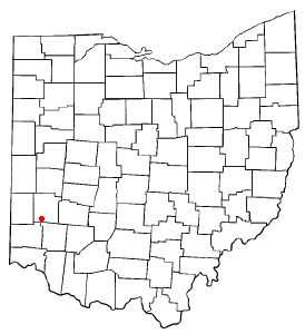
mapsize = 250px
map_caption = Location of Germantown, Montgomery County, Ohio
mapsize1 =
map_caption1 =subdivision_type = Country
subdivision_name =United States
subdivision_type1 = State
subdivision_name1 =Ohio
subdivision_type2 = County
subdivision_name2 = Montgomerygovernment_footnotes =
government_type =
leader_title =
leader_name =
leader_title1 =
leader_name1 =
established_title =
established_date =unit_pref = Imperial
area_footnotes =area_magnitude =
area_total_km2 = 9.3
area_land_km2 = 9.3
area_water_km2 = 0.0
area_total_sq_mi = 3.6
area_land_sq_mi = 3.6
area_water_sq_mi = 0.0population_as_of = 2000
population_footnotes =
population_total = 4884
population_density_km2 = 525.6
population_density_sq_mi = 1361.2timezone = Eastern (EST)
utc_offset = -5
timezone_DST = EDT
utc_offset_DST = -4
elevation_footnotes = GR|3
elevation_m = 220
elevation_ft = 722
latd = 39 |latm = 37 |lats = 38 |latNS = N
longd = 84 |longm = 21 |longs = 57 |longEW = Wpostal_code_type =
ZIP code s
postal_code = 45325, 45327
area_code = 937
blank_name = FIPS code
blank_info = 39-29932GR|2
blank1_name = GNIS feature ID
blank1_info = 1064716GR|3
website =
footnotes =Germantown is a village in Montgomery County,
Ohio ,United States . The population was 4,884 at the 2000 census. It is part of the Dayton Metropolitan Statistical Area.Geography
Germantown is located at coor dms|39|37|38|N|84|21|57|W|city (39.627133, -84.365951)GR|1.
According to the
United States Census Bureau , the village has a total area of 3.6square mile s (9.3km² ), all of it land.Demographics
As of the
census GR|2 of 2000, there were 4,884 people, 1,898 households, and 1,412 families residing in the village. Thepopulation density was 1,361.2 people per square mile (525.3/km²). There were 1,994 housing units at an average density of 555.7/sq mi (214.5/km²). The racial makeup of the village was 98.53% White, 0.37% African American, 0.10% Native American, 0.31% Asian, 0.08% from other races, and 0.61% from two or more races. Hispanic or Latino of any race were 0.78% of the population.There were 1,898 households out of which 36.2% had children under the age of 18 living with them, 59.8% were married couples living together, 10.5% had a female householder with no husband present, and 25.6% were non-families. 22.8% of all households were made up of individuals and 9.3% had someone living alone who was 65 years of age or older. The average household size was 2.55 and the average family size was 3.00.
In the village the population was spread out with 27.1% under the age of 18, 7.4% from 18 to 24, 29.6% from 25 to 44, 23.4% from 45 to 64, and 12.5% who were 65 years of age or older. The median age was 37 years. For every 100 females there were 97.9 males. For every 100 females age 18 and over, there were 92.5 males.
The median income for a household in the village was $47,179, and the median income for a family was $54,617. Males had a median income of $40,156 versus $28,622 for females. The
per capita income for the village was $23,287. About 4.0% of families and 5.8% of the population were below thepoverty line , including 11.0% of those under age 18 and 1.3% of those age 65 or over.References
External links
Wikimedia Foundation. 2010.