- Belpre, Ohio
Infobox Settlement
official_name = Belpre, Ohio
settlement_type =City
nickname =
motto =
imagesize =
image_caption =
image_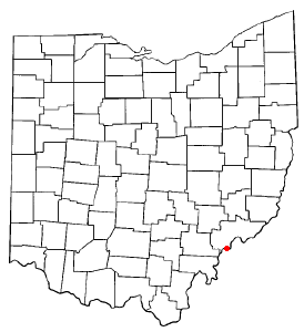
mapsize = 250px
map_caption = Location of Belpre, Ohio
mapsize1 =
map_caption1 =subdivision_type = Country
subdivision_name =United States
subdivision_type1 = State
subdivision_name1 =Ohio
subdivision_type2 = County
subdivision_name2 = Washingtongovernment_footnotes =
government_type =
leader_title =Mayor
leader_name = Michael L. Lorentz (D) [cite web
title = Washington County Election Results
url = http://www.co.washington.oh.us/linkfile/PastElections/Current_Election_Nov2007.html
accessdate = 2008-03-22 ]leader_title1 =
leader_name1 =
established_title =
established_date =unit_pref = Imperial
area_footnotes =area_magnitude =
area_total_km2 = 9.2
area_land_km2 = 9.1
area_water_km2 = 0.1
area_total_sq_mi = 3.6
area_land_sq_mi = 3.5
area_water_sq_mi = 0.0population_as_of = 2000
population_footnotes =
population_total = 6660
population_density_km2 = 729.6
population_density_sq_mi = 1889.6timezone = Eastern (EST)
utc_offset = -5
timezone_DST = EDT
utc_offset_DST = -4
elevation_footnotes = GR|3
elevation_m = 187
elevation_ft = 614
latd = 39 |latm = 16 |lats = 49 |latNS = N
longd = 81 |longm = 35 |longs = 6 |longEW = Wpostal_code_type =
ZIP code
postal_code = 45714
area_code = 740
blank_name = FIPS code
blank_info = 39-05424GR|2
blank1_name = GNIS feature ID
blank1_info = 1077518GR|3
website = http://www.cityofbelpre.com/
footnotes =Belpre is a city in Washington County,
Ohio ,United States , along theOhio River . It is part of the Parkersburg-Marietta-Vienna, WV-OH Metropolitan Statistical Area. The population was 6,660 at the 2000 census.The city was also the second settlement in the
Northwest Territory after Marietta, located just upriver and today thecounty seat of Washington County. The town was originally named Belle Prairie or "Beautiful Prairie."The
Steven Soderbergh film "Bubble", released in 2006, was filmed in Belpre and Parkersburg using an all-local cast.Geography
Belpre is located at coor dms|39|16|49|N|81|35|6|W|city (39.280175, -81.585072)GR|1.
According to the
United States Census Bureau , the city has a total area of 3.5square mile s (9.2km² ), of which, 3.5 square miles (9.1 km²) of it is land and 0.04 square miles (0.1 km²) of it (0.85%) is water.Demographics
As of the
census GR|2 of 2000, there were 6,660 people, 3,058 households, and 1,923 families residing in the city. Thepopulation density was 1,889.6 people per square mile (730.5/km²). There were 3,283 housing units at an average density of 931.5/sq mi (360.1/km²). The racial makeup of the city was 96.01% White, 2.10% African American, 0.11% Native American, 0.42% Asian, 0.12% from other races, and 1.25% from two or more races. Hispanic or Latino of any race were 0.48% of the population.There were 3,058 households out of which 25.2% had children under the age of 18 living with them, 47.9% were married couples living together, 11.4% had a female householder with no husband present, and 37.1% were non-families. 32.7% of all households were made up of individuals and 14.0% had someone living alone who was 65 years of age or older. The average household size was 2.18 and the average family size was 2.73.
In the city the population was spread out with 20.9% under the age of 18, 8.3% from 18 to 24, 26.4% from 25 to 44, 26.0% from 45 to 64, and 18.4% who were 65 years of age or older. The median age was 41 years. For every 100 females there were 84.1 males. For every 100 females age 18 and over, there were 80.1 males.
The median income for a household in the city was $29,603, and the median income for a family was $36,401. Males had a median income of $31,743 versus $21,789 for females. The
per capita income for the city was $18,195. About 12.1% of families and 15.2% of the population were below thepoverty line , including 26.7% of those under age 18 and 7.6% of those age 65 or over.ee also
*
List of cities and towns along the Ohio River References
External links
Wikimedia Foundation. 2010.