- Waynesville, Ohio
-
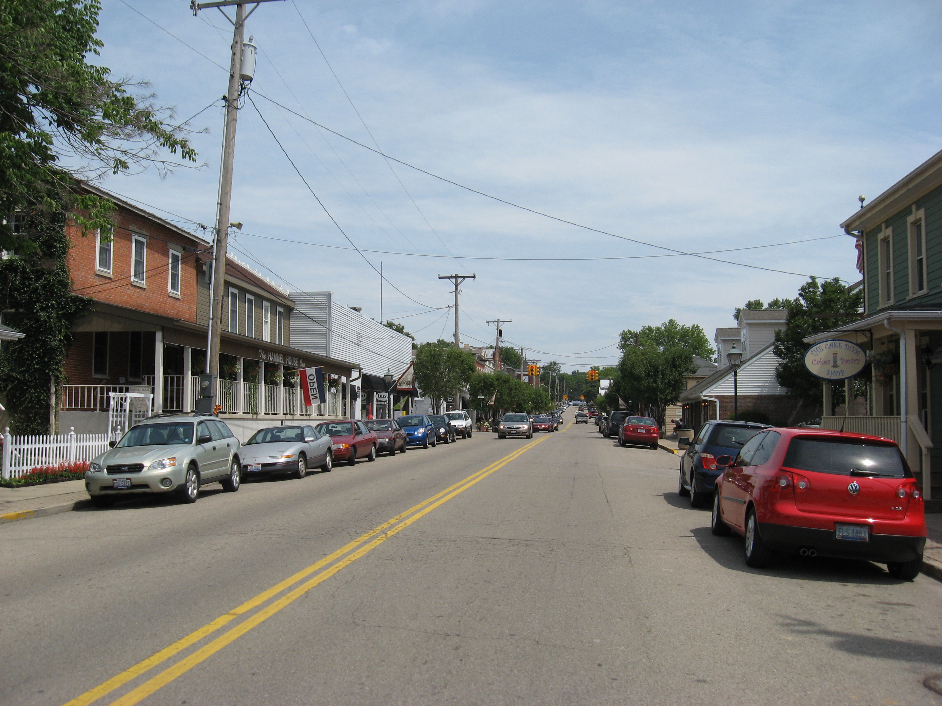
 Downtown Waynesville
Waynesville is a village in Wayne Township, Warren County, Ohio, United States. As of the 2000 census, the village population was 2,558, up from 1,949 in 1990. It is named for General "Mad" Anthony Wayne. The village, located at the crossroads of U.S. Route 42 and State Route 73, is known for its antique stores and its annual sauerkraut festival. Caesar Creek State Park is located five miles east of the village.
Waynesville is served by the Mary L. Cook Public Library. In 2005, the library loaned more than 203,000 items to its 8,000 cardholders. Total holdings in 2005 were over 67,000 volumes with over 110 periodical subscriptions.[1] In addition the community is served by WYNS-FM, a low-powered community radio station which also streams on the internet.
Contents
Geography

Waynesville is located at 39°31′55″N 84°05′11″W / 39.532037°N 84.086460°WCoordinates: 39°31′55″N 84°05′11″W / 39.532037°N 84.086460°W (39.532037, -84.086460).[2]
According to the United States Census Bureau, the village has a total area of 2.3 square miles (6.0 km2), of which, 2.3 square miles (6.0 km2) of it is land and 0.1 square miles (0.26 km2) of it (2.99%) is water.
Samuel Heighway, the projector of Waynesville. built what appears to have been the first cabin in that town March 9, 1797, but numerous tracts in the vicinity of that place had been sold and settled prior to that time.
Demographics
As of the census[3] of 2000, there were 2,558 people, 1,005 households, and 721 families residing in the village. The population density was 1,124.8 people per square mile (435.1/km2). There were 1,037 housing units at an average density of 456.0 per square mile (176.4/km2). The racial makeup of the village was 98.32% White, 0.08% African American, 0.23% Native American, 0.08% Asian, 0.16% from other races, and 1.13% from two or more races. Hispanic or Latino of any race were 0.74% of the population.
There were 1,005 households out of which 36.8% had children under the age of 18 living with them, 59.6% were married couples living together, 9.4% had a female householder with no husband present, and 28.2% were non-families. 24.8% of all households were made up of individuals and 12.5% had someone living alone who was 65 years of age or older. The average household size was 2.54 and the average family size was 3.04.
In the village the population was spread out with 27.4% under the age of 18, 6.5% from 18 to 24, 31.4% from 25 to 44, 22.0% from 45 to 64, and 12.6% who were 65 years of age or older. The median age was 36 years. For every 100 females there were 89.5 males. For every 100 females age 18 and over, there were 82.5 males.
The median income for a household in the village was $50,202, and the median income for a family was $56,538. Males had a median income of $41,932 versus $31,207 for females. The per capita income for the village was $24,539. About 1.9% of families and 3.9% of the population were below the poverty line, including 3.3% of those under age 18 and 5.5% of those age 65 or over.
Early History
Waynesville was founded on the west bank of the Little Miami River in 1797 by Samuel Heighway on land he purchased from Judge John Cleves Simms. The area was in the Northwest Territory until Ohio achieved statehood in 1803. General “Mad” Anthony Wayne opened the land for settlement through the Treaty of Greenville and, appropriately, Waynesville was named for him. Heighway platted Waynesville in the fashion of an English village, laying the town out in twelve squares of four acres each. The squares retain their names todayas noted by sign posts on each corner. Waynesville has significance as an important Quaker settlement. The Miami Monthly Meeting, established in 1803 as the first such gathering in southwestern Ohio, is located here. Early homes were built of logs and later mostly of frame, as wood was plentiful while bricks had to be made on site. The Accommodation Stage Coach Line ran along Third Street, which was the major road of that time, and Waynesville was the half way point between Springfield and Cincinnati, Ohio. In the first half of the nineteenth century, Main Street became the center of commercial activity. The Village of Waynesville is fortunate to have over 200 historic buildings that are still in existence. Most of these properties are in the older section of town which includes Main Street, Third Street, Fourth Street, and parts of Fifth Street.
References
- ^ "2005 Ohio Public Library Statistics:Statistics by County and Town". State Library of Ohio. http://winslo.state.oh.us/publib/2005_stats_by_county.xls. Retrieved November 10, 2006.
- ^ "US Gazetteer files: 2010, 2000, and 1990". United States Census Bureau. 2011-02-12. http://www.census.gov/geo/www/gazetteer/gazette.html. Retrieved 2011-04-23.
- ^ "American FactFinder". United States Census Bureau. http://factfinder.census.gov. Retrieved 2008-01-31.
Further reading
- Elva R. Adams. Warren County Revisited. [Lebanon, Ohio]: Warren County Historical Society, 1989.
- Robert L. Black. The Little Miami Railroad. Cincinnati: n.p., 1940.
- The Centennial Atlas of Warren County, Ohio. Lebanon, Ohio: The Centennial Atlas Association, 1903.
- Josiah Morrow. The History of Warren County, Ohio. Chicago: W.H. Beers, 1883. (Reprinted several times)
- Ohio Atlas & Gazetteer. 6th ed. Yarmouth, Maine: DeLorme, 2001. ISBN 0-89933-281-1
- Cynthia L. Pauwels, Historic Warren County - An Illustrated History, San Antonio, Historical Publishing Network, 2009, ISBN 9781935377092.
- William E. Smith. History of Southwestern Ohio: The Miami Valleys. New York: Lewis Historical Publishing, 1964. 3 vols.
- Warren County Engineer's Office. Official Highway Map 2003. Lebanon, Ohio: The Office, 2003.
- Waynesville's First 200 Years, The Waynesville Historical Society, 1997.
External links
- Village Website
- Mary L. Cook Public Library
- Museum at the Friends Home
- Waynesville Area Chamber of Commerce
Municipalities and communities of Warren County, Ohio Cities Franklin | Lebanon | Loveland‡ | Mason | Middletown‡ | Monroe‡ | Springboro‡

Villages Blanchester‡ | Butlerville | Carlisle‡ | Corwin | Harveysburg | Maineville | Morrow | Pleasant Plain | South Lebanon | Waynesville
Townships Clearcreek | Deerfield | Franklin | Hamilton | Harlan | Massie | Salem | Turtlecreek | Union | Washington | Wayne
CDPs Five Points | Hunter | Landen | Loveland Park‡
Unincorporated
communitiesBeedles Station | Chautauqua‡ | Cozaddale | Crosswick | Dallasburg | Dodds | Fosters | Greentree Corners | Hagemans Crossing | Hammel and Millgrove | Hillcrest | Hopkinsville | Kings Mills | Level | Mathers Mill | Middletown Junction | Murdoch | Oregonia | Red Lion | Ridgeville | San Mar Gale | Twenty Mile Stand | Zoar
Footnotes ‡This populated place also has portions in an adjacent county or counties
Categories:- Villages in Ohio
- Populated places in Warren County, Ohio

Wikimedia Foundation. 2010.