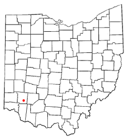
- Morrow, Ohio
-
Morrow, Ohio — Village — Location of Morrow, Ohio Coordinates: 39°21′11″N 84°7′47″W / 39.35306°N 84.12972°WCoordinates: 39°21′11″N 84°7′47″W / 39.35306°N 84.12972°W Country United States State Ohio County Warren Area - Total 1.7 sq mi (4.5 km2) - Land 1.7 sq mi (4.4 km2) - Water 0.0 sq mi (0.1 km2) Elevation[1] 640 ft (195 m) Population (2000) - Total 1,286 - Density 760.7/sq mi (293.7/km2) Time zone Eastern (EST) (UTC-5) - Summer (DST) EDT (UTC-4) ZIP code 45152 Area code(s) 513 FIPS code 39-52374[2] GNIS feature ID 1065061[1] Website www.vil.morrow.oh.us/ Morrow is a village in Salem Township, Warren County, Ohio, United States. As of the 2000 census, the village population was 1,286, up from 1,206 in 1990. The village is named for Governor Jeremiah Morrow.
Morrow is home to the second largest winery in Ohio, Valley Vineyards.[citation needed]
Contents
Geography
Morrow is located at 39°21′11″N 84°7′47″W / 39.35306°N 84.12972°W (39.353116, -84.129594)[3].
According to the United States Census Bureau, the village has a total area of 1.7 square miles (4.4 km2), of which, 1.7 square miles (4.4 km2) of it is land and 0.04 square miles (0.10 km2) of it (1.74%) is water.
Demographics
As of the census[2] of 2000, there were 1,286 people, 462 households, and 298 families residing in the village. The population density was 760.7 people per square mile (293.8/km²). There were 498 housing units at an average density of 294.6 per square mile (113.8/km²). The racial makeup of the village was 97.82% White, 0.70% African American, 0.86% Native American, 0.08% Asian, 0.16% from other races, and 0.39% from two or more races. Hispanic or Latino of any race were 2.18% of the population.
There were 462 households out of which 34.0% had children under the age of 18 living with them, 47.4% were married couples living together, 14.1% had a female householder with no husband present, and 35.3% were non-families. 29.0% of all households were made up of individuals and 14.5% had someone living alone who was 65 years of age or older. The average household size was 2.58 and the average family size was 3.19.
In the village the population was spread out with 25.6% under the age of 18, 6.6% from 18 to 24, 30.6% from 25 to 44, 21.4% from 45 to 64, and 15.9% who were 65 years of age or older. The median age was 37 years. For every 100 females there were 85.8 males. For every 100 females age 18 and over, there were 83.0 males.
The median income for a household in the village was $32,566, and the median income for a family was $44,750. Males had a median income of $31,827 versus $24,444 for females. The per capita income for the village was $15,416. About 5.2% of families and 15.5% of the population were below the poverty line, including 10.1% of those under age 18 and 11.1% of those age 65 or over.
Education
The village is in the Little Miami Local School District.
Government and infrastructure
The Morrow Post Office of the United States Postal Service is located at 531 West Pike Street.[4]
Music
- The town is the subject of a song called "To Morrow", about a man who wishes to take a train "to Morrow" and return "tomorrow" night, playing on the similar pronunciations of the two phrases. The song was popularly recorded by The Kingston Trio and also appeared in episode 5 in the first season of The Muppet Show.
- The town is the hometown to two of the founding members of the band Blessid Union of Souls.
- The town is the hometown to the Indie rock band Quiet tree.
Notable residents
- Mark Whitacre, former FBI informant
References
- ^ a b "US Board on Geographic Names". United States Geological Survey. 2007-10-25. http://geonames.usgs.gov. Retrieved 2008-01-31.
- ^ a b "American FactFinder". United States Census Bureau. http://factfinder.census.gov. Retrieved 2008-01-31.
- ^ "US Gazetteer files: 2010, 2000, and 1990". United States Census Bureau. 2011-02-12. http://www.census.gov/geo/www/gazetteer/gazette.html. Retrieved 2011-04-23.
- ^ "Post Office Location - Morrow." United States Postal Service. Retrieved on February 12, 2009.
Further reading
- Elva R. Adams. Warren County Revisited. [Lebanon, Ohio]: Warren County Historical Society, 1989.
- Robert L. Black. The Little Miami Railroad. Cincinnati: n.p., 1940.
- The Centennial Atlas of Warren County, Ohio. Lebanon, Ohio: The Centennial Atlas Association, 1903.
- Josiah Morrow. The History of Warren County, Ohio. Chicago: W.H. Beers, 1883. (Reprinted several times)
- Ohio Atlas & Gazetteer. 6th ed. Yarmouth, Maine: DeLorme, 2001. ISBN 0-89933-281-1
- William E. Smith. History of Southwestern Ohio: The Miami Valleys. New York: Lewis Historical Publishing, 1964. 3 vols.
- Warren County Engineer's Office. Official Highway Map 2003. Lebanon, Ohio: The Office, 2003.
Municipalities and communities of Warren County, Ohio County seat: Lebanon Cities Franklin | Lebanon | Loveland‡ | Mason | Middletown‡ | Monroe‡ | Springboro‡
Villages Blanchester‡ | Butlerville | Carlisle‡ | Corwin | Harveysburg | Maineville | Morrow | Pleasant Plain | South Lebanon | Waynesville
Townships Clearcreek | Deerfield | Franklin | Hamilton | Harlan | Massie | Salem | Turtlecreek | Union | Washington | Wayne
CDPs Five Points | Hunter | Landen | Loveland Park‡
Unincorporated
communitiesBeedles Station | Chautauqua‡ | Cozaddale | Crosswick | Dallasburg | Dodds | Fosters | Greentree Corners | Hagemans Crossing | Hammel and Millgrove | Hillcrest | Hopkinsville | Kings Mills | Level | Mathers Mill | Middletown Junction | Murdoch | Oregonia | Red Lion | Ridgeville | San Mar Gale | Twenty Mile Stand | Zoar
Footnotes ‡This populated place also has portions in an adjacent county or counties
Categories:- Populated places in Warren County, Ohio
- Villages in Ohio
Wikimedia Foundation. 2010.


