- Pleasant Plain, Ohio
Infobox Settlement
official_name = Pleasant Plain, Ohio
settlement_type = Village
nickname =
motto =
imagesize =
image_caption =
image_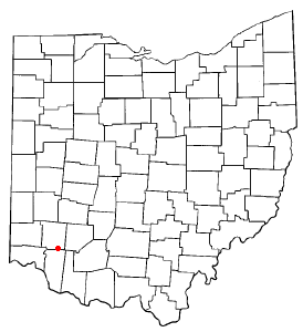
mapsize = 250x200px
map_caption = Location of Pleasant Plain, Ohio
mapsize1 =
map_caption1 =subdivision_type = Country
subdivision_name =United States
subdivision_type1 = State
subdivision_name1 =Ohio
subdivision_type2 = County
subdivision_name2 = Warrengovernment_footnotes =
government_type =
leader_title =
leader_name =
leader_title1 =
leader_name1 =
established_title =
established_date =unit_pref = Imperial
area_footnotes =
area_magnitude =
area_total_km2 = 0.3
area_land_km2 = 0.3
area_water_km2 = 0.0
area_total_sq_mi = 0.1
area_land_sq_mi = 0.1
area_water_sq_mi = 0.0population_as_of = 2000
population_footnotes =
population_total = 156
population_density_km2 = 556.7
population_density_sq_mi = 1442.0timezone = Eastern (EST)
utc_offset = -5
timezone_DST = EDT
utc_offset_DST = -4
elevation_footnotes = GR|3
elevation_m = 270
elevation_ft = 886
latd = 39 |latm = 16 |lats = 47 |latNS = N
longd = 84 |longm = 6 |longs = 33 |longEW = Wpostal_code_type =
ZIP code
postal_code = 45162
area_code = 513
blank_name = FIPS code
blank_info = 39-63576GR|2
blank1_name = GNIS feature ID
blank1_info = 1061555GR|3
website =
footnotes =Pleasant Plain is a village in Harlan Township,
Warren County, Ohio ,United States . As of the 2000 census, the village population was 156, down from 178 in 1990.Geography
Pleasant Plain is located at coor dms|39|16|47|N|84|6|33|W|city (39.279783, -84.109250)GR|1.
According to the
United States Census Bureau , the village has a total area of 0.1square mile s (0.3km² ), all of it land.Demographics
As of the
census GR|2 of 2000, there were 156 people, 55 households, and 40 families residing in the village. Thepopulation density was 1,442.0 people per square mile (547.6/km²). There were 57 housing units at an average density of 526.9/sq mi (200.1/km²). The racial makeup of the village was 99.36% White and 0.64% Asian.There were 55 households out of which 45.5% had children under the age of 18 living with them, 56.4% were married couples living together, 12.7% had a female householder with no husband present, and 25.5% were non-families. 20.0% of all households were made up of individuals and 5.5% had someone living alone who was 65 years of age or older. The average household size was 2.84 and the average family size was 3.34.
In the village the population was spread out with 31.4% under the age of 18, 8.3% from 18 to 24, 31.4% from 25 to 44, 17.9% from 45 to 64, and 10.9% who were 65 years of age or older. The median age was 36 years. For every 100 females there were 116.7 males. For every 100 females age 18 and over, there were 105.8 males.
The median income for a household in the village was $45,833, and the median income for a family was $45,625. Males had a median income of $40,208 versus $27,000 for females. The
per capita income for the village was $18,323. About 4.2% of families and 7.3% of the population were below thepoverty line , including 14.6% of those under the age of eighteen and 11.1% of those sixty five or over.The village is in the Goshen Local School District. Mail is delivered through the Pleasant Plain post office while telephone service is provided through the Butlerville exchange.
External links
References
*Elva R. Adams. "Warren County Revisited". [Lebanon, Ohio] : Warren County Historical Society, 1989.
*"The Centennial Atlas of Warren County, Ohio". Lebanon, Ohio: The Centennial Atlas Association, 1903.
*Josiah Morrow. "The History of Warren County, Ohio". Chicago: W.H. Beers, 1883. (Reprinted several times)
*"Ohio Atlas & Gazetteer". 6th ed.Yarmouth, Maine : DeLorme, 2001. ISBN 0-89933-281-1
*William E. Smith. "History of Southwestern Ohio: The Miami Valleys". New York: Lewis Historical Publishing, 1964. 3 vols.
*Warren County Engineer's Office. "Official Highway Map 2003". Lebanon, Ohio: The Office, 2003.
Wikimedia Foundation. 2010.