- Landen, Ohio
Infobox Settlement
official_name = Landen, Ohio
settlement_type = CDP
nickname =
motto =
imagesize =
image_caption =
image_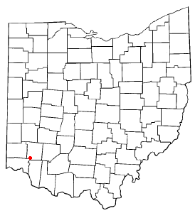
mapsize = 250px
map_caption = Location of Landen, Ohio
mapsize1 =
map_caption1 =subdivision_type = Country
subdivision_name =United States
subdivision_type1 = State
subdivision_name1 =Ohio
subdivision_type2 = County
subdivision_name2 = Warrengovernment_footnotes =
government_type =
leader_title =
leader_name =
leader_title1 =
leader_name1 =
established_title =
established_date =unit_pref = Imperial
area_footnotes =area_magnitude =
area_total_km2 = 12.3
area_land_km2 = 12.1
area_water_km2 = 0.2
area_total_sq_mi = 4.8
area_land_sq_mi = 4.7
area_water_sq_mi = 0.1population_as_of = 2000
population_footnotes =
population_total = 12766
population_density_km2 = 1054.0
population_density_sq_mi = 2729.7timezone = Eastern (EST)
utc_offset = -5
timezone_DST = EDT
utc_offset_DST = -4
elevation_footnotes = GR|3
elevation_m = 248
elevation_ft = 814
latd = 39 |latm = 18 |lats = 33 |latNS = N
longd = 84 |longm = 17 |longs = 5 |longEW = Wpostal_code_type =
postal_code =
area_code =
blank_name = FIPS code
blank_info = 39-41755GR|2
blank1_name = GNIS feature ID
blank1_info = 1052751GR|3
website =
footnotes =Landen is a
census-designated place (CDP) in Deerfield Township,Warren County, Ohio ,United States . The population was 12,766 at the 2000 census. It is located around Columbia Road and Montgomery Road in the southeastern part of the township. It surrounds Twenty Mile Stand and near Fosters.Landen was so named after the family that owned the farmland surrounding Twenty Mile Stand. There is a man-made lake in the northern portion of Landen. This is one of the many focal points of the surrounding subdivions.
Geography
Landen is located at coor dms|39|18|33|N|84|17|5|W|city (39.309067, -84.284739)GR|1.
According to the
United States Census Bureau , the CDP has a total area of 4.8square mile s (12.3km² ), of which, 4.7 square miles (12.1 km²) of it is land and 0.1 square miles (0.2 km²) of it (1.68%) is water.ubdivisions in Landen
chools
*Pre-schools
**Children's World
**Lakeview
**The Goddard School
*Elementary schools
**J.F. Burnes Elementary (Kings Local School District, K-4th grade)
**Columbia Elementary (Kings Local School District, 5th-6th grade)
*High school
**Kings High School
*Driving
**Landen Driving AcademyDemographics
As of the
census GR|2 of 2000, there were 12,766 people, 4,905 households, and 3,448 families residing in the CDP. Thepopulation density was 2,729.7 people per square mile (1,053.2/km²). There were 5,162 housing units at an average density of 1,103.8/sq mi (425.9/km²). The racial makeup of the CDP was 93.86% White, 1.48% African American, 0.09% Native American, 2.70% Asian, 0.10% Pacific Islander, 0.78% from other races, and 0.99% from two or more races. Hispanic or Latino of any race were 2.18% of the population.There were 4,905 households out of which 40.1% had children under the age of 18 living with them, 61.1% were married couples living together, 6.7% had a female householder with no husband present, and 29.7% were non-families. 23.5% of all households were made up of individuals and 3.3% had someone living alone who was 65 years of age or older. The average household size was 2.60 and the average family size was 3.14.
In the CDP the population was spread out with 29.3% under the age of 18, 6.5% from 18 to 24, 38.7% from 25 to 44, 20.4% from 45 to 64, and 5.1% who were 65 years of age or older. The median age was 34 years. For every 100 females there were 99.3 males. For every 100 females age 18 and over, there were 96.1 males.
The median income for a household in the CDP was $67,562, and the median income for a family was $78,236. Males had a median income of $52,446 versus $35,264 for females. The
per capita income for the CDP was $32,861. About 1.2% of families and 2.5% of the population were below thepoverty line , including 2.3% of those under age 18 and 1.9% of those age 65 or over.References
External links
Wikimedia Foundation. 2010.