- Lowell, Ohio
Infobox Settlement
official_name = Lowell, Ohio
settlement_type = Village
nickname =
motto =
imagesize =
image_caption =
image_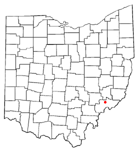
mapsize = 250px
map_caption = Location of Lowell, Ohio
mapsize1 =
map_caption1 =subdivision_type = Country
subdivision_name =United States
subdivision_type1 = State
subdivision_name1 =Ohio
subdivision_type2 = County
subdivision_name2 = Washingtongovernment_footnotes =
government_type =Mayor-council
leader_title =Mayor
leader_name = Douglas Seese [cite web
title = Washington County Public Officials
url = http://www.mariettatimes.com/page/content.detail/id/500031.html?nav=5061
accessdate = 2008-03-18 ]
leader_title1 =
leader_name1 =
established_title =
established_date =unit_pref = Imperial
area_footnotes =area_magnitude =
area_total_km2 = 0.7
area_land_km2 = 0.7
area_water_km2 = 0.0
area_total_sq_mi = 0.3
area_land_sq_mi = 0.3
area_water_sq_mi = 0.0population_as_of = 2000
population_footnotes =
population_total = 628
population_density_km2 = 956.1
population_density_sq_mi = 2476.3timezone = Eastern (EST)
utc_offset = -5
timezone_DST = EDT
utc_offset_DST = -4
elevation_footnotes = GR|3
elevation_m = 188
elevation_ft = 617
latd = 39 |latm = 31 |lats = 45 |latNS = N
longd = 81 |longm = 30 |longs = 27 |longEW = Wpostal_code_type =
ZIP code
postal_code = 45744
area_code = 740
blank_name = FIPS code
blank_info = 39-45164GR|2
blank1_name = GNIS feature ID
blank1_info = 1065718GR|3
website =
footnotes =Lowell is a village in Washington County,
Ohio ,United States , along theMuskingum River . The population was 628 at the 2000 census.Lowell is the Third settlement in the
Northwest Territory afterMarietta, Ohio andBelpre, Ohio . [cite web
title = Lowell Information.
url = http://www.mariettatimes.com/page/content.detail/id/500062.html?nav=5071
accessdate = 2008-03-18 ]Geography
Lowell is located at coor dms|39|31|45|N|81|30|27|W|city (39.529174, -81.507370),GR|1 along the
Muskingum River .According to the
United States Census Bureau , the village has a total area of 0.2square mile s (0.6km² ), all of it land.State Routes 60 and 530 connect in Lowell.
Demographics
As of the
census GR|2 of 2000, there were 628 people, 258 households, and 182 families residing in the village. Thepopulation density was 2,476.3 people per square mile (969.9/km²). There were 297 housing units at an average density of 1,171.1/sq mi (458.7/km²). The racial makeup of the village was 99.68% White, and 0.32% from two or more races. Hispanic or Latino of any race were 0.48% of the population.There were 258 households out of which 31.0% had children under the age of 18 living with them, 55.0% were married couples living together, 10.5% had a female householder with no husband present, and 29.1% were non-families. 27.9% of all households were made up of individuals and 14.7% had someone living alone who was 65 years of age or older. The average household size was 2.43 and the average family size was 2.93.
In the village the population was spread out with 25.0% under the age of 18, 7.5% from 18 to 24, 24.4% from 25 to 44, 25.3% from 45 to 64, and 17.8% who were 65 years of age or older. The median age was 38 years. For every 100 females there were 98.7 males. For every 100 females age 18 and over, there were 90.7 males.
The median income for a household in the village was $30,865, and the median income for a family was $37,500. Males had a median income of $26,029 versus $18,864 for females. The
per capita income for the village was $14,611. About 11.9% of families and 14.5% of the population were below thepoverty line , including 28.6% of those under age 18 and 8.6% of those age 65 or over.Education
Lowell is the home of Lowell Elementary (k-6) which is part of the Fort Frye School District
Fort Frye High School and was once the site of Lowell High School which is no longer in use. [cite web
title = Schools of Washington County
url = http://www.washogs.org/school_list.html
accessdate = 2008-03-19 ]Notable natives and residents
*
Don Carlos Buell , aMajor General who fought in theSeminole War , theMexican-American War , and theAmerican Civil War . [cite web
title = Biography
url = http://battleofshiloh.50webs.com/bio/index.html
accessdate = 2008-03-18 ]References
Further reading
* Schneider, Norris F. "History of Lowell and Adams Township", Midwest Book Company, Lowell, Ohio, 1946.
* "Williams History of Washington County, Ohio 1788-1881", H. Z. Williams & Brother Publishers, Cleveland, Ohio, 1881.External links
Wikimedia Foundation. 2010.