- Ohio State Route 60
-
State Route 60 Route information Maintained by ODOT Length: 190.45 mi[1] (306.50 km) Existed: 1924 – present Major junctions South end: 
 SR 7 / SR 26 in Marietta
 I-70 in Zanesville
 US 30 near Hayesville
 SR 2 near Vermilion
North end:  US 6 in Vermilion
Location Counties: Washington, Morgan, Muskingum, Coshocton, Holmes, Ashland, Huron, Erie Highway system Ohio highways
Interstates • U.S. Routes • State Routes←  SR 59
SR 59SR 61  →
→ Signs in Marietta indicating that this stretch of road is simultaneously State Route 7 North and State Route 60 South.
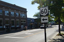
 The northern terminus of State Route 60 in downtown Vermilion.
State Route 60 is a north–south state highway that runs the entire length of the U.S. state of Ohio, from State Route 7 along the Ohio River in Marietta to U.S. Route 6 near Lake Erie in Vermilion.
Heading south from Vermilion, Route 60 traverses rural North Central Ohio while connecting Vermilion, New London, Ashland, and Loudonville. South of Loudonville, Route 60 enters more hilly country, before entering the Muskingum River Valley at Dresden. It closely parallels the Muskingum River for the remainder of its journey to Marietta except for an 11 miles (18 km) stretch in Morgan County where it moves inland to avoid bends in the river.
Parts of State Route 60 were once signed as State Route 77. In order to eliminate confusion with an interstate highway in Ohio having the same number, State Route 77 was renumbed as State Route 60.
References
- ^ Mileages retrieved from Technical Services Straight Line Diagrams unless otherwise noted.
External links
Categories:- State highways in Ohio
- Transportation in Washington County, Ohio
- Transportation in Morgan County, Ohio
- Transportation in Muskingum County, Ohio
- Transportation in Coshocton County, Ohio
- Transportation in Holmes County, Ohio
- Transportation in Ashland County, Ohio
- Transportation in Huron County, Ohio
- Transportation in Erie County, Ohio
Wikimedia Foundation. 2010.

