- Muskingum River
-
Muskingum River 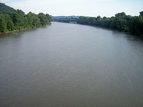
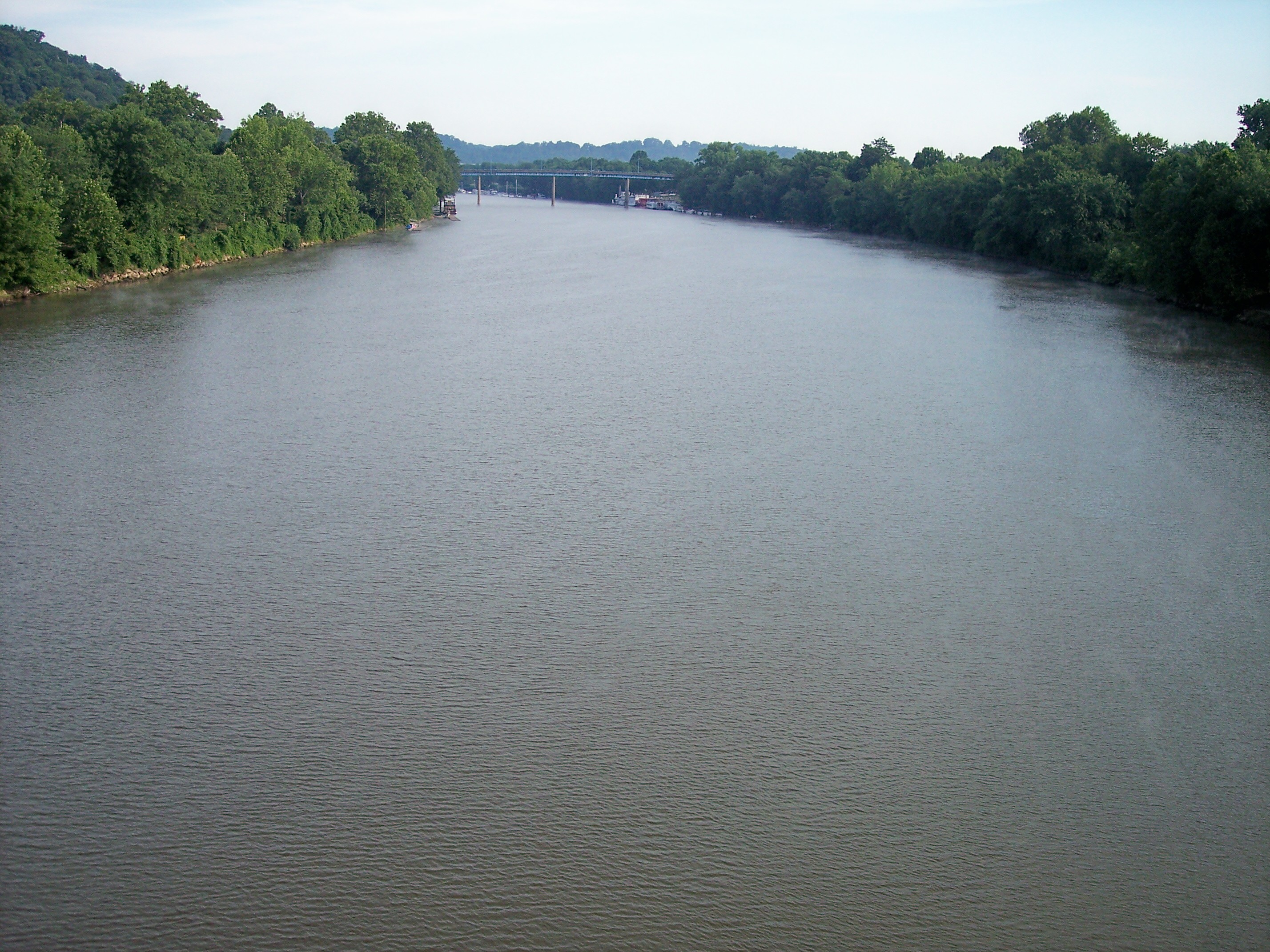
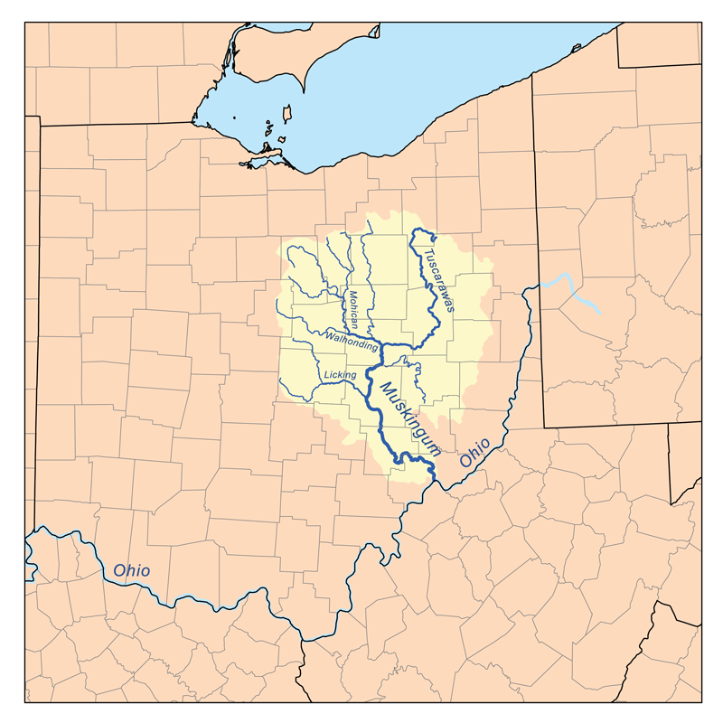
The Muskingum River near its mouth in Marietta, OhioOrigin Confluence of the Tuscarawas and Walhonding Rivers Mouth Ohio River at Marietta, Ohio Basin countries USA Length 111 mi (179 km) Mouth elevation 582 ft (177 m) [1] Basin area 8,051 mi² (20,852 km²) [2]  Map of the Muskingum River watershed.
The Muskingum River is a tributary of the Ohio River, approximately 111 miles (179 km) long, in southeastern Ohio in the United States. An important commercial route in the 19th century, it flows generally southward through the eastern hill country of Ohio. Via the Ohio, it is part of the Mississippi River watershed.
Contents
Course
The Muskingum is formed at Coshocton in east-central Ohio by the confluence of the Walhonding and Tuscarawas rivers. It flows in a meandering course southward past Conesville, Trinway and Dresden to Zanesville, and then southeastward past South Zanesville, Philo, Malta, McConnelsville, Beverly, Lowell, Stockport and Devola. It joins the Ohio at Marietta.
Along its course the Muskingum collects Wills Creek near Conesville; Wakatomika Creek at Dresden; the Licking River at Zanesville; Moxahala Creek at South Zanesville; and Wolf Creek near Beverly.[3]
History
The word Muskingum derives from a similar-sounding Delaware (Native American) word, which some claim to translate as "eye of the elk" or "by the riverside". Historically, it was also the name of a large Wyandot town along the river.
Noted frontier explorer, Christopher Gist, reached the Big Sandy Creek tributary of the river on December 4, 1751. Traveling downriver, he recorded arriving on December 14 at the western Wyandot town of Muskingum, at present-day Coshocton. There he remained for the following month.[4]
Marietta was founded in 1788 as the first permanent settlement in the Northwest Territory, at the mouth of the Muskingum River on the Ohio River. The Big Bottom Massacre occurred along its banks in 1791.
Zanesville was settled by European Americans in 1799 at the site where Zane's Trace crossed the Muskingum at the mouth of the Licking River. In the mid-19th century the Muskingum was an important commercial shipping route, with dams and locks controlling the water level to allow boats to travel up and down the river. With the decrease in use of water-based transportation in Ohio by the 1920s, the locks fell into disrepair.
Since the 1960s, the locks have been repaired to enable pleasure craft to travel the entire navigable length of the river. The Muskingum waterway is one of the few remaining systems in the US to use hand-operated river locks. The navigation system has been designated a national Historic Civil Engineering Landmark. In 2006, it was designated "An Ohio Water Trail;" this designation provides for increased canoe access on the river.
Located north of the Mason-Dixon Line, from around 1812 to 1861 the Muskingum River was a major Underground Railroad route used by fugitive slaves escaping from the South on their journey north to Lake Erie and Canada.
Nonprofit organizations
The [1] Friends of the Lower Muskingum River is a 501 (c) (3) nonprofit land trust based in Marietta, Ohio, concerned with protection of the Muskingum River and adjacent lands. In addition, the [2] Muskingum River Conservation District is a quasi-governmental entity concerned with flood control on the river.
Variant names
According to the Geographic Names Information System, the Muskingum River has also been known as:
- Big Muskingum River
- Elk River
- Mouskindom River
- Mushkingum River
- Muskingham River
- Riviere Chiagnez
See also
- List of Ohio rivers
- Muskingum River Power Plant
External links
- [3] A history-travel guide on the Ohio and Muskingum Rivers
References
- ^ U.S. Geological Survey. Marietta quadrangle, Ohio. 1:24,000. 7.5 Minute Series. Washington D.C.: USGS, 1994.
- ^ "Map of Ohio watersheds". http://www.dnr.state.oh.us/water/watersheds/Basins72PDI_40x40_OnScreen.gif.
- ^ DeLorme (1991). Ohio Atlas & Gazetteer. Yarmouth, Maine: DeLorme. ISBN 0-89933-233-1
- ^ Darlington, Journal of Christopher Gist
Categories:- Muskingum River
- Rivers of Ohio
- Tributaries of the Ohio River
- Geography of Coshocton County, Ohio
- Geography of Morgan County, Ohio
- Geography of Muskingum County, Ohio
- Geography of Washington County, Ohio
Wikimedia Foundation. 2010.