- McConnelsville, Ohio
-
McConnelsville, Ohio — Village — Downtown McConnelsville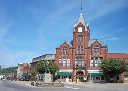 Location of McConnelsville, Ohio
Coordinates: 39°38′56″N 81°51′7″W / 39.64889°N 81.85194°WCoordinates: 39°38′56″N 81°51′7″W / 39.64889°N 81.85194°W Country United States State Ohio County Morgan Area – Total 1.8 sq mi (4.7 km2) – Land 1.8 sq mi (4.6 km2) – Water 0.1 sq mi (0.2 km2) Elevation[1] 692 ft (211 m) Population (2000) – Total 1,676 – Density 953.7/sq mi (368.2/km2) Time zone Eastern (EST) (UTC-5) – Summer (DST) EDT (UTC-4) ZIP code 43756 Area code(s) 740 FIPS code 39-45822[2] GNIS feature ID 1061495[1] 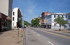 Main Street in McConnelsville in 2007
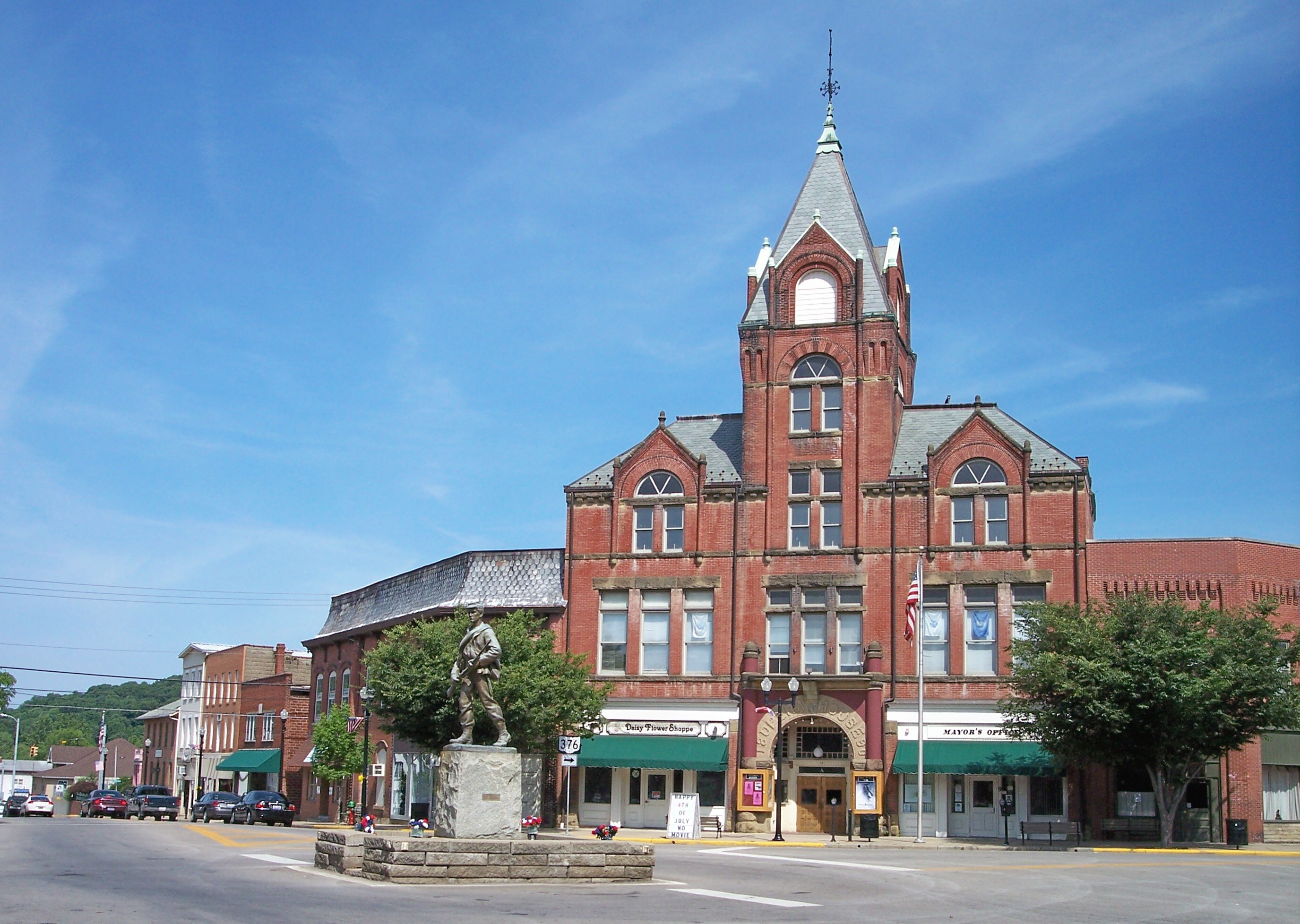
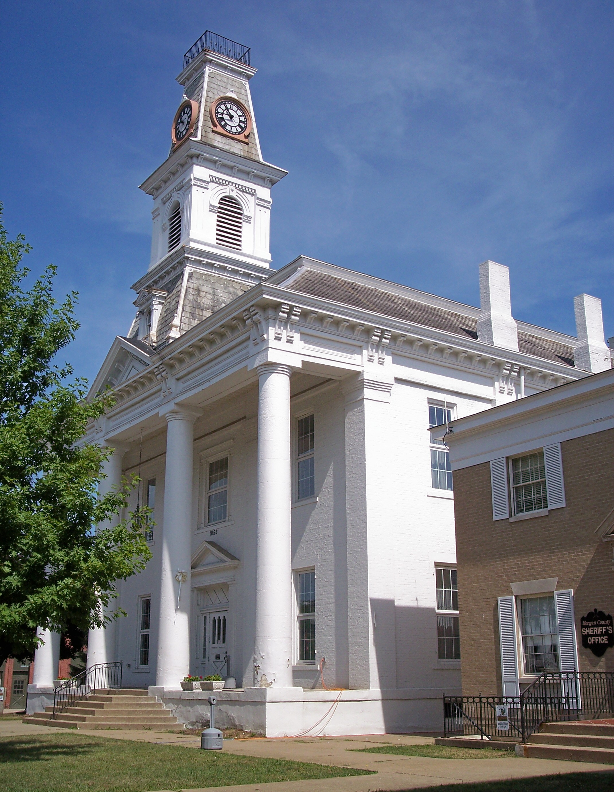
 The Morgan County Courthouse in 2007
McConnelsville is a village in Morgan County, Ohio, United States. The population was 1,676 at the 2000 census. It is the county seat of Morgan County[3]. As of October 19 2011, the mayor is John Walter Finley.
Contents
Geography
McConnelsville is located at 39°38′56″N 81°51′7″W / 39.64889°N 81.85194°W (39.648915, -81.851954)[4]. It is on the east bank of the Muskingum River, opposite Malta, Ohio.
According to the United States Census Bureau, the village has a total area of 1.8 square miles (4.7 km2), of which, 1.8 square miles (4.7 km2) of it is land and 0.1 square miles (0.26 km2) of it (3.85%) is water.
As the town's water tower proudly proclaims, McConnelsville "was the Home of the Hawk Battalion."
Demographics
As of the census[2] of 2000, there were 1,676 people, 805 households, and 445 families residing in the village. The population density was 953.7 people per square mile (367.7/km²). There were 881 housing units at an average density of 501.3 per square mile (193.3/km²). The racial makeup of the village was 95.70% White, 1.49% African American, 0.48% Native American, 0.06% Asian, 0.42% from other races, and 1.85% from two or more races. Hispanic or Latino of any race were 0.24% of the population.
There were 805 households out of which 25.0% had children under the age of 18 living with them, 40.5% were married couples living together, 11.4% had a female householder with no husband present, and 44.6% were non-families. 42.4% of all households were made up of individuals and 26.2% had someone living alone who was 65 years of age or older. The average household size was 2.08 and the average family size was 2.84.
In the village the population was spread out with 22.8% under the age of 18, 6.6% from 18 to 24, 24.6% from 25 to 44, 22.7% from 45 to 64, and 23.3% who were 65 years of age or older. The median age was 42 years. For every 100 females there were 77.9 males. For every 100 females age 18 and over, there were 70.7 males.
The median income for a household in the village was $25,563, and the median income for a family was $39,769. Males had a median income of $31,615 versus $19,537 for females. The per capita income for the village was $17,818. About 13.7% of families and 18.1% of the population were below the poverty line, including 27.0% of those under age 18 and 14.4% of those age 65 or over.
Notable natives and residents
- Frederick Samuel Dellenbaugh - American explorer, writer, and topographer of the Colorado River, Alaska, and Siberia
- James J. Gibson – American psychologist[5]
- William Lawrence - Republican politician involved with the attempt to impeach Andrew Johnson, creating the United States Department of Justice, helping to create the American Red Cross, and ratifying the Geneva Convention
- Otho F. Strahl - Brigadier general in the Confederate Army who was killed at the Battle of Franklin
- Seth Thomas - appointed to the United States Court of Appeals for the Eighth Circuit by President Franklin D. Roosevelt
- Thomas Tipton - former Senator from Nebraska
References
- ^ a b "US Board on Geographic Names". United States Geological Survey. 2007-10-25. http://geonames.usgs.gov. Retrieved 2008-01-31.
- ^ a b "American FactFinder". United States Census Bureau. http://factfinder.census.gov. Retrieved 2008-01-31.
- ^ "Find a County". National Association of Counties. http://www.naco.org/Counties/Pages/FindACounty.aspx. Retrieved 2011-06-07.
- ^ "US Gazetteer files: 2010, 2000, and 1990". United States Census Bureau. 2011-02-12. http://www.census.gov/geo/www/gazetteer/gazette.html. Retrieved 2011-04-23.
- ^ Office of the Home Secretary, National Academy of Sciences - Biographical Memoirs, Volume 63
Municipalities and communities of Morgan County, Ohio Villages Chesterhill | Malta | McConnelsville | Stockport

Townships Unincorporated
communitiesBishopville | Ringgold | Rose Farm
Categories:- Villages in Ohio
- Populated places in Morgan County, Ohio
- County seats in Ohio
- Muskingum River


Wikimedia Foundation. 2010.