- South Zanesville, Ohio
Infobox Settlement
official_name = South Zanesville, Ohio
settlement_type = Village
nickname =
motto =
imagesize =
image_caption =
image_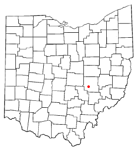
mapsize = 250x200px
map_caption = Location of South Zanesville, Ohio
mapsize1 =
map_caption1 =subdivision_type = Country
subdivision_name =United States
subdivision_type1 = State
subdivision_name1 =Ohio
subdivision_type2 = County
subdivision_name2 = Muskingumgovernment_footnotes =
government_type =
leader_title =
leader_name =
leader_title1 =
leader_name1 =
established_title =
established_date =unit_pref = Imperial
area_footnotes =area_magnitude =
area_total_km2 = 1.9
area_land_km2 = 1.9
area_water_km2 = 0.0
area_total_sq_mi = 0.7
area_land_sq_mi = 0.7
area_water_sq_mi = 0.0population_as_of = 2000
population_footnotes =
population_total = 1936
population_density_km2 = 1024.4
population_density_sq_mi = 2653.2timezone = Eastern (EST)
utc_offset = -5
timezone_DST = EDT
utc_offset_DST = -4
elevation_footnotes = GR|3
elevation_m = 225
elevation_ft = 738
latd = 39 |latm = 54 |lats = 9 |latNS = N
longd = 82 |longm = 1 |longs = 12 |longEW = Wpostal_code_type =
ZIP code
postal_code = 43701
area_code = 740
blank_name = FIPS code
blank_info = 39-73894GR|2
blank1_name = GNIS feature ID
blank1_info = 1070944GR|3
website =
footnotes =South Zanesville is a village in Muskingum County,
Ohio ,United States , along theMuskingum River at the mouth ofMoxahala Creek . The population was 1,936 at the 2000 census.Geography
South Zanesville is located at 39°54'9" North, 82°1'12" West (39.902554, -82.019931)GR|1.
According to the
United States Census Bureau , the village has a total area of 0.7square mile s (1.9km² ), of which, 0.7 square miles (1.9 km²) of it is land and none of the area is covered with water.Demographics
As of the
census GR|2 of 2000, there were 1,936 people, 797 households, and 540 families residing in the village. Thepopulation density was 2,653.2 people per square mile (1,024.0/km²). There were 874 housing units at an average density of 1,197.8/sq mi (462.3/km²). The racial makeup of the village was 97.73% White, 1.08% African American, 0.21% Native American, 0.10% Asian, 0.00% Pacific Islander, 0.10% from other races, and 0.77% from two or more races. 0.26% of the population were Hispanic or Latino of any race.There were 797 households out of which 32.1% had children under the age of 18 living with them, 48.8% were married couples living together, 13.6% had a female householder with no husband present, and 32.2% were non-families. 26.5% of all households were made up of individuals and 10.9% had someone living alone who was 65 years of age or older. The average household size was 2.43 and the average family size was 2.90.
In the village the population was spread out with 25.2% under the age of 18, 9.0% from 18 to 24, 29.7% from 25 to 44, 21.3% from 45 to 64, and 14.7% who were 65 years of age or older. The median age was 36 years. For every 100 females there were 89.6 males. For every 100 females age 18 and over, there were 89.0 males.
The median income for a household in the village was $32,292, and the median income for a family was $37,837. Males had a median income of $27,724 versus $21,220 for females. The
per capita income for the village was $14,920. 11.1% of the population and 10.3% of families were below thepoverty line . 12.5% of those under the age of 18 and 14.4% of those 65 and older were living below the poverty line.High Schools
References
External links
Wikimedia Foundation. 2010.