- Pena Blanca, New Mexico
Infobox Settlement
official_name = Pena Blanca, New Mexico
settlement_type = CDP
nickname =
motto =
imagesize =
image_caption =
image_
imagesize =
image_caption =
image_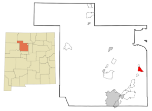
mapsize = 250px
map_caption = Location of Pena Blanca, New Mexico
mapsize1 =
map_caption1 =subdivision_type = Country
subdivision_name =United States
subdivision_type1 = State
subdivision_name1 =New Mexico
subdivision_type2 = County
subdivision_name2 = Sandoval
government_footnotes =
government_type =
leader_title =
leader_name =
leader_title1 =
leader_name1 =
established_title =
established_date =unit_pref = Imperial
area_footnotes =area_magnitude =
area_total_km2 = 17.6
area_land_km2 = 17.6
area_water_km2 = 0.0
area_total_sq_mi = 6.8
area_land_sq_mi = 6.8
area_water_sq_mi = 0.0population_as_of = 2000
population_footnotes =
population_total = 661
population_density_km2 = 37.6
population_density_sq_mi = 97.4timezone = Mountain (MST)
utc_offset = -7
timezone_DST = MDT
utc_offset_DST = -6
elevation_footnotes =
elevation_m = 1596
elevation_ft = 5236
latd = 35 |latm = 34 |lats = 23 |latNS = N
longd = 106 |longm = 20 |longs = 14 |longEW = Wpostal_code_type =
ZIP code
postal_code = 87041
area_code = 505
blank_name = FIPS code
blank_info = 35-55830
blank1_name = GNIS feature ID
blank1_info = 0928768
website =
footnotes =Pena Blanca is a
census-designated place (CDP) in Sandoval County,New Mexico , in theUnited States . As of the 2000 census, the CDP population was 661. It is part of the Albuquerque Metropolitan Statistical Area.Pena Blanca's name is derived from the Spanish term for "white rock", "peña blanca". However, without the
tilde , "pena blanca" actually means "white sorrow" or "white pain".Geography
Pena Blanca is located at coor dms|35|34|23|N|106|20|14|W|city (35.573078, -106.337361)GR|1.
According to the
United States Census Bureau , the CDP has a total area of 6.8square mile s (17.6km² ), all of it land.Demographics
As of the
census GR|2 of 2000, there were 661 people, 226 households, and 169 families residing in the CDP. Thepopulation density was 97.4 people per square mile (37.6/km²). There were 262 housing units at an average density of 38.6/sq mi (14.9/km²). The racial makeup of the CDP was 26.63% White, 0.91% African American, 5.60% Native American, 0.15% Pacific Islander, 63.24% from other races, and 3.48% from two or more races. Hispanic or Latino of any race were 79.43% of the population.There were 226 households out of which 38.5% had children under the age of 18 living with them, 54.4% were married couples living together, 10.2% had a female householder with no husband present, and 25.2% were non-families. 16.8% of all households were made up of individuals and 7.5% had someone living alone who was 65 years of age or older. The average household size was 2.92 and the average family size was 3.33.
In the CDP the population was spread out with 29.7% under the age of 18, 10.4% from 18 to 24, 28.3% from 25 to 44, 21.9% from 45 to 64, and 9.7% who were 65 years of age or older. The median age was 33 years. For every 100 females there were 99.7 males. For every 100 females age 18 and over, there were 94.6 males.
The median income for a household in the CDP was $24,063, and the median income for a family was $28,214. Males had a median income of $19,732 versus $24,583 for females. The
per capita income for the CDP was $15,401. About 25.3% of families and 27.0% of the population were below thepoverty line , including 30.8% of those under age 18 and 13.0% of those age 65 or over.References
External links
Wikimedia Foundation. 2010.