- Madrid, New Mexico
-
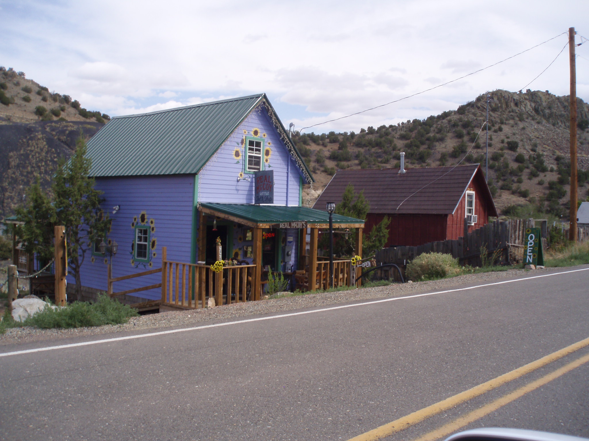
Madrid, New Mexico — CDP — Old miners cabins remodeled into shops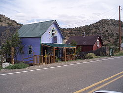 Location of Madrid, New Mexico
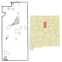
Coordinates: 35°24′21″N 106°9′16″W / 35.40583°N 106.15444°WCoordinates: 35°24′21″N 106°9′16″W / 35.40583°N 106.15444°W Country United States State New Mexico County Santa Fe Area - Total 1.4 sq mi (3.7 km2) - Land 1.4 sq mi (3.7 km2) - Water 0.0 sq mi (0.0 km2) Elevation 6,020 ft (1,835 m) Population (2000) - Total 149 - Density 105.0/sq mi (40.5/km2) Time zone Mountain (MST) (UTC-7) - Summer (DST) MDT (UTC-6) ZIP code 87010 Area code(s) 505 FIPS code 35-46100 GNIS feature ID 0899746 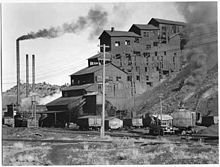 Anthracite coal breaker and power house buildings, Madrid, circa 1935. Anthracite coal was preferred for passenger trains, as it burned cleaner.
Madrid is a census-designated place (CDP) in Santa Fe County, New Mexico, United States. It is part of the Santa Fe, New Mexico Metropolitan Statistical Area. The population was 149 at the 2000 census. Today Madrid (/məˈdrɪd/, "MAD-rid", Spanish: [maˈðɾið]) has become an artists community with galleries lining Route 14 (the Turquoise Trail). It still has remnants of its past with the Mineshaft Tavern and the Coal Mine Museum. The ending of the 2007 film Wild Hogs was set and filmed in the town.
Contents
History
Beginnings
Madrid was a coal mining company town in Northern New Mexico started in the 1850s.
Madrid Miners AA Minor League Baseball Team
The Miners were started by the Madrid Employees Club and won many pennants. The Oscar Huber Ballpark was the first lighted ballpark west of the Mississippi in the 1920s.[1]
Geography
Madrid is located at 35°24′21″N 106°09′16″W / 35.405833°N 106.154498°W (35.405833, -106.154498).[1]
According to the United States Census Bureau, the CDP has a total area of 1.4 square miles (3.6 km2), all of it land.
Demographics
As of the census[2] of 2000, there were 149 people, 82 households, and 27 families residing in the CDP. The population density was 105.0 people per square mile (40.5/km2). There were 103 housing units at an average density of 72.6 per square mile (28.0/km2). The racial makeup of the CDP was 89.93% White, 2.01% African American, 1.34% Native American, 4.03% from other races, and 2.68% from two or more races. Hispanic or Latino of any race were 20.81% of the population.
There were 82 households out of which 17.1% had children under the age of 18 living with them, 20.7% were married couples living together, 11.0% had a female householder with no husband present, and 65.9% were non-families. 52.4% of all households were made up of individuals and 4.9% had someone living alone who was 65 years of age or older. The average household size was 1.82 and the average family size was 2.68.
In the CDP the population was spread out with 16.8% under the age of 18, 4.7% from 18 to 24, 34.9% from 25 to 44, 36.9% from 45 to 64, and 6.7% who were 65 years of age or older. The median age was 39 years. For every 100 females there were 109.9 males. For every 100 females age 18 and over, there were 106.7 males.
The median income for a household in the CDP was $21,905, and the median income for a family was $7,386. Males had a median income of $50,385 versus $28,750 for females. The per capita income for the CDP was $20,025. There were 52.4% of families and 19.8% of the population living below the poverty line, including 43.5% of under eighteens and none of those over 64.
References
- ^ "US Gazetteer files: 2010, 2000, and 1990". United States Census Bureau. 2011-02-12. http://www.census.gov/geo/www/gazetteer/gazette.html. Retrieved 2011-04-23.
- ^ "American FactFinder". United States Census Bureau. http://factfinder.census.gov. Retrieved 2008-01-31.
External links
Municipalities and communities of Santa Fe County, New Mexico Cities 
Town CDPs Agua Fria | Canada de los Alamos | Cedar Grove | Chimayo‡ | Chupadero | Cuartelez | Cundiyo | Cuyamungue | El Rancho | El Valle de Arroyo Seco | Eldorado at Santa Fe | Galisteo | Glorieta | Jaconita | La Cienega | La Puebla | Lamy | Los Cerrillos | Madrid | Pojoaque | Rio Chiquito | Rio en Medio | San Ildefonso Pueblo | Santa Cruz | Sombrillo | Tesuque
Unincorporated
communitiesNambé Pueblo | Seton Village | Stanley | Waldo
Indian reservation Footnotes ‡This populated place also has portions in an adjacent county or counties
Categories:- Populated places in Santa Fe County, New Mexico
- Census-designated places in New Mexico


Wikimedia Foundation. 2010.