- Lamy, New Mexico
Infobox Settlement
official_name = Lamy, New Mexico
settlement_type = CDP
nickname =
motto =
imagesize =
image_caption =
image_
imagesize =
image_caption =
image_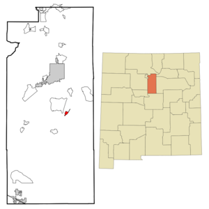
mapsize = 250px
map_caption = Location of Lamy, New Mexico
mapsize1 =
map_caption1 =subdivision_type = Country
subdivision_name =United States
subdivision_type1 = State
subdivision_name1 =New Mexico
subdivision_type2 = County
subdivision_name2 = Santa Fe
government_footnotes =
government_type =
leader_title =
leader_name =
leader_title1 =
leader_name1 =
established_title =
established_date =unit_pref = Imperial
area_footnotes =area_magnitude =
area_total_km2 = 2.8
area_land_km2 = 2.8
area_water_km2 = 0.0
area_total_sq_mi = 1.1
area_land_sq_mi = 1.1
area_water_sq_mi = 0.0population_as_of = 2000
population_footnotes =
population_total = 137
population_density_km2 = 48.7
population_density_sq_mi = 126.2timezone = Mountain (MST)
utc_offset = -7
timezone_DST = MDT
utc_offset_DST = -6
elevation_footnotes =
elevation_m = 1976
elevation_ft = 6483
latd = 35 |latm = 29 |lats = 10 |latNS = N
longd = 105 |longm = 52 |longs = 50 |longEW = Wpostal_code_type =
ZIP code
postal_code = 87540
area_code = 505
blank_name = FIPS code
blank_info = 35-38890
blank1_name = GNIS feature ID
blank1_info = 0890917
website =
footnotes =Lamy is a
census-designated place (CDP) in Santa Fe County,New Mexico ,United States , to the south of the city of Sante Fe. The town was named after ArchbishopJean-Baptiste Lamy , and lies within the "Bishop John Lamy Spanish Land Grant", which dates back to the eighteenth century [ "Spanish Exploration and Settlement" in "Windmills and Dreams: A History of the Eldorado Community, 1997, ECIA, privately printed ] .Lamy is part of the
Santa Fe, New Mexico Metropolitan Statistical Area . The population was 137 at the 2000 census. The formerAtchison, Topeka, and Santa Fe Railroad (ATSF), now theBurlington Northern Santa Fe (BNSF), passes through Lamy. This railroad, usually called just the "Santa Fe", was originally planned to run fromAtchison, Kansas , on theMissouri River , to Santa Fe, the capital city ofNew Mexico , and then points west. However, as the tracks progressed west intoNew Mexico , thecivil engineer s in charge realized that the hills surrounding Santa Fe made this impractical. Hence, they built the railway line though Lamy, instead. Later on, a spur line was built from Lamy to Santa Fe, bringing the railroad to Santa Fe at last. In1896 theFred Harvey company built the luxurious "El Ortiz Hotel" here. Thus Lamy became an important railroad junction. In 1992 the spur line was taken over by theSanta Fe Southern Railway , which operates a popular excursion train, using vintage passenger railcars and modern freight cars, between Santa Fe and Lamy.The significance of Lamy as a railroad junction is referred to by instrumental group the
California Guitar Trio in a five-part suite "Train to Lamy" on their second album "Invitation".Geography
Lamy is located at coor dms|35|29|10|N|105|52|50|W|city (35.486162, -105.880490)GR|1.
According to the
United States Census Bureau , the CDP has a total area of 1.1square mile s (2.8km² ), all of it land.Demographics
As of the
census GR|2 of 2000, there were 137 people, 55 households, and 33 families residing in the CDP. Thepopulation density was 126.2 people per square mile (48.5/km²). There were 64 housing units at an average density of 59.0/sq mi (22.7/km²). The racial makeup of the CDP was 74.45% White, 2.92% Native American, 18.25% from other races, and 4.38% from two or more races. Hispanic or Latino of any race were 44.53% of the population.There were 55 households out of which 40.0% had children under the age of 18 living with them, 49.1% were married couples living together, 10.9% had a female householder with no husband present, and 38.2% were non-families. 29.1% of all households were made up of individuals and 9.1% had someone living alone who was 65 years of age or older. The average household size was 2.49 and the average family size was 3.18.
In the CDP the population was spread out with 27.7% under the age of 18, 10.2% from 18 to 24, 26.3% from 25 to 44, 28.5% from 45 to 64, and 7.3% who were 65 years of age or older. The median age was 34 years. For every 100 females there were 95.7 males. For every 100 females age 18 and over, there were 98.0 males.
The median income for a household in the CDP was $43,333, and the median income for a family was $27,083. Males had a median income of $25,568 versus $0 for females. The
per capita income for the CDP was $16,765. There were 17.5% of families and 20.5% of the population living below thepoverty line , including no under eighteens and none of those over 64.Notable residents
Author and screenwriter
Melinda Snodgrass lives near Lamy with her family.
= Notes =External links
* [http://harvey.library.arizona.edu/finding_aid/8nm/1/welcome.html Photos of "El Ortiz" railroad hotel, Lamy, 1896-1945]
* [http://www.trainweb.com/slides/ss03/ss03a_20.htm Photo, Lamy in 1997]
* [http://www.huntel.com/~artpike/lamy1.htm Photo of Lamy in 1880]
Wikimedia Foundation. 2010.