- National Register of Historic Places listings in Santa Cruz County, California
-
This list includes properties and districts listed on the National Register of Historic Places in Santa Cruz County, California. Click the "Map of all coordinates" link to the right to view a Google map of all properties and districts with latitude and longitude coordinates in the table below.[1]
-
- This National Park Service list is complete through NPS recent listings posted November 10, 2011.[2]
[3] Landmark name [4] Image Date listed Location City or town Summary 1 Bank of Santa Cruz County 
March 15, 1982 1502 Pacific Ave.
36°58′31″N 122°01′31″W / 36.975278°N 122.025278°WSanta Cruz 2 Bayview Hotel 
March 30, 1992 8041 Soquel Dr.
36°58′39″N 121°53′58″W / 36.9775°N 121.899444°WAptos Built in 1878 3 Godfrey M. Bockius House July 13, 1989 322 E. Beach St.
36°54′58″N 121°44′51″W / 36.916111°N 121.7475°WWatsonville 4 Branciforte Adobe January 31, 1979 1351 N. Branciforte Ave.
36°59′23″N 122°00′35″W / 36.989722°N 122.009722°WSanta Cruz 5 Allan Brown Site June 25, 1981 Address Restricted Santa Cruz 6 Carmelita Court March 20, 1986 315-321 Main St.
36°57′56″N 122°01′20″W / 36.965556°N 122.022222°WSanta Cruz 7 Jose Joaquin Castro Adobe December 12, 1976 NW of Watsonville at 184 Old Adobe Rd.
36°56′46″N 121°48′40″W / 36.946111°N 121.811111°WWatsonville 8 Cope Row Houses 
January 28, 1982 412-420 Lincoln St.
36°58′20″N 122°01′49″W / 36.972222°N 122.030278°WSanta Cruz 9 Cowell Lime Works Historic District 
November 21, 2007 University of California, Santa Cruz campus; High St. and Glen Coolidge Dr. Santa Cruz Built by Henry Cowell, now part of University of California, Santa Cruz campus 10 Davenport Jail 
April 27, 1992 1 Center St.
37°00′38″N 122°11′31″W / 37.010556°N 122.191944°WDavenport 11 Felton Covered Bridge 
June 19, 1973 Covered Bridge Road
37°03′07″N 122°04′13″W / 37.051944°N 122.070278°WFelton An 1890s wooden covered Brown truss bridge, tallest covered bridge in the U.S., entrance to Felton for 45 years, part of park now. 12 Felton Presbyterian Church April 6, 1978 6299 Gushee St.
37°03′10″N 122°04′24″W / 37.052778°N 122.073333°WFelton 13 Garfield Park Branch Library March 26, 1992 705 Woodrow Ave.
36°57′29″N 122°02′16″W / 36.958056°N 122.037778°WSanta Cruz 14 Glen Canyon Covered Bridge 
May 17, 1984 Branciforte Dr.
37°00′00″N 122°00′08″W / 37.0°N 122.002222°WSanta Cruz 15 Golden Gate Villa 
July 24, 1975 924 3rd St.
36°58′02″N 122°01′18″W / 36.967222°N 122.021667°WSanta Cruz 16 Grace Episcopal Church December 19, 2006 12547 CA 9
37°07′00″N 122°07′11″W / 37.116667°N 122.119722°WBoulder Creek 17 Hihn Building March 20, 1973 201 Monterey Ave.
36°58′23″N 121°56′58″W / 36.973056°N 121.949444°WCapitola 18 A. J. Hinds House August 25, 1983 529 Chestnut St.
36°58′25″N 122°01′48″W / 36.973611°N 122.03°WSanta Cruz 19 Hotel Metropole May 23, 1979 1111 Pacific Ave.
36°58′19″N 122°01′29″W / 36.971944°N 122.024722°WSanta Cruz 20 Judge Lee House June 30, 1980 128 E. Beach St.
36°54′42″N 121°45′13″W / 36.911667°N 121.753611°WWatsonville 21 Lettunich Building September 24, 1992 406 Main St.
36°54′37″N 121°45′19″W / 36.910278°N 121.755278°WWatsonville 22 Live Oak Ranch July 10, 1975 105 Mentel Ave.
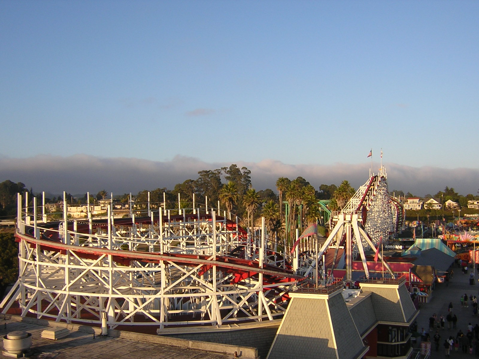
36°58′38″N 121°59′57″W / 36.977222°N 121.999167°WSanta Cruz 23 Looff Carousel and Roller Coaster on the Santa Cruz Beach Boardwalk 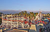
February 27, 1987 Along Beach St.
36°57′52″N 122°00′51″W / 36.964444°N 122.014167°WSanta Cruz 24 Madison House February 2, 1984 335 East Lake
36°54′57″N 121°45′06″W / 36.915833°N 121.751667°WWatsonville 25 Mansion House Hotel August 18, 1983 418-424 Main St.
36°54′38″N 121°45′21″W / 36.910556°N 121.755833°WWatsonville 26 Mission Hill Area Historic District 
May 17, 1976 Mission St.
36°58′39″N 122°01′43″W / 36.9775°N 122.028611°WSanta Cruz 27 Neary-Rodriguez Adobe February 24, 1975 130-134 School St.
36°58′40″N 122°01′39″W / 36.977778°N 122.0275°WSanta Cruz 28 Octagon Building 
March 24, 1971 Corner of Front and Cooper Sts.
36°58′29″N 122°01′29″W / 36.974722°N 122.024722°WSanta Cruz 29 Old Riverview Historic District January 22, 1988 Blue Gum Ave., Capitola Ave., Riverview Ave., Riverview Dr., and Wharf Rd.
36°58′27″N 121°57′12″W / 36.974167°N 121.953333°WCapitola 30 Phillipshurst-Riverwood August 4, 1983 CA 9
37°06′02″N 122°05′58″W / 37.100556°N 122.099444°WBen Lomond 31 Redman House July 28, 2004 1635 W. Beach Dr.
36°53′47″N 121°46′33″W / 36.896389°N 121.775833°WWatsonville 32 Rispin Mansion March 14, 1991 2200 Wharf Rd.
36°58′43″N 121°57′22″W / 36.978611°N 121.956111°WCapitola 33 Elias H. Robinson House 
January 9, 1998 363 Ocean St.
36°58′24″N 122°01′02″W / 36.973333°N 122.017222°WSanta Cruz 34 Sand Hill Bluff Site June 20, 2008 Address Restricted Santa Cruz 35 Santa Cruz Downtown Historic District July 27, 1989 Roughly Rincon St., Church St., Chestnut St., Walnut St., Cedar St., Laurel St., Myrtle St., and Lincoln St.
36°58′15″N 122°02′23″W / 36.970833°N 122.039722°WSanta Cruz 36 Hiram D. Scott House 
April 13, 1977 4603 Scotts Valley Drive
37°02′57″N 122°01′02″W / 37.049167°N 122.017222°WScotts Valley 37 Six Sisters-Lawn Way Historic District 
May 1, 1987 Roughly bounded by San Jose Ave., Capitola Ave., and Esplanade
36°58′21″N 121°57′40″W / 36.9725°N 121.961111°WCapitola 38 Stoesser Block and Annex April 7, 1983 331-341 Main St.
36°54′34″N 121°45′20″W / 36.909444°N 121.755556°WWatsonville 39 US Post Office-Santa Cruz Main 
January 11, 1985 850 Front St.
36°58′36″N 122°01′33″W / 36.976667°N 122.025833°WSanta Cruz 40 Valencia Hall September 20, 1984 Valencia Rd.
36°59′47″N 121°51′55″W / 36.996389°N 121.865278°WAptos 41 Venetian Court Apartments 
April 2, 1987 1500 Wharf Rd.
36°58′22″N 121°57′08″W / 36.972778°N 121.952222°WCapitola 1924 condominuiums 42 Veterans Memorial Building 
April 27, 1992 842-846 Front St.
36°58′34″N 122°01′29″W / 36.976111°N 122.024722°WSanta Cruz 43 Watsonville City Plaza August 22, 1983 Bounded by Main, Peck, Union, and E. Beach Cts.
36°54′37″N 121°45′17″W / 36.910278°N 121.754722°WWatsonville 44 Watsonville-Lee Road Site May 28, 1976 Address Restricted Watsonville See also
- National Register of Historic Places listings in California
- List of National Historic Landmarks in California
References
- ^ The latitude and longitude information provided in this table was derived originally from the National Register Information System, which has been found to be fairly accurate for about 99% of listings. For about 1% of NRIS original coordinates, experience has shown that one or both coordinates are typos or otherwise extremely far off; some corrections may have been made. A more subtle problem causes many locations to be off by up to 150 yards, depending on location in the country: most NRIS coordinates were derived from tracing out latitude and longitudes off of USGS topographical quadrant maps created under the North American Datum of 1927, which differs from the current, highly accurate WGS84 GPS system used by Google maps. Chicago is about right, but NRIS longitudes in Washington are higher by about 4.5 seconds, and are lower by about 2.0 seconds in Maine. Latitudes differ by about 1.0 second in Florida. Some locations in this table may have been corrected to current GPS standards.
- ^ "National Register of Historic Places: Weekly List Actions". National Park Service, United States Department of the Interior. Retrieved on November 10, 2011.
- ^ Numbers represent an ordering by significant words. Various colorings, defined here, differentiate National Historic Landmark sites and National Register of Historic Places Districts from other NRHP buildings, structures, sites or objects.
- ^ "National Register Information System". National Register of Historic Places. National Park Service. . http://nrhp.focus.nps.gov/natreg/docs/All_Data.html.
U.S. National Register of Historic Places Topics Lists by states Alabama • Alaska • Arizona • Arkansas • California • Colorado • Connecticut • Delaware • Florida • Georgia • Hawaii • Idaho • Illinois • Indiana • Iowa • Kansas • Kentucky • Louisiana • Maine • Maryland • Massachusetts • Michigan • Minnesota • Mississippi • Missouri • Montana • Nebraska • Nevada • New Hampshire • New Jersey • New Mexico • New York • North Carolina • North Dakota • Ohio • Oklahoma • Oregon • Pennsylvania • Rhode Island • South Carolina • South Dakota • Tennessee • Texas • Utah • Vermont • Virginia • Washington • West Virginia • Wisconsin • WyomingLists by territories Lists by associated states Other Municipalities and communities of Santa Cruz County, California Cities 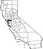
CDPs Amesti | Aptos | Aptos Hills-Larkin Valley | Ben Lomond | Bonny Doon | Boulder Creek | Brookdale | Corralitos | Davenport | Day Valley | Felton | Freedom | Interlaken | La Selva Beach | Live Oak | Lompico | Mount Hermon | Pajaro Dunes | Paradise Park | Pasatiempo | Pleasure Point | Rio del Mar | Seacliff | Soquel | Twin Lakes | Zayante
Unincorporated
communitiesOpal Cliffs | Summit | Swanton
Ghost
townCategories:- History of Santa Cruz County, California
- Santa Cruz County, California
- National Register of Historic Places in California by county
- Lists of National Register of Historic Places in California
-


Wikimedia Foundation. 2010.