- Ben Lomond, California
Infobox Settlement
official_name = Ben Lomond, California
other_name =
native_name =
nickname =
settlement_type = CDP
motto =
imagesize =
image_caption =
flag_size =
image_
seal_size =
image_shield =
shield_size =
image_blank_emblem =
blank_emblem_type =
blank_emblem_size =
imagesize =
image_caption =
flag_size =
image_
seal_size =
image_shield =
shield_size =
image_blank_emblem =
blank_emblem_type =
blank_emblem_size =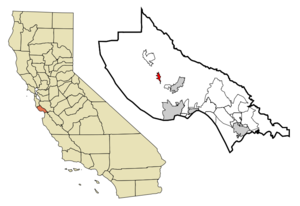
mapsize = 250x200px
map_caption = Location in Santa Cruz County and the state ofCalifornia
mapsize1 =
map_caption1 =
image_dot_
dot_mapsize =
dot_map_caption =
dot_x =
dot_y =
pushpin_
pushpin_label_position =
pushpin_map_caption =
pushpin_mapsize =
subdivision_type = Country
subdivision_name =United States
subdivision_type1 = State
subdivision_name1 =California
subdivision_type2 = County
subdivision_name2 = Santa Cruz
subdivision_type3 =
subdivision_name3 =
subdivision_type4 =
subdivision_name4 =
government_footnotes =
government_type =
leader_title =
leader_name =
leader_title1 =
leader_name1 =
leader_title2 =
leader_name2 =
leader_title3 =
leader_name3 =
leader_title4 =
leader_name4 =
established_title =
established_date =
established_title2 =
established_date2 =
established_title3 =
established_date3 =
area_magnitude =
unit_pref =
area_footnotes =
area_total_km2 = 2.2
area_land_km2 = 2.2
area_water_km2 = 0
area_total_sq_mi = 0.8
area_land_sq_mi = 0.8
area_water_sq_mi = 0
area_water_percent =
area_urban_km2 =
area_urban_sq_mi =
area_metro_km2 =
area_metro_sq_mi =
area_blank1_title =
area_blank1_km2 =
area_blank1_sq_mi =
population_as_of = 2000
population_footnotes =
population_note =
population_total = 2364
population_density_km2 = 1074.5
population_density_sq_mi = 2955
population_metro =
population_density_metro_km2 =
population_density_metro_sq_mi =
population_urban =
population_density_urban_km2 =
population_density_urban_sq_mi =
population_blank1_title =
population_blank1 =
population_density_blank1_km2 =
population_density_blank1_sq_mi =
timezone = PST
utc_offset = -8
timezone_DST = PDT
utc_offset_DST = -7
latd = 37 |latm = 4 |lats = 58 |latNS = N
longd = 122 |longm = 5 |longs = 1 |longEW = W
elevation_footnotes =
elevation_m = 101
elevation_ft = 331
postal_code_type =ZIP code
postal_code = 95005
area_code = 831
blank_name = FIPS code
blank_info = 06-05332
blank1_name = GNIS feature ID
blank1_info = 1655826
website =
footnotes =Ben Lomond is a
census-designated place (CDP) in Santa Cruz County,California ,United States . The population was 2,364 at the 2000 census.Geography
Ben Lomond is located on State Highway 9, about 12 miles from
Santa Cruz, CA and 34 miles fromSan Jose, CA (the nearest major city) at coor dms|37|5|24|N|122|5|24|W|city (37.09, -122.09)GR|1.According to the
United States Census Bureau , the CDP has a total area of 0.8square mile s (2.2km² ). All of it is land and none of it is covered by water.Loch Lomond is a reservoir built on Newell Creek.
The Wagon Wheel Bar and Restaurant was where heavyweight boxer
Jim Jeffreys trained in the 1940's.Climate
The Western Climate Center reports that Ben Lomond has an average annual rainfall of 52.09 inches and an average annual snowfall of 0.2 inch. January is the coldest month with a normal maximum of 55.9°F and a normal minimum of 35.3°F. August is the warmest month with a normal maximum of 81.8°F and a normal minimum of 48.2°F.
Demographics
As of the
census GR|2 of 2000, there were 2,364 people, 873 households, and 577 families residing in the CDP. Thepopulation density was 2,802.2 people per square mile (1,086.6/km²). There were 924 housing units at an average density of 1,095.3/sq mi (424.7/km²). The racial makeup of the CDP was 91.16% White, 0.17% African American, 0.68% Native American, 1.65% Asian, 0.13% Pacific Islander, 2.37% from other races, and 3.85% from two or more races. Hispanic or Latino of any race were 6.43% of the population.There were 873 households out of which 36.4% had children under the age of 18 living with them, 48.2% were married couples living together, 11.6% had a female householder with no husband present, and 33.8% were non-families. 21.9% of all households were made up of individuals and 3.6% had someone living alone who was 65 years of age or older. The average household size was 2.66 and the average family size was 3.09.
In the CDP the population was spread out with 25.9% under the age of 18, 9.0% from 18 to 24, 32.7% from 25 to 44, 27.5% from 45 to 64, and 5.0% who were 65 years of age or older. The median age was 36 years. For every 100 females there were 105.7 males. For every 100 females age 18 and over, there were 100.0 males.
The median income for a household in the CDP was $57,241, and the median income for a family was $59,412. Males had a median income of $40,602 versus $28,042 for females. The
per capita income for the CDP was $25,691. About 2.7% of families and 7.3% of the population were below thepoverty line , including 1.7% of those under age 18 and none of those age 65 or over.Politics
In the state legislature Ben Lomond is located in the 11th Senate District, represented by Democrat
Joe Simitian , and in the 27th Assembly District, represented by DemocratJohn Laird . Federally, Ben Lomond is located inCalifornia's 14th congressional district , which has a Cook PVI of D +18 [cite web | title = Will Gerrymandered Districts Stem the Wave of Voter Unrest? | publisher = Campaign Legal Center Blog | url=http://www.clcblog.org/blog_item-85.html | accessdate = 2008-02-10] and is represented by DemocratAnna Eshoo .References
External links
* [http://www.scruzwiki.org Santa Cruz Wiki - The People's Guide to Santa Cruz County, California.]
* [http://www.sequoiaretreatcenter.come The Sequoia Retreat Center Ben Lomond, California.]
Wikimedia Foundation. 2010.