| [3] |
Landmark name [4] |
Image |
Date listed |
Location |
City or town |
Summary |
| 1 |
Agnews Insane Asylum |
|
01997-08-13August 13, 1997 |
4000 Lafayette Ave.
37°23′38″N 121°57′10″W / 37.393889°N 121.952778°W / 37.393889; -121.952778 (Agnews Insane Asylum) |
Santa Clara |
|
| 2 |
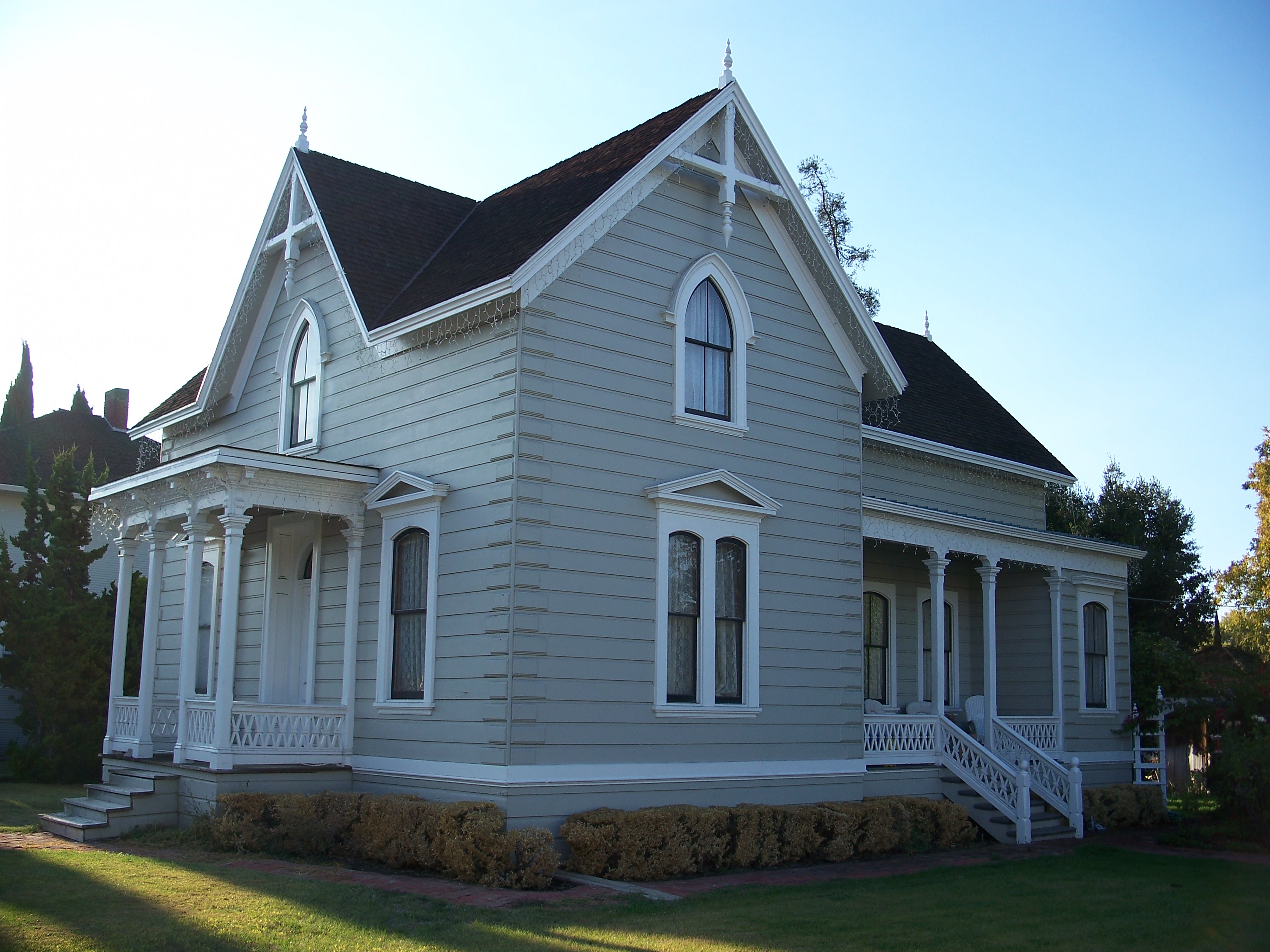
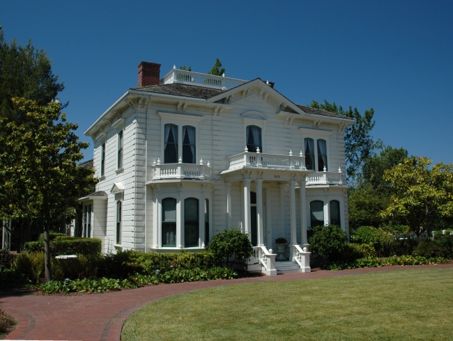
John Colpitts Ainsley House No. 3 |
|
02005-10-03October 3, 2005 |
300 Grant St.
37°17′26″N 121°56′37″W / 37.290556°N 121.943611°W / 37.290556; -121.943611 (John Colpitts Ainsley House No. 3) |
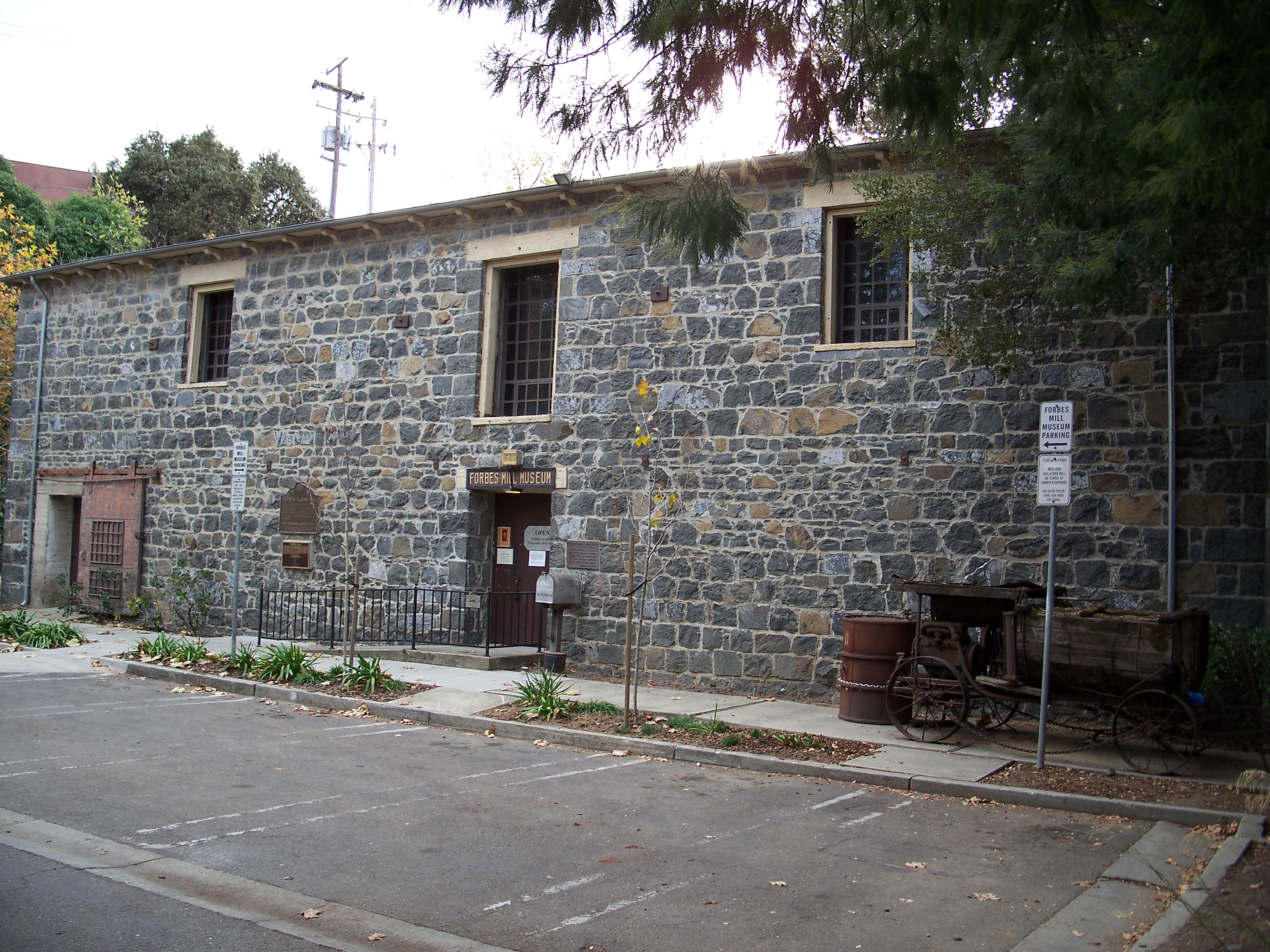
Campbell |
|
| 3 |
Theophilus Allen House |
|
01999-05-20May 20, 1999 |
601 Melville Ave.
37°26′38″N 122°08′49″W / 37.443889°N 122.146944°W / 37.443889; -122.146944 (Theophilus Allen House) |
Palo Alto |
|
| 4 |
Alviso Historic District |
|
01973-10-09October 9, 1973 |
Boundaries unknown at this time
37°25′30″N 121°58′00″W / 37.425°N 121.966667°W / 37.425; -121.966667 (Alviso Historic District) |
Alviso |
|
| 5 |
Jose Maria Alviso Adobe |
|
01997-10-07October 7, 1997 |
92 Piedmont Rd.
37°26′17″N 121°52′08″W / 37.438056°N 121.868889°W / 37.438056; -121.868889 (Jose Maria Alviso Adobe) |
Milpitas |
|
| 6 |
Ashworth-Remillard House |
|
01976-12-12December 12, 1976 |
755 Story Rd.
37°19′43″N 121°51′34″W / 37.328611°N 121.859444°W / 37.328611; -121.859444 (Ashworth-Remillard House) |
San Jose |
|
| 7 |
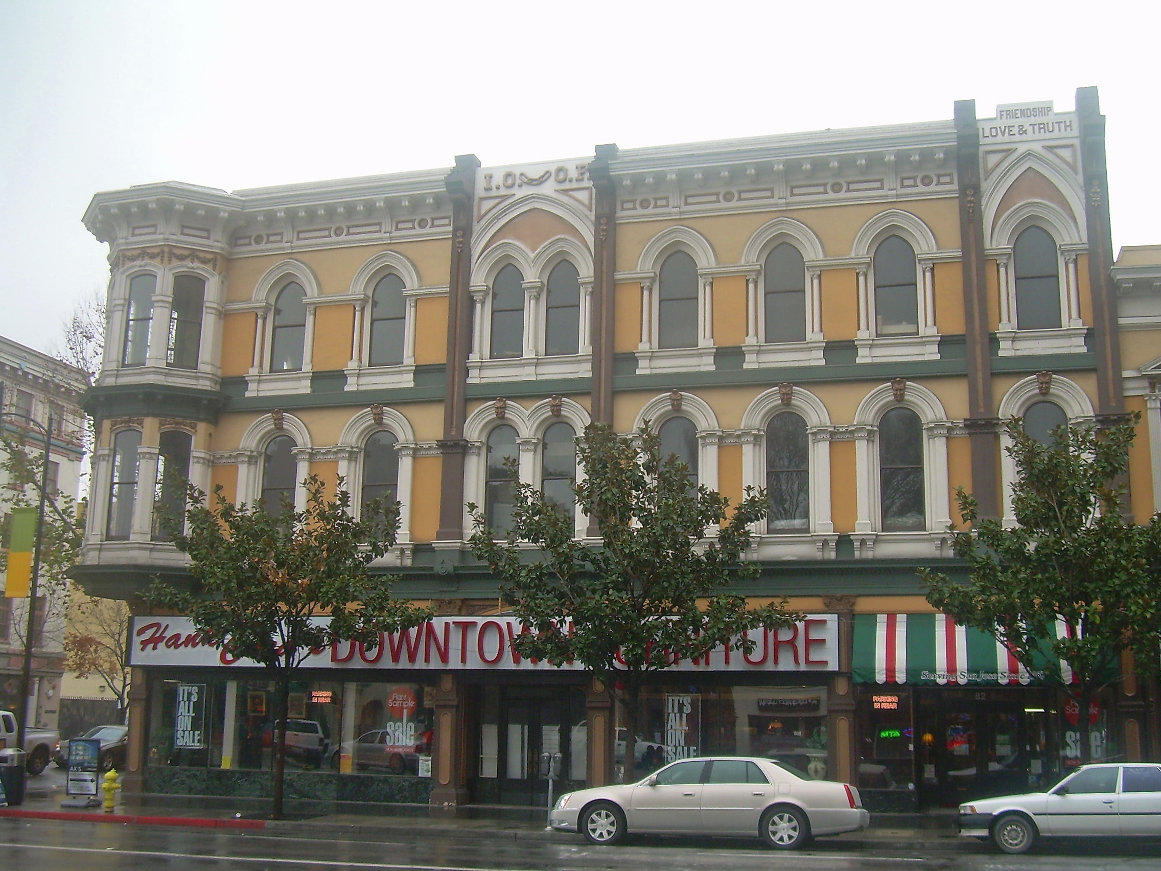
Building at 27-29 Fountain Alley |
|
01982-03-02March 2, 1982 |
27-29 Fountain Alley
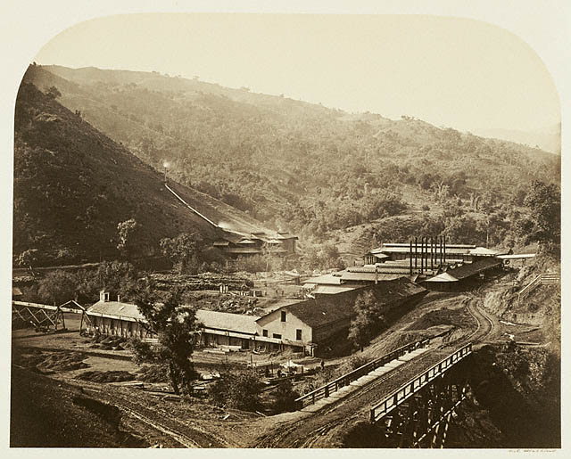
37°20′16″N 121°54′46″W / 37.337778°N 121.912778°W / 37.337778; -121.912778 (Building at 27-29 Fountain Alley) |
San Jose |
|
| 8 |
Campbell Union Grammar School |
|
01979-07-20July 20, 1979 |
11 E. Campbell Ave.
37°17′16″N 121°56′52″W / 37.287778°N 121.947778°W / 37.287778; -121.947778 (Campbell Union Grammar School) |
Campbell |
|
| 9 |
Campbell Union High School Historic District |
|
01989-08-17August 17, 1989 |
1 W. Campbell Ave.
37°17′13″N 121°57′14″W / 37.286994°N 121.953864°W / 37.286994; -121.953864 (Campbell Union High School Historic District) |
Campbell |
|
| 10 |
Christian Church of Gilroy |
|
01982-04-01April 1, 1982 |
160 5th St.
37°00′28″N 121°34′14″W / 37.007778°N 121.570556°W / 37.007778; -121.570556 (Christian Church of Gilroy) |
Gilroy |
|
| 11 |
Civic Art Gallery |
|
01973-01-29January 29, 1973 |
110 Market St.
37°20′01″N 121°53′21″W / 37.333611°N 121.889167°W / 37.333611; -121.889167 (Civic Art Gallery) |
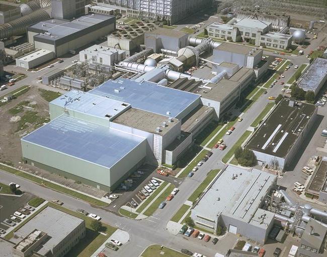
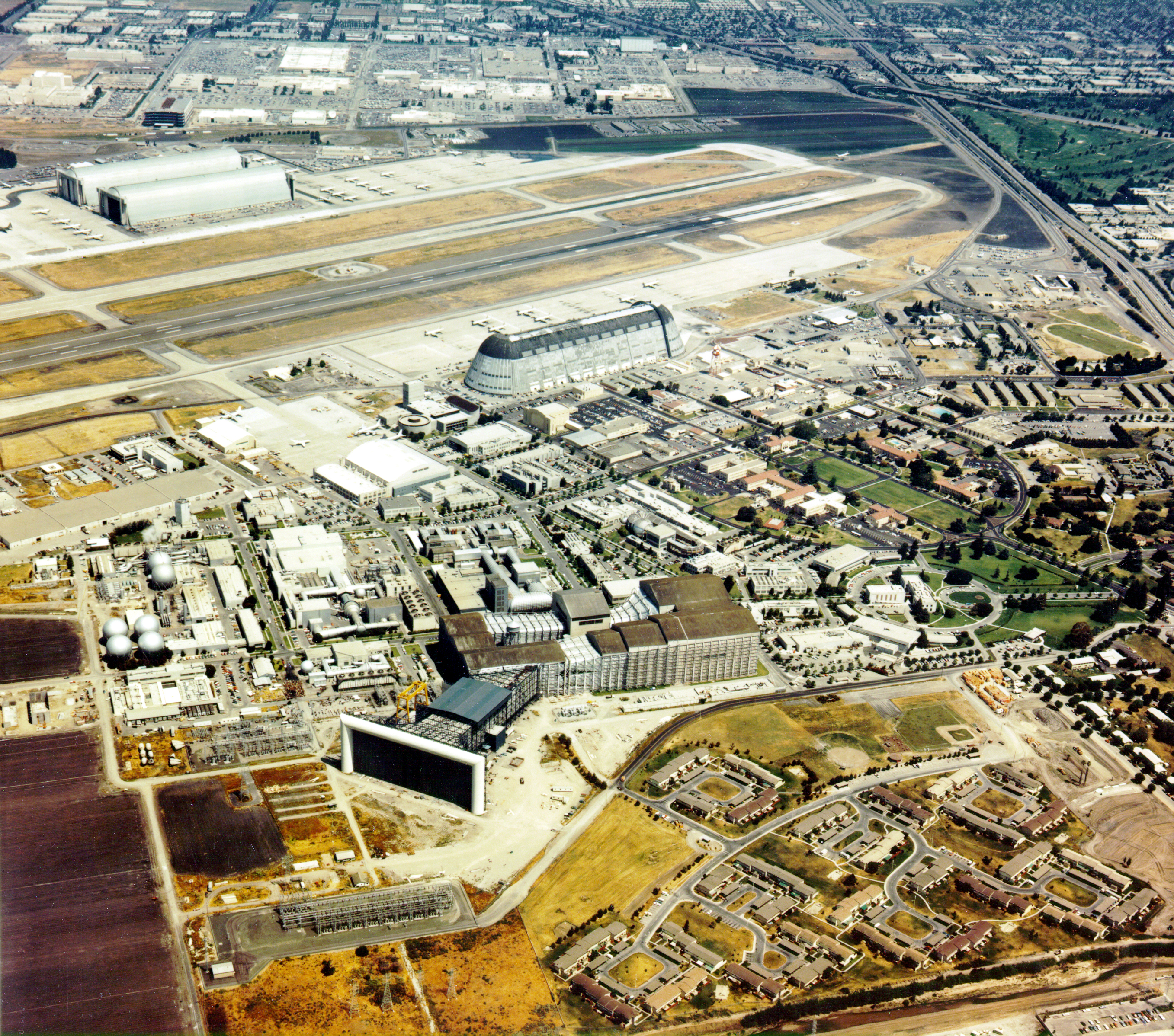
San Jose |
|
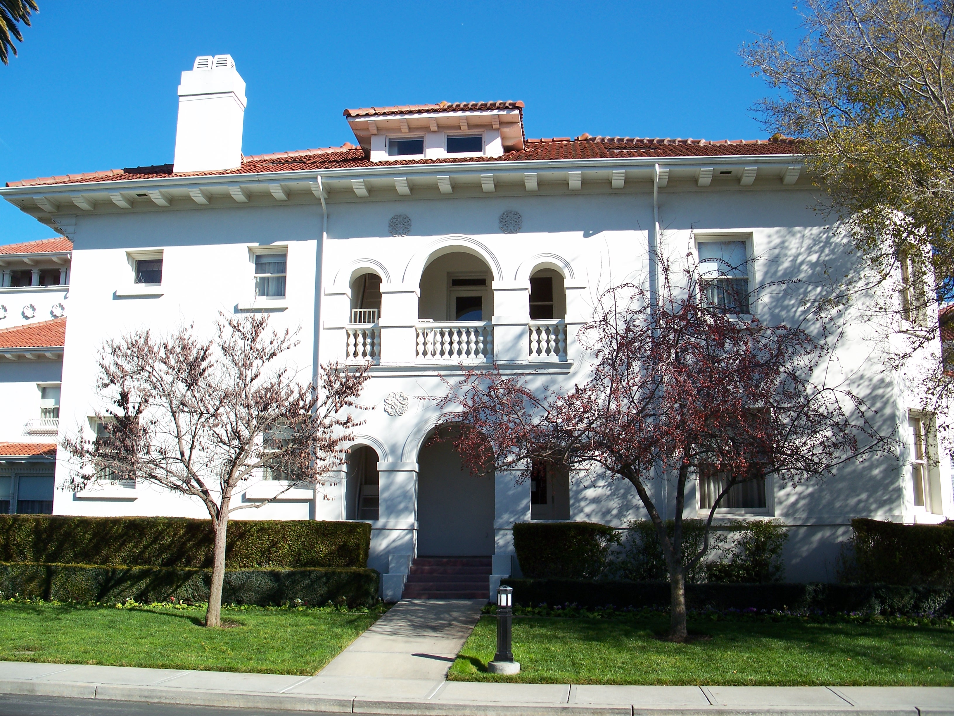
| 12 |
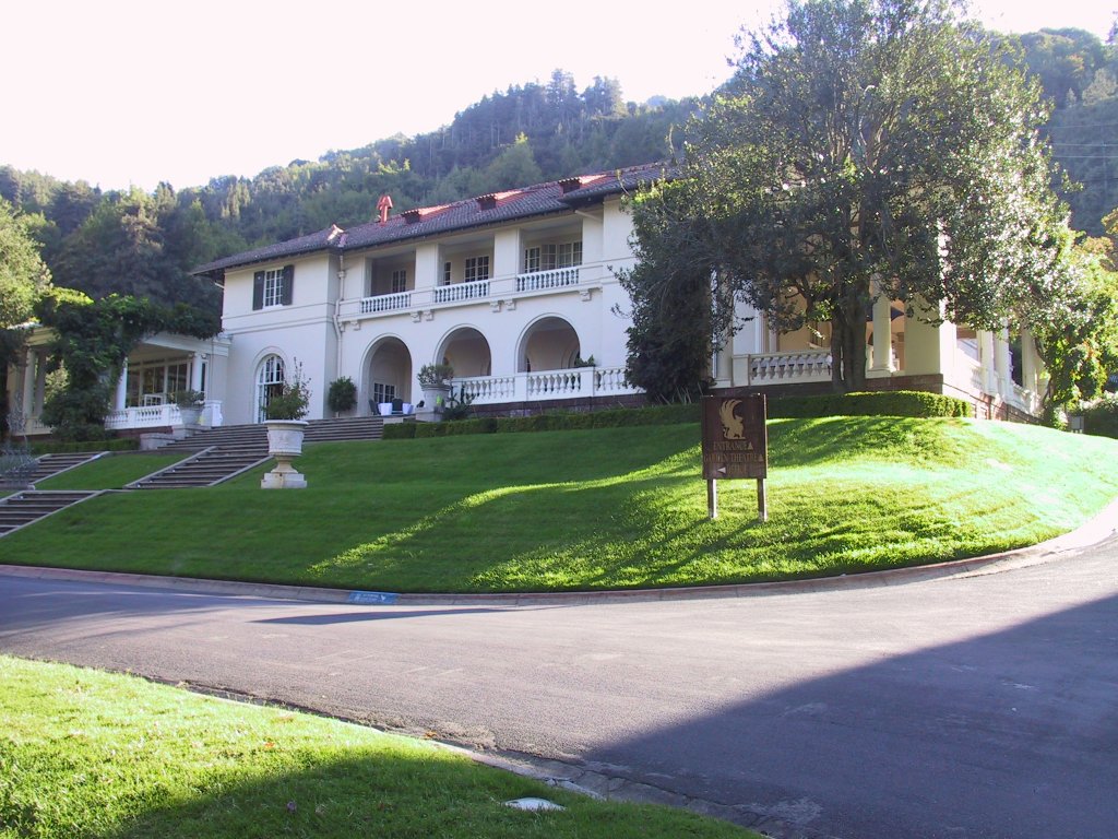
Coyote Creek Archeological District |
|
01971-10-14October 14, 1971 |
Address Restricted
|
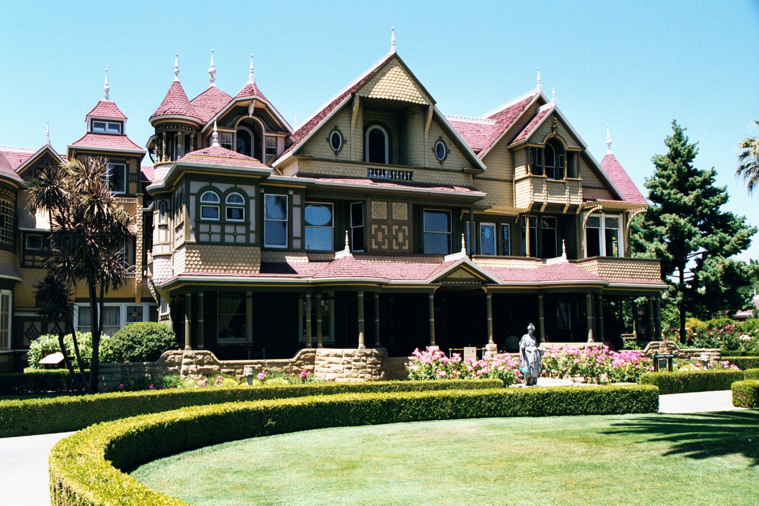
Gilroy Hot Springs |
|
| 13 |
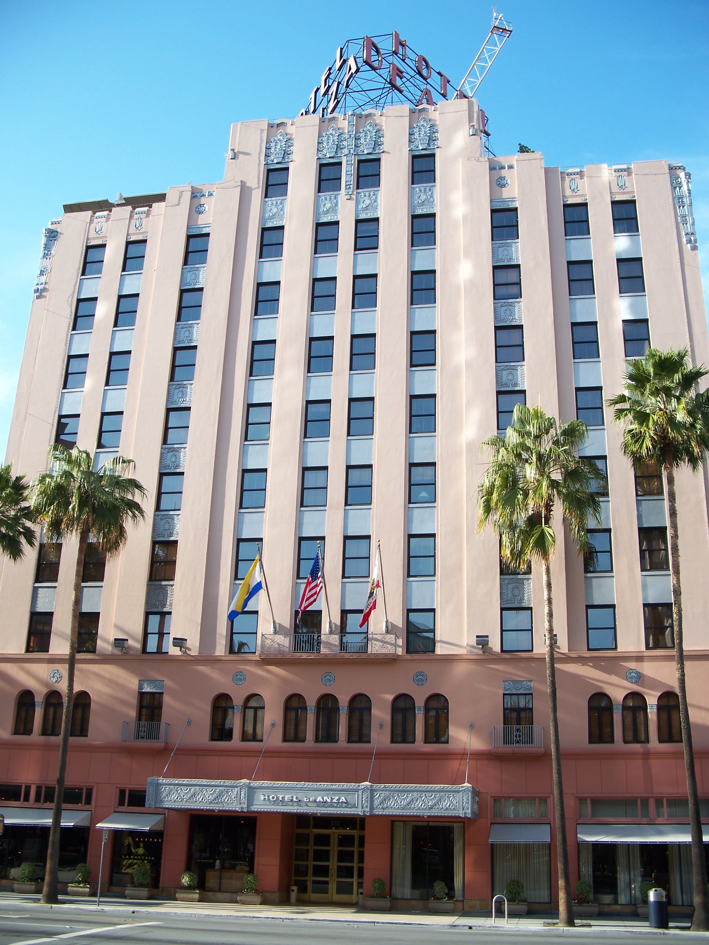
De Anza Hotel |
|
01982-01-21January 21, 1982 |
233 W. Santa Clara St.
37°20′04″N 121°53′38″W / 37.334444°N 121.893889°W / 37.334444; -121.893889 (De Anza Hotel) |
San Jose |
|
| 14 |
Pedro de Lemos House |
|
01980-01-10January 10, 1980 |
100-110 Waverley Oaks
37°25′59″N 122°08′19″W / 37.433056°N 122.138611°W / 37.433056; -122.138611 (Pedro de Lemos House) |
Palo Alto |
|
| 15 |
Dohrmann Building |
|
01986-02-20February 20, 1986 |
325 S. First St.
37°19′52″N 121°53′09″W / 37.331111°N 121.885833°W / 37.331111; -121.885833 (Dohrmann Building) |
San Jose |
|
| 16 |
Donner-Houghton House |
|
02002-01-24January 24, 2002 |
156 E. St. John
37°20′26″N 121°53′19″W / 37.340556°N 121.888611°W / 37.340556; -121.888611 (Donner-Houghton House) |
San Jose |
|
| 17 |
T. B. Downing House |
|
01973-10-30October 30, 1973 |
706 Cowper St.
37°26′47″N 122°09′20″W / 37.446389°N 122.155556°W / 37.446389; -122.155556 (T. B. Downing House) |
Palo Alto |
|
| 18 |
Dunker House |
|
01982-02-19February 19, 1982 |
420 Maple St.
37°27′31″N 122°08′58″W / 37.458611°N 122.149444°W / 37.458611; -122.149444 (Dunker House) |
Palo Alto |
|
| 19 |
East San Jose Carnegie Library |
|
01990-12-10December 10, 1990 |
1102 E. Santa Clara St.
37°20′49″N 121°52′03″W / 37.346944°N 121.8675°W / 37.346944; -121.8675 (East San Jose Carnegie Library) |
San Jose |
|
| 20 |
First Unitarian Universalist Church |
|
01977-11-17November 17, 1977 |
160 N. 3rd St.
37°20′23″N 121°53′20″W / 37.339722°N 121.888889°W / 37.339722; -121.888889 (First Unitarian Universalist Church) |
San Jose |
|
| 21 |
Forbes Mill Annex |
|
01978-07-31July 31, 1978 |
CA 17
37°13′19″N 121°58′47″W / 37.221944°N 121.979722°W / 37.221944; -121.979722 (Forbes Mill Annex) |
Los Gatos |
|
| 22 |
Fraternal Hall Building |
|
01990-02-15February 15, 1990 |
140 University Ave. and 514 High St.
37°26′36″N 122°09′44″W / 37.443333°N 122.162222°W / 37.443333; -122.162222 (Fraternal Hall Building) |
Palo Alto |
|
| 23 |
Arthur Monroe Free House |
|
02002-04-26April 26, 2002 |
66 S. 14th St.
37°20′32″N 121°52′31″W / 37.342222°N 121.875278°W / 37.342222; -121.875278 (Arthur Monroe Free House) |
San Jose |
|
| 24 |
Galindo-Leigh House |
|
01980-08-22August 22, 1980 |
140 S. Peter Dr.
37°17′06″N 121°55′21″W / 37.285°N 121.9225°W / 37.285; -121.9225 (Galindo-Leigh House) |
Campbell |
|
| 25 |
Gilroy Free Library |
|
01988-06-23June 23, 1988 |
195 Fifth St.
37°00′28″N 121°34′14″W / 37.007778°N 121.570556°W / 37.007778; -121.570556 (Gilroy Free Library) |
Gilroy |
|
| 26 |
Gilroy Yamato Hot Springs |
|
01995-08-21August 21, 1995 |
9½ mi. NE of jct. of New Ave. and Roop Rd.
37°06′30″N 121°28′39″W / 37.108333°N 121.4775°W / 37.108333; -121.4775 (Gilroy Yamato Hot Springs) |
Gilroy |
|
| 27 |
Green Gables |
|
02005-07-28July 28, 2005 |
Channing Ave., Ivy Ln., Greer Rd., Wildwood Ln.
37°26′45″N 122°07′27″W / 37.445833°N 122.124167°W / 37.445833; -122.124167 (Green Gables) |
Palo Alto |
|
| 28 |
Greenmeadow |
|
02005-07-28July 28, 2005 |
Nelson Dr., El Capitan Pl., Adobe Pl., Creekside Dr.
37°24′47″N 122°06′38″W / 37.413056°N 122.110556°W / 37.413056; -122.110556 (Greenmeadow) |
Palo Alto |
|
| 29 |
Willard Griffin House and Carriage House |
|
01977-04-13April 13, 1977 |
12345 S. El Monte Ave.
37°21′43″N 122°07′26″W / 37.361944°N 122.123889°W / 37.361944; -122.123889 (Willard Griffin House and Carriage House) |
Los Altos |
|
| 30 |
Capt. James A. Hamilton House |
|
01980-06-09June 9, 1980 |
2295 S. Basom Ave.
37°16′54″N 121°55′52″W / 37.281667°N 121.931111°W / 37.281667; -121.931111 (Capt. James A. Hamilton House) |
San Jose |
|
| 31 |
Hanna-Honeycomb House |
|
01978-11-07November 7, 1978 |
737 Frenchman's Rd.
37°25′00″N 122°09′45″W / 37.416667°N 122.1625°W / 37.416667; -122.1625 (Hanna-Honeycomb House) |
Palo Alto |
|
| 32 |
Hayes Mansion |
|
01975-08-01August 1, 1975 |
200 Edenvale Ave.
37°15′45″N 121°49′11″W / 37.2625°N 121.819722°W / 37.2625; -121.819722 (Hayes Mansion) |
San Jose |
|
| 33 |
Hensley Historic District |
|
01983-06-21June 21, 1983 |
Roughly bounded by Julian, 1st, 7th, and Empire Sts.
37°20′40″N 121°53′29″W / 37.344444°N 121.891389°W / 37.344444; -121.891389 (Hensley Historic District) |
San Jose |
|
| 34 |
Hewlett-Packard House and Garage |
|
02007-04-20April 20, 2007 |
367 Addison Ave.
37°26′35″N 122°09′12″W / 37.443056°N 122.153333°W / 37.443056; -122.153333 (Hewlett-Packard House and Garage) |
Palo Alto |
|
| 35 |
Highway 152 Tree Row |
|
02007-07-03July 3, 2007 |
California State Route 152
|
Gilroy |
|
| 36 |
Edgar Holloway House |
|
01982-01-28January 28, 1982 |
7539 Eigleberry St.
37°00′32″N 121°34′12″W / 37.008889°N 121.57°W / 37.008889; -121.57 (Edgar Holloway House) |
Gilroy |
|
| 37 |
Lou Henry Hoover House |
|
01978-01-30January 30, 1978 |
623 Mirada Rd.
37°25′05″N 122°10′04″W / 37.418056°N 122.167778°W / 37.418056; -122.167778 (Lou Henry Hoover House) |
Stanford |
|
| 38 |
Hostess House |
|
01976-07-30July 30, 1976 |
W of University Ave. underpass of El Camino Real
37°26′35″N 122°09′53″W / 37.443056°N 122.164722°W / 37.443056; -122.164722 (Hostess House) |
Palo Alto |
|
| 39 |
Hotel Montgomery |
|
02006-04-20April 20, 2006 |
211 SW First St.
37°19′57″N 121°53′15″W / 37.3325°N 121.8875°W / 37.3325; -121.8875 (Hotel Montgomery) |
San Jose |
|
| 40 |
Hotel Sainte Claire |
|
01980-06-03June 3, 1980 |
302 and 320 S. Market St.
37°20′13″N 121°52′58″W / 37.336944°N 121.882778°W / 37.336944; -121.882778 (Hotel Sainte Claire) |
San Jose |
|
| 41 |
Warner Hutton House |
|
02006-03-17March 17, 2006 |
13777a Fruitvale Ave.
37°16′06″N 122°00′43″W / 37.268333°N 122.011944°W / 37.268333; -122.011944 (Warner Hutton House) |
Saratoga |
|
| 42 |
Kee House |
|
01985-04-11April 11, 1985 |
2310 Yale St.
37°25′27″N 122°08′47″W / 37.424167°N 122.146389°W / 37.424167; -122.146389 (Kee House) |
Palo Alto |
|
| 43 |
Kotani-En Garden |
|
01976-11-07November 7, 1976 |
Address Restricted
|
Los Gatos |
|
| 44 |
Andrew J. Landrum House |
|
01982-02-19February 19, 1982 |
1219 Santa Clara St.
37°20′50″N 121°56′52″W / 37.347222°N 121.947778°W / 37.347222; -121.947778 (Andrew J. Landrum House) |
Santa Clara |
|
| 45 |
Lantarnam Hall |
|
01985-12-19December 19, 1985 |
12355 Stonebrook Dr.
37°21′24″N 122°07′19″W / 37.356667°N 122.121944°W / 37.356667; -122.121944 (Lantarnam Hall) |
Los Altos Hills |
|
| 46 |
Le Petit Trianon |
|
01972-11-15November 15, 1972 |
De Anza College campus
37°19′14″N 122°02′46″W / 37.320556°N 122.046111°W / 37.320556; -122.046111 (Le Petit Trianon) |
Cupertino |
|
| 47 |
Leib Carriage House |
|
01980-06-02June 2, 1980 |
60 N. Keeble Ave.
37°19′59″N 121°54′29″W / 37.333056°N 121.908056°W / 37.333056; -121.908056 (Leib Carriage House) |
San Jose |
|
| 48 |
James Lick Mill |
|
01982-03-02March 2, 1982 |
305 Montague Expwy.
37°23′59″N 121°56′30″W / 37.399722°N 121.941667°W / 37.399722; -121.941667 (James Lick Mill) |
Santa Clara |
|
| 49 |
Live Oak Creamery |
|
01982-03-11March 11, 1982 |
88 Martin St.
37°00′30″N 121°34′02″W / 37.008333°N 121.567222°W / 37.008333; -121.567222 (Live Oak Creamery) |
Gilroy |
|
| 50 |
Los Gatos Historic Commercial District |
|
01991-09-13September 13, 1991 |
1-24 N. Santa Cruz Ave., 9-15 University Ave. and 14-198 W. Main St.
37°13′19″N 121°58′58″W / 37.221944°N 121.982778°W / 37.221944; -121.982778 (Los Gatos Historic Commercial District) |
Los Gatos |
|
| 51 |
MacFarland House |
|
02006-07-21July 21, 2006 |
775 Santa Ynez St.
37°25′01″N 122°10′07″W / 37.416944°N 122.168611°W / 37.416944; -122.168611 (MacFarland House) |
Stanford |
|
| 52 |
Malaguerra Winery |
|
01980-10-23October 23, 1980 |
N. of Morgan Hill on Burnett Ave.
37°10′06″N 121°39′14″W / 37.168333°N 121.653889°W / 37.168333; -121.653889 (Malaguerra Winery) |
Morgan Hill |
|
| 53 |
Paul Masson Mountain Winery |
|
01983-06-09June 9, 1983 |
Pierce Rd.
37°15′37″N 122°03′49″W / 37.260278°N 122.063611°W / 37.260278; -122.063611 (Paul Masson Mountain Winery) |
Saratoga |
|
| 54 |
McCullagh-Jones House |
|
01974-10-29October 29, 1974 |
18000 Overlook Rd.
37°13′37″N 121°59′36″W / 37.226944°N 121.993333°W / 37.226944; -121.993333 (McCullagh-Jones House) |
Los Gatos |
|
| 55 |
Miller-Melone Ranch |
|
01993-04-01April 1, 1993 |
12795 Saratoga-Sunnyvale Rd.
37°16′57″N 122°01′55″W / 37.2825°N 122.031944°W / 37.2825; -122.031944 (Miller-Melone Ranch) |
Saratoga |
|
| 56 |
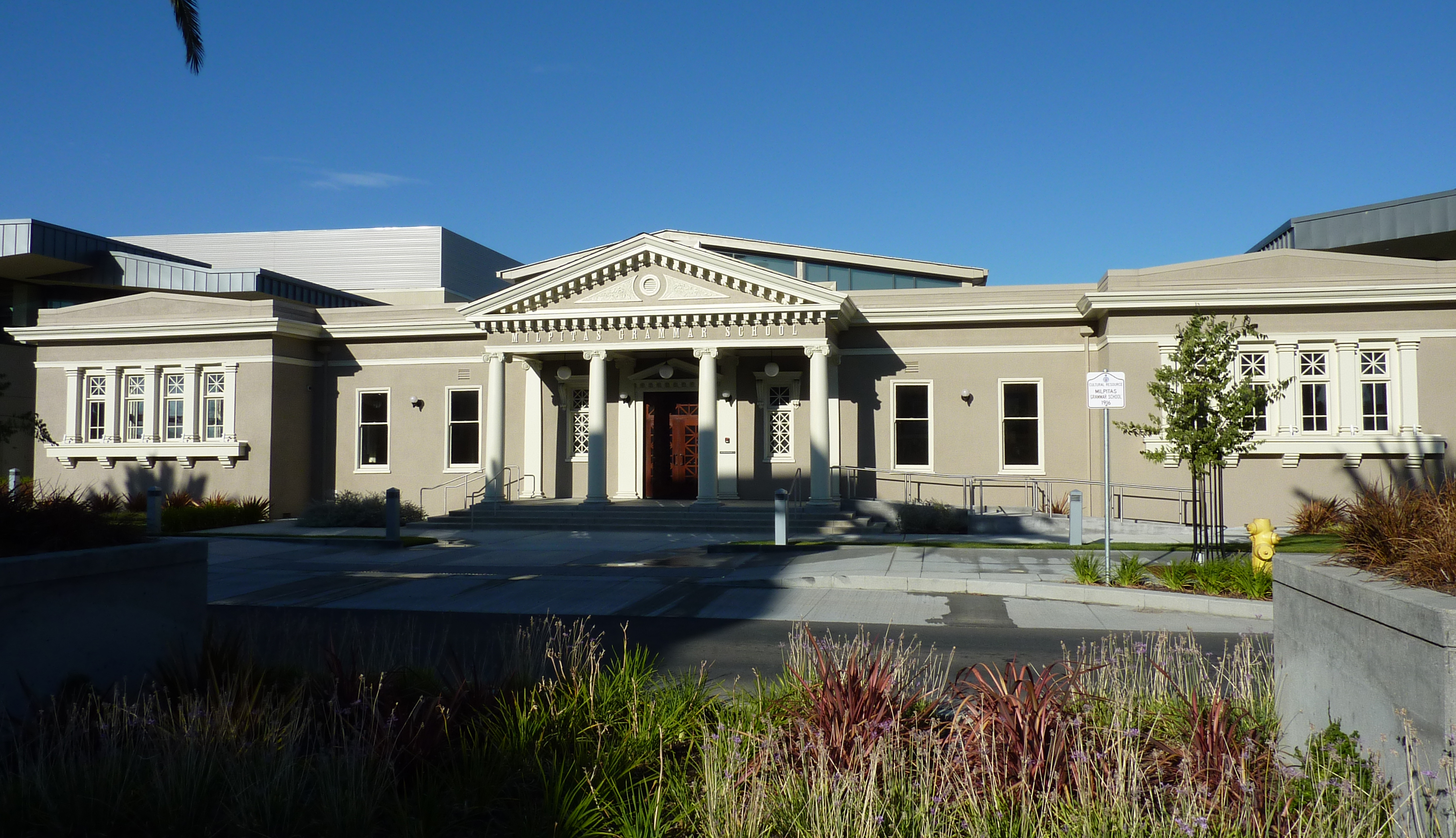
Milpitas Grammar School |
|
01993-07-22July 22, 1993 |
160 N. Main St.
37°25′59″N 121°54′21″W / 37.433056°N 121.905833°W / 37.433056; -121.905833 (Milpitas Grammar School) |
Milpitas |
|
| 57 |
Moir Building |
|
01982-10-29October 29, 1982 |
227-247 N. 1st St.
37°20′23″N 121°53′32″W / 37.339722°N 121.892222°W / 37.339722; -121.892222 (Moir Building) |
San Jose |
|
| 58 |
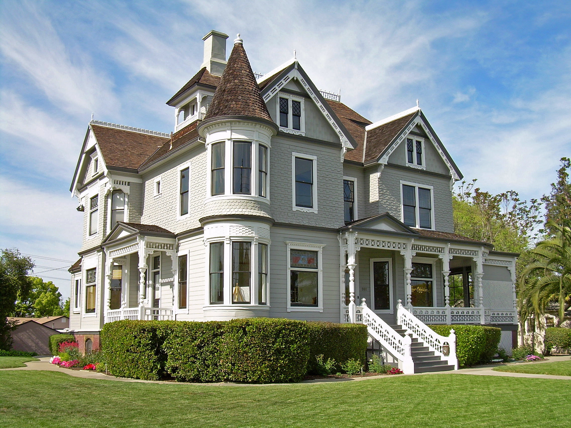
Charles Copeland Morse House |
|
01977-04-13April 13, 1977 |
981 Fremont St.
37°21′08″N 121°56′41″W / 37.352222°N 121.944722°W / 37.352222; -121.944722 (Charles Copeland Morse House) |
Santa Clara |
|
| 59 |
Mountain View Adobe |
|
02002-10-28October 28, 2002 |
157 Moffett Blvd.
37°23′45″N 122°04′37″W / 37.395833°N 122.076944°W / 37.395833; -122.076944 (Mountain View Adobe) |
Mountain View |
|
| 60 |
New Almaden |
|
01966-10-15October 15, 1966 |
14 mi. S of San Jose on CR G8
37°10′48″N 121°50′08″W / 37.18°N 121.835556°W / 37.18; -121.835556 (New Almaden) |
San Jose |
|
| 61 |
Norris House |
|
01980-07-24July 24, 1980 |
1247 Cowper St.
37°26′34″N 122°08′54″W / 37.442778°N 122.148333°W / 37.442778; -122.148333 (Norris House) |
Palo Alto |
|
| 62 |
Frank Norris Cabin |
|
01966-10-15October 15, 1966 |
10 mi. W of Gilroy off CA 152
37°02′11″N 121°42′45″W / 37.036389°N 121.7125°W / 37.036389; -121.7125 (Frank Norris Cabin) |
Gilroy |
|
| 63 |
Old City Hall |
|
01975-04-16April 16, 1975 |
7410 Monterey St.
37°00′26″N 121°34′03″W / 37.007222°N 121.5675°W / 37.007222; -121.5675 (Old City Hall) |
Gilroy |
|
| 64 |
Palo Alto Medical Clinic |
|
02010-06-21June 21, 2010 |
300 Homer Ave.
37°26′37″N 122°09′28″W / 37.443611°N 122.157778°W / 37.443611; -122.157778 (Palo Alto Medical Clinic) |
Palo Alto |
|
| 65 |
Palo Alto Southern Pacific Railroad Depot |
|
01996-04-18April 18, 1996 |
95 University Ave.
37°26′37″N 122°09′53″W / 37.443611°N 122.164722°W / 37.443611; -122.164722 (Palo Alto Southern Pacific Railroad Depot) |
Palo Alto |
|
| 66 |
Palo Alto Stock Farm Horse Barn |
|
01985-12-12December 12, 1985 |
Fremont Rd.
37°25′29″N 122°11′00″W / 37.424722°N 122.183333°W / 37.424722; -122.183333 (Palo Alto Stock Farm Horse Barn) |
Stanford |
|
| 67 |
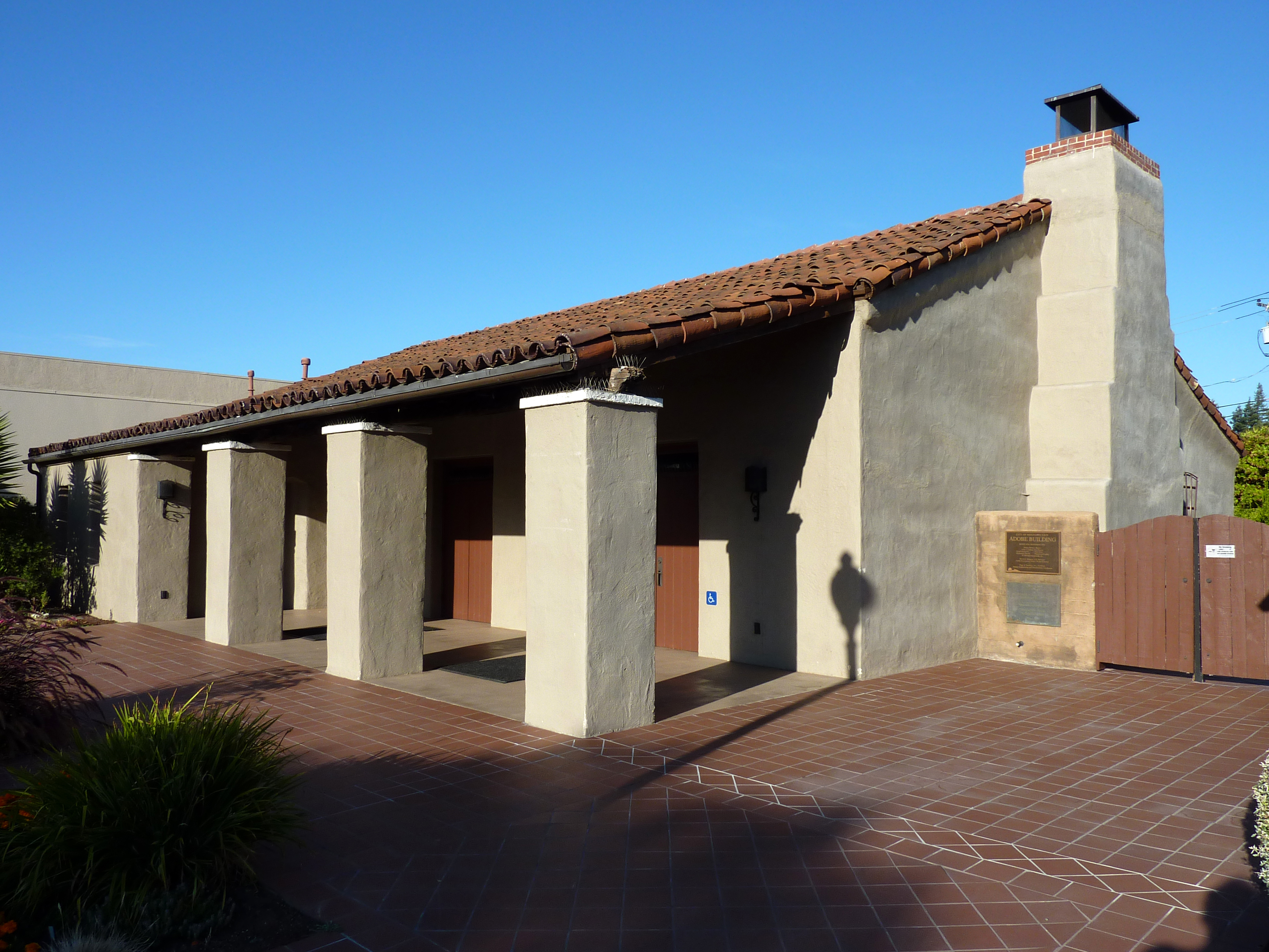
Luis Maria Peralta Adobe |
|
01973-10-15October 15, 1973 |
184 W. St. John St.
37°20′11″N 121°53′36″W / 37.336389°N 121.893333°W / 37.336389; -121.893333 (Luis Maria Peralta Adobe) |
San Jose |
|
| 68 |
Pettigrew House |
|
01980-11-25November 25, 1980 |
Address Restricted
37°26′29″N 122°08′51″W / 37.441389°N 122.1475°W / 37.441389; -122.1475 (Pettigrew House) |
Palo Alto |
|
| 69 |
Picchetti Brothers Winery |
|
01979-05-10May 10, 1979 |
SW of Cupertino at 13100 Montebello Rd.
37°17′40″N 122°05′21″W / 37.294444°N 122.089167°W / 37.294444; -122.089167 (Picchetti Brothers Winery) |
Cupertino |
|
| 70 |
Poverty Flat Site |
|
01972-02-23February 23, 1972 |
Address Restricted
|
Morgan Hill |
|
| 71 |
Professorville Historic District |
|
01980-10-03October 3, 1980 |
Roughly bounded by Embarcadero Rd., Addison Ave., Emerson and Cowper Sts.
37°26′29″N 122°09′05″W / 37.441389°N 122.151389°W / 37.441389; -122.151389 (Professorville Historic District) |
Palo Alto |
|
| 72 |
Ramona Street Architectural District |
|
01986-03-27March 27, 1986 |
518-581 Ramona St. and 255-267 Hamilton Ave.
37°26′42″N 122°09′37″W / 37.445°N 122.160278°W / 37.445; -122.160278 (Ramona Street Architectural District) |
Palo Alto |
|
| 73 |
Henry A. Rengstorff House |
|
01978-06-13June 13, 1978 |
1737 Stierlin Rd.
37°25′05″N 122°04′33″W / 37.418056°N 122.075833°W / 37.418056; -122.075833 (Henry A. Rengstorff House) |
Mountain View |
|
| 74 |
Ernest & Emily Renzel House |
|
02010-09-23September 23, 2010 |
120 Arroyo Way
37°20′32″N 121°52′18″W / 37.342222°N 121.871667°W / 37.342222; -121.871667 (Ernest & Emily Renzel House) |
San Jose |
|
| 75 |
Roberto-Sunol Adobe |
|
01977-03-17March 17, 1977 |
770 Lincoln Ave.
37°18′59″N 121°54′22″W / 37.316389°N 121.906111°W / 37.316389; -121.906111 (Roberto-Sunol Adobe) |
San Jose |
|
| 76 |
Roma Bakery |
|
01982-01-21January 21, 1982 |
655 Almaden Ave.
37°20′33″N 121°53′07″W / 37.3425°N 121.885278°W / 37.3425; -121.885278 (Roma Bakery) |
San Jose |
|
| 77 |
Ross House |
|
01982-10-29October 29, 1982 |
693 S. 2nd St.
37°19′35″N 121°52′51″W / 37.326389°N 121.880833°W / 37.326389; -121.880833 (Ross House) |
San Jose |
|
| 78 |
St. James Square Historic District |
|
01979-11-27November 27, 1979 |
Roughly bounded by N. 1st, N. 4th, E. St. James, and E. St. John Sts.
37°20′20″N 121°53′25″W / 37.338889°N 121.890278°W / 37.338889; -121.890278 (St. James Square Historic District) |
San Jose |
|
| 79 |
St. Joseph's Roman Catholic Church |
|
01977-08-26August 26, 1977 |
Market and San Fernando Sts.
37°20′03″N 121°53′22″W / 37.334167°N 121.889444°W / 37.334167; -121.889444 (St. Joseph's Roman Catholic Church) |
San Jose |
|
| 80 |
San Jose Downtown Historic District |
|
01983-05-26May 26, 1983 |
E. Santa Clara, South First, Second, Third and E. San Fernando Sts.
37°20′10″N 121°53′15″W / 37.336111°N 121.8875°W / 37.336111; -121.8875 (San Jose Downtown Historic District) |
San Jose |
|
| 81 |
Santa Clara Depot |
|
01985-02-28February 28, 1985 |
1 Railroad Ave.
37°21′11″N 121°56′06″W / 37.353056°N 121.935°W / 37.353056; -121.935 (Santa Clara Depot) |
Santa Clara |
|
| 82 |
Santa Clara Verein |
|
01984-01-19January 19, 1984 |
1082 Alviso St.
37°21′05″N 121°56′29″W / 37.351389°N 121.941389°W / 37.351389; -121.941389 (Santa Clara Verein) |
Santa Clara |
|
| 83 |
Saratoga Foothill Club |
|
02005-02-27February 27, 2005 |
20399 Park Place
37°15′32″N 122°01′44″W / 37.258889°N 122.028889°W / 37.258889; -122.028889 (Saratoga Foothill Club) |
Saratoga |
|
| 84 |
Saratoga Village Library |
|
02007-01-17January 17, 2007 |
14410 Oak St.
37°15′27″N 122°01′49″W / 37.2575°N 122.030278°W / 37.2575; -122.030278 (Saratoga Village Library) |
Saratoga |
|
| 85 |
Paul Shoup House |
|
02011-09-23September 23, 2011 |
500 University Ave.
37°22′25″N 122°07′07″W / 37.373611°N 122.118611°W / 37.373611; -122.118611 (Paul Shoup House) |
Los Altos |
|
| 86 |
Southern Pacific Depot |
|
01993-04-01April 1, 1993 |
65 Cahill St.
37°19′49″N 121°54′06″W / 37.330278°N 121.901667°W / 37.330278; -121.901667 (Southern Pacific Depot) |
San Jose |
|
| 87 |
Spillman Engineering 3-Abreast Carousel |
|
02000-04-13April 13, 2000 |
139 B Eastridge Mall
37°19′33″N 121°48′47″W / 37.325833°N 121.813056°W / 37.325833; -121.813056 (Spillman Engineering 3-Abreast Carousel) |
San Jose |
|
| 88 |
John Adam Squire House |
|
01972-03-06March 6, 1972 |
900 University Ave.
37°27′11″N 122°09′11″W / 37.453056°N 122.153056°W / 37.453056; -122.153056 (John Adam Squire House) |
Palo Alto |
|
| 89 |
John Steinbeck House |
|
01989-12-28December 28, 1989 |
16250 Greenwood Ln.
37°13′57″N 121°59′55″W / 37.2325°N 121.998611°W / 37.2325; -121.998611 (John Steinbeck House) |
Monte Sereno |
|
| 90 |
Troy Laundry |
|
01982-01-28January 28, 1982 |
722 Almaden Ave.
37°19′26″N 121°53′04″W / 37.323889°N 121.884444°W / 37.323889; -121.884444 (Troy Laundry) |
San Jose |
|
| 91 |
Twohy Building |
|
02003-10-06October 6, 2003 |
210 S. First St.
37°19′59″N 121°53′12″W / 37.333056°N 121.886667°W / 37.333056; -121.886667 (Twohy Building) |
San Jose |
|
| 92 |
U.S. Post Office |
|
01981-04-05April 5, 1981 |
380 Hamilton Ave.
37°26′46″N 122°09′29″W / 37.446111°N 122.158056°W / 37.446111; -122.158056 (U.S. Post Office) |
Palo Alto |
|
| 93 |
Unitary Plan Wind Tunnel |
|
01985-10-03October 3, 1985 |
Ames Research Center
37°25′03″N 122°03′35″W / 37.4175°N 122.059722°W / 37.4175; -122.059722 (Unitary Plan Wind Tunnel) |
Moffett Field |
|
| 94 |
US Naval Air Station Sunnyvale, California, Historic District |
|
01994-02-24February 24, 1994 |
Naval Air Station Moffett Field
37°24′46″N 122°03′13″W / 37.412778°N 122.053611°W / 37.412778; -122.053611 (US Naval Air Station Sunnyvale, California, Historic District) |
Sunnyvale |
|
| 95 |
Villa Mira Monte |
|
01978-05-25May 25, 1978 |
17860 Monterey Rd.
37°08′04″N 121°39′22″W / 37.134444°N 121.656111°W / 37.134444; -121.656111 (Villa Mira Monte) |
Morgan Hill |
|
| 96 |
Villa Montalvo |
|
01978-05-01May 1, 1978 |
14800 Montalvo Rd.
37°14′26″N 122°01′49″W / 37.240556°N 122.030278°W / 37.240556; -122.030278 (Villa Montalvo) |
Saratoga |
|
| 97 |
We and Our Neighbors Clubhouse |
|
01978-12-20December 20, 1978 |
S of San Jose at 15460 Union Ave.
37°14′37″N 121°55′48″W / 37.243611°N 121.93°W / 37.243611; -121.93 (We and Our Neighbors Clubhouse) |
San Jose |
|
| 98 |
Welch-Hurst |
|
01978-09-18September 18, 1978 |
15800 Sanborn Rd.
37°14′21″N 122°04′17″W / 37.239167°N 122.071389°W / 37.239167; -122.071389 (Welch-Hurst) |
Saratoga |
|
| 99 |
Wheeler Hospital |
|
01990-09-13September 13, 1990 |
650 Fifth St.
37°00′21″N 121°34′34″W / 37.005833°N 121.576111°W / 37.005833; -121.576111 (Wheeler Hospital) |
Gilroy |
|
| 100 |
Wilson House |
|
01980-01-02January 2, 1980 |
860 University St.
37°27′11″N 122°09′13″W / 37.453056°N 122.153611°W / 37.453056; -122.153611 (Wilson House) |
Palo Alto |
|
| 101 |
Winchester House |
|
01974-08-07August 7, 1974 |
525 S. Winchester Blvd.
37°19′05″N 121°57′00″W / 37.318056°N 121.95°W / 37.318056; -121.95 (Winchester House) |
San Jose |
Also known as Winchester Mystery House |
| 102 |
Woodhills |
|
01978-12-20December 20, 1978 |
S of Cupertino on Prospect Rd.
37°17′12″N 122°03′32″W / 37.286667°N 122.058889°W / 37.286667; -122.058889 (Woodhills) |
Cupertino |
Also known as Fremont Older House |
| 103 |
Earl and Virginia Young House |
|
02009-01-08January 8, 2009 |
1888 White Oaks Road
37°15′39″N 121°56′55″W / 37.260833°N 121.948611°W / 37.260833; -121.948611 (Earl and Virginia Young House) |
Campbell |
|
| 104 |
Yung See San Fong House |
|
01983-09-08September 8, 1983 |
16660 Cypress Way
37°12′58″N 121°57′36″W / 37.216111°N 121.96°W / 37.216111; -121.96 (Yung See San Fong House) |
Los Gatos |
|
 Category:National Register of Historic Places •
  Portal:National Register of Historic Places