- Curry County, New Mexico
-
Curry County, New Mexico 
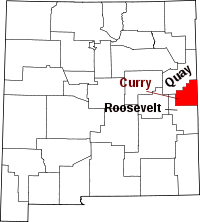
Location in the state of New Mexico
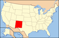
New Mexico's location in the U.S.Founded 25 February 1909 Seat Clovis Largest city Clovis Area
- Total
- Land
- Water
1,408 sq mi (3,647 km²)
1,406 sq mi (3,642 km²)
2 sq mi (5 km²), 0.12%Population
- (2000)
- Density
45,044
31/sq mi (12/km²)Website www.currycounty.org Curry County is a county located in the U.S. state of New Mexico. The population was approximately 45,044 at the 2000 census. Its county seat is Clovis.[1] It is named in honor of George Curry, territorial governor of New Mexico from 1907 to 1910. It is located on the far eastern state line, adjacent to the state of Texas, forming part of the region of Eastern New Mexico.
Contents
Geography
According to the U.S. Census Bureau, the county has a total area of 1,408 square miles (3,646.7 km2), of which 1,406 square miles (3,641.5 km2) is land and 2 square miles (5.2 km2) (0.12%) is water.
Adjacent counties
- Quay County, New Mexico - north
- Roosevelt County, New Mexico - west, south
- Bailey County, Texas - southeast
- Parmer County, Texas - east
- Deaf Smith County, Texas - northeast
Demographics
Historical populations Census Pop. %± 2000 45,044 — 2010 48,376 7.4% 2010
Whereas according to the 2010 U.S. Census Bureau:
- 69.7% White
- 6.3% Black
- 1.2% Native American
- 1.3% Asian
- 0.1% Native Hawaiian or Pacific Islander
- 4.1% Two or more races
- 17.3% Other races
- 39.5% Hispanic or Latino (of any race)
2000
As of the census[2] of 2000, there were 45,044 people, 16,766 households, and 11,870 families residing in the county. The population density was 32 people per square mile (12/km²). There were 19,212 housing units at an average density of 14 per square mile (5/km²). The racial makeup of the county was 72.40% White, 6.86% Black or African American, 1.00% Native American, 1.78% Asian, 0.13% Pacific Islander, 14.08% from other races, and 3.75% from two or more races. 30.38% of the population were Hispanic or Latino of any race.
There were 16,766 households out of which 38.00% had children under the age of 18 living with them, 54.00% were married couples living together, 12.80% had a female householder with no husband present, and 29.20% were non-families. 25.50% of all households were made up of individuals and 9.00% had someone living alone who was 65 years of age or older. The average household size was 2.62 and the average family size was 3.15.
In the county the population was spread out with 30.10% under the age of 18, 11.50% from 18 to 24, 28.80% from 25 to 44, 18.10% from 45 to 64, and 11.50% who were 65 years of age or older. The median age was 31 years. For every 100 females there were 97.60 males. For every 100 females age 18 and over, there were 94.30 males.
The median income for a household in the county was $28,917, and the median income for a family was $33,900. Males had a median income of $25,086 versus $19,523 for females. The per capita income for the county was $15,049. About 15.50% of families and 19.00% of the population were below the poverty line, including 25.10% of those under age 18 and 14.30% of those age 65 or over.
Localities
Cities
Villages
Census-designated place
Other localities
- Bellview
- Broadview
- Gallaher
- Pleasant Hill
- Portair
- Ranchvale
- St. Vrain
See also
- National Register of Historic Places listings in Curry County, New Mexico
- USS Curry County (LST-685)
References
- ^ "Find a County". National Association of Counties. http://www.naco.org/Counties/Pages/FindACounty.aspx. Retrieved 2011-06-07.
- ^ "American FactFinder". United States Census Bureau. http://factfinder.census.gov. Retrieved 2008-01-31.
External links
- County Fair information, 2006
- Curry County information on High Plains Historical Foundation
- A resource for the Clovis/ Portales/ Curry/ Roosevelt and Cannon Air Force Base Community

Quay County Deaf Smith County, Texas 
Roosevelt County 
Parmer County, Texas  Curry County, New Mexico

Roosevelt County Bailey County, Texas Municipalities and communities of Curry County, New Mexico Cities Villages CDP  State of New Mexico
Topics Delegations · Geography · Government · History · Landmarks · Military · Natural history · New Mexicans · Settlements · Transportation · Tribes · Visitor attractions
Society Culture · Demographics · Economy · Education · Politics
Regions Cities Alamogordo · Albuquerque · Artesia · Carlsbad · Clovis · Corrales · Deming · Española · Farmington · Gallup · Grants · Hobbs · Las Cruces · Las Vegas · Los Alamos · Los Lunas · Lovington · Portales · Raton · Rio Rancho · Roswell · Ruidoso · Santa Fe · Silver City · Socorro · Sunland Park · Taos · Tucumcari
Counties Bernalillo · Catron · Chaves · Cibola · Colfax · Curry · De Baca · Doña Ana · Eddy · Grant · Guadalupe · Harding · Hidalgo · Lea · Lincoln · Los Alamos · Luna · McKinley · Mora · Otero · Quay · Rio Arriba · Roosevelt · Sandoval · San Juan · San Miguel · Santa Fe · Sierra · Socorro · Taos · Torrance · Union · Valencia
Categories:- New Mexico counties
- Curry County, New Mexico
- Populated places established in 1909
Wikimedia Foundation. 2010.


