- Luna County, New Mexico
-
Luna County, New Mexico  Luna County Courthouse in Deming, New Mexico
Location in the state of New Mexico
New Mexico's location in the U.S.Founded March 16, 1901 Seat Deming Largest city Deming Area
- Total
- Land
- Water
2,965 sq mi (7,679 km²)
2,965 sq mi (7,679 km²)
0 sq mi (0 km²), 0.01%Population
- (2000)
- Density
25,016
8/sq mi (3/km²)Website lunacountynm.us Luna County is a county located in the U.S. state of New Mexico. As of 2000, the population was 25,016. Its county seat is Deming.[1]
Contents
History
Before dawn on March 16, 1916, Mexican revolutionary Pancho Villa led several hundred of his rebel soldiers across the Mexican border into the southern county village of Columbus. The invaders raided and burned much of the town, causing many residents to flee to the desert. Although the raid completely surprised everyone in the town, it also awakened 350 United States Army soldiers at Camp Furlong at the edge of town, who defended the town with two machine guns. The fighting continued until dawn, when Villa fled back across the Mexican border, five hours after invading and approximately ninety minutes after attacking the town. Despite the U.S. Army's counter "Mexican Expedition" into Mexico, Villa was never caught; he died seven years later at the hands of an assassin.
Eighteen Columbus residents and U.S. soldiers were killed in the raid, while approximately seventy-five of Villa's soldiers were killed. This raid was the last invasion of American territory until the Japanese invasion of Attu Island during World War II.
Today, Pancho Villa State Park is located in the village of Columbus. It features beautiful cacti and the ruins of "the U.S. Army's first greaserack".
Geography
According to the U.S. Census Bureau, the county has a total area of 2,965 square miles (7,680 km²), of which 2,965 square miles (7,680 km²) is land and 0 square miles (0 km²) (0.01%) is water. The bulk of the county is flat lowland, either grassland or desert scrub, but it also contains three mountain ranges: Cooke's Range in the north, the Florida Mountains on the southeastern side of Deming near the center of the county, and the Tres Hermanas Mountains in the southern part of the county near Columbus.
Adjacent counties (American) and municipalities (Mexican)
- Sierra County, New Mexico - northeast
- Doña Ana County, New Mexico - east
- Grant County, New Mexico - west
- Hidalgo County, New Mexico - west
- Ascensión, Chihuahua, Mexico - south
Demographics
Historical populations Census Pop. %± 2000 25,016 — 2010 25,095 0.3% 2010
Whereas according to the 2010 U.S. Census Bureau:
- 77.7% White
- 1.1% Black
- 1.3% Native American
- 0.5% Asian
- 0.0% Native Hawaiian or Pacific Islander
- 2.6% Two or more races
- 16.8% Other races
- 61.5% Hispanic or Latino (of any race)
2000
As of the census[2] of 2000, there were 25,016 people, 9,397 households, and 6,596 families residing in the county. The population density was 8 people per square mile (3/km²). There were 11,291 housing units at an average density of 4 per square mile (1/km²). The racial makeup of the county was 74.30% White, 0.94% Black or African American, 1.11% Native American, 0.34% Asian, 20.23% from other races, and 3.08% from two or more races. 57.70% of the population were Hispanic or Latino of any race.
There were 9,397 households out of which 33.90% had children under the age of 18 living with them, 53.60% were married couples living together, 12.40% had a female householder with no husband present, and 29.80% were non-families. 26.40% of all households were made up of individuals and 14.00% had someone living alone who was 65 years of age or older. The average household size was 2.64 and the average family size was 3.20.
In the county the population was spread out with 30.00% under the age of 18, 7.60% from 18 to 24, 22.70% from 25 to 44, 21.50% from 45 to 64, and 18.20% who were 65 years of age or older. The median age was 37 years. For every 100 females there were 95.20 males. For every 100 females age 18 and over, there were 93.20 males.
The median income for a household in the county was $20,784, and the median income for a family was $24,252. Males had a median income of $25,008 versus $16,883 for females. The per capita income for the county was $11,218. About 27.20% of families and 32.90% of the population were below the poverty line, including 46.80% of those under age 18 and 15.80% of those age 65 or over.
Localities
City
Village
Other locality
Education
Residents are zoned to Deming Public Schools.
See also
- Luna, New Mexico, a community in Catron County
- National Register of Historic Places listings in Luna County, New Mexico
References
- ^ "Find a County". National Association of Counties. http://www.naco.org/Counties/Pages/FindACounty.aspx. Retrieved 2011-06-07.
- ^ "American FactFinder". United States Census Bureau. http://factfinder.census.gov. Retrieved 2008-01-31.
External links

Sierra County Grant County and Hidalgo County 
Doña Ana County  Luna County, New Mexico

Ascensión, Chihuahua, Mexico Municipalities and communities of Luna County, New Mexico City 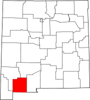
Village Ghost towns  State of New Mexico
Topics Delegations · Geography · Government · History · Landmarks · Military · Natural history · New Mexicans · Settlements · Transportation · Tribes · Visitor attractions
Society Culture · Demographics · Economy · Education · Politics
Regions Cities Alamogordo · Albuquerque · Artesia · Carlsbad · Clovis · Corrales · Deming · Española · Farmington · Gallup · Grants · Hobbs · Las Cruces · Las Vegas · Los Alamos · Los Lunas · Lovington · Portales · Raton · Rio Rancho · Roswell · Ruidoso · Santa Fe · Silver City · Socorro · Sunland Park · Taos · Tucumcari
Counties Bernalillo · Catron · Chaves · Cibola · Colfax · Curry · De Baca · Doña Ana · Eddy · Grant · Guadalupe · Harding · Hidalgo · Lea · Lincoln · Los Alamos · Luna · McKinley · Mora · Otero · Quay · Rio Arriba · Roosevelt · Sandoval · San Juan · San Miguel · Santa Fe · Sierra · Socorro · Taos · Torrance · Union · Valencia
Categories:- New Mexico counties
- Luna County, New Mexico
- States and territories established in 1901
- Counties of the United States with Hispanic majority populations


Wikimedia Foundation. 2010.