- Cibola County, New Mexico
-
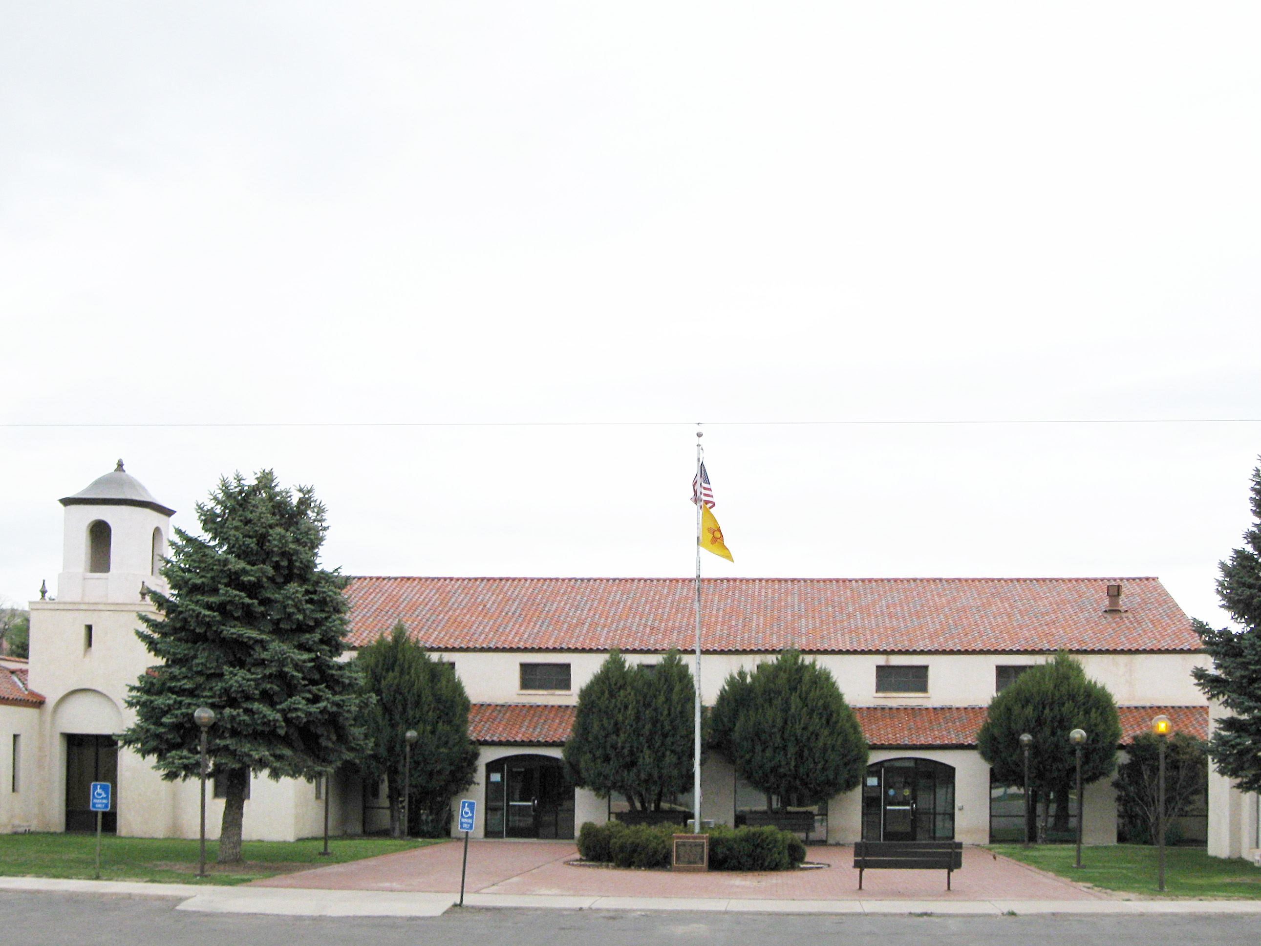
Cibola County, New Mexico 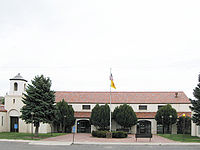 Cibola County Courthouse in Grants, New Mexico
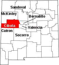
Location in the state of New Mexico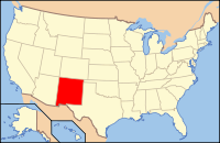
New Mexico's location in the U.S.Founded June 19, 1981 Seat Grants Largest city Grants Area
- Total
- Land
- Water
4,542 sq mi (11,764 km²)
4,540 sq mi (11,759 km²)
2 sq mi (5 km²), 0.06%Population
- (2010)
- Density
27,213
5/sq mi (2/km²)Cibola County is a county located in the U.S. state of New Mexico. As of 2010, the population was 27,213.[1] Its county seat is Grants.[2] It is New Mexico's newest county, created on June 19, 1981, from the westernmost four-fifths of the formerly much larger Valencia County.
Contents
Geography
According to the U.S. Census Bureau, the county has a total area of 4,542 square miles (11,763.7 km2), of which 4,539 square miles (11,756.0 km2) is land and 2 square miles (5.2 km2) (0.06%) is water.
Adjacent counties
- McKinley County, New Mexico - north
- Sandoval County, New Mexico - northeast
- Bernalillo County, New Mexico - east
- Valencia County, New Mexico - east
- Socorro County, New Mexico - southeast
- Catron County, New Mexico - south
- Apache County, Arizona - west
National protected areas
- Cibola National Forest (part)
- El Malpais National Conservation Area
- El Malpais National Monument
- El Morro National Monument
Demographics
As of the census[3] of 2000, there were 25,595 people, 8,327 households, and 6,278 families residing in the county. The population density was 6 people per square mile (2/km²). There were 10,328 housing units at an average density of 2 per square mile (1/km²). The racial makeup of the county was 39.61% White, 0.96% Black or African American, 40.32% Native American, 0.38% Asian, 0.05% Pacific Islander, 15.44% from other races, and 3.24% from two or more races. 33.42% of the population were Hispanic or Latino of any race.
There were 8,327 households out of which 38.00% had children under the age of 18 living with them, 50.60% were married couples living together, 18.30% had a female householder with no husband present, and 24.60% were non-families. 21.10% of all households were made up of individuals and 7.30% had someone living alone who was 65 years of age or older. The average household size was 2.95 and the average family size was 3.41.
In the county the population was spread out with 30.70% under the age of 18, 9.60% from 18 to 24, 27.50% from 25 to 44, 21.50% from 45 to 64, and 10.70% who were 65 years of age or older. The median age was 33 years. For every 100 females there were 95.50 males. For every 100 females age 18 and over, there were 92.20 males.
The median income for a household in the county was $27,774, and the median income for a family was $30,714. Males had a median income of $27,652 versus $20,078 for females. The per capita income for the county was $11,731. About 21.50% of families and 24.80% of the population were below the poverty line, including 32.00% of those under age 18 and 17.70% of those age 65 or over.
Localities
City
Town
Other localities
- Anaconda
- Acomita Lake
- Bibo
- Bluewater Village
- Candy Kitchen
- Cebolleta
- Cebolletita
- Cubero
- Encinal
- Laguna
- Mesita
- Mountain View
- North Acomita Village
- Paguate
- Paraje
- Pinehill
- San Mateo
- San Rafael
- Seama
- Skyline-Ganipa
Education
All public schools in the county are operated by Grants/Cibola County Schools.
See also
References
- ^ http://2010.census.gov/2010census/data/
- ^ "Find a County". National Association of Counties. http://www.naco.org/Counties/Pages/FindACounty.aspx. Retrieved 2011-06-07.
- ^ "American FactFinder". United States Census Bureau. http://factfinder.census.gov. Retrieved 2008-01-31.
- County status and boundary changes United States Census Bureau
Further reading
- Baldwin, J.A. and D.R. Rankin. (1995). Hydrogeology of Cibola County, New Mexico [Water-Resources Investigations Report 94-4178]. Albuquerque: U.S. Department of the Interior, U.S. Geological Survey.
- Maxwell, C.H. (1989). Mineral resources of the Petaca Pinta wilderness study area, Cibola County, New Mexico [U.S. Geological Survey Bulletin 1734-H]. Denver: U.S. Department of the Interior, U.S. Geological Survey.

McKinley County Sandoval County Apache County, Arizona 
Bernalillo County and Valencia County  Cibola County, New Mexico

Catron County Socorro County Municipalities and communities of Cibola County, New Mexico County seat: Grants City 
Town CDPs Acomita Lake | Encinal | Laguna | Mesita | North Acomita Village | Paguate | Paraje | Pinehill | Seama | Skyline-Ganipa
Unincorporated
communitiesBluewater Village | Candy Kitchen | Fence Lake | Mountain View | San Mateo
Indian reservations Footnotes ‡This populated place also has portions in an adjacent county or counties
 State of New Mexico
Santa Fe (capital) Topics Delegations · Geography · Government · History · Landmarks · Military · Natural history · New Mexicans · Settlements · Transportation · Tribes · Visitor attractions
Society Culture · Demographics · Economy · Education · Politics
Regions Cities Alamogordo · Albuquerque · Artesia · Carlsbad · Clovis · Corrales · Deming · Española · Farmington · Gallup · Grants · Hobbs · Las Cruces · Las Vegas · Los Alamos · Los Lunas · Lovington · Portales · Raton · Rio Rancho · Roswell · Ruidoso · Santa Fe · Silver City · Socorro · Sunland Park · Taos · Tucumcari
Counties Bernalillo · Catron · Chaves · Cibola · Colfax · Curry · De Baca · Doña Ana · Eddy · Grant · Guadalupe · Harding · Hidalgo · Lea · Lincoln · Los Alamos · Luna · McKinley · Mora · Otero · Quay · Rio Arriba · Roosevelt · Sandoval · San Juan · San Miguel · Santa Fe · Sierra · Socorro · Taos · Torrance · Union · Valencia
Categories:- New Mexico counties
- Cibola County, New Mexico
- 1981 establishments in the United States
- Populated places established in 1981


Wikimedia Foundation. 2010.