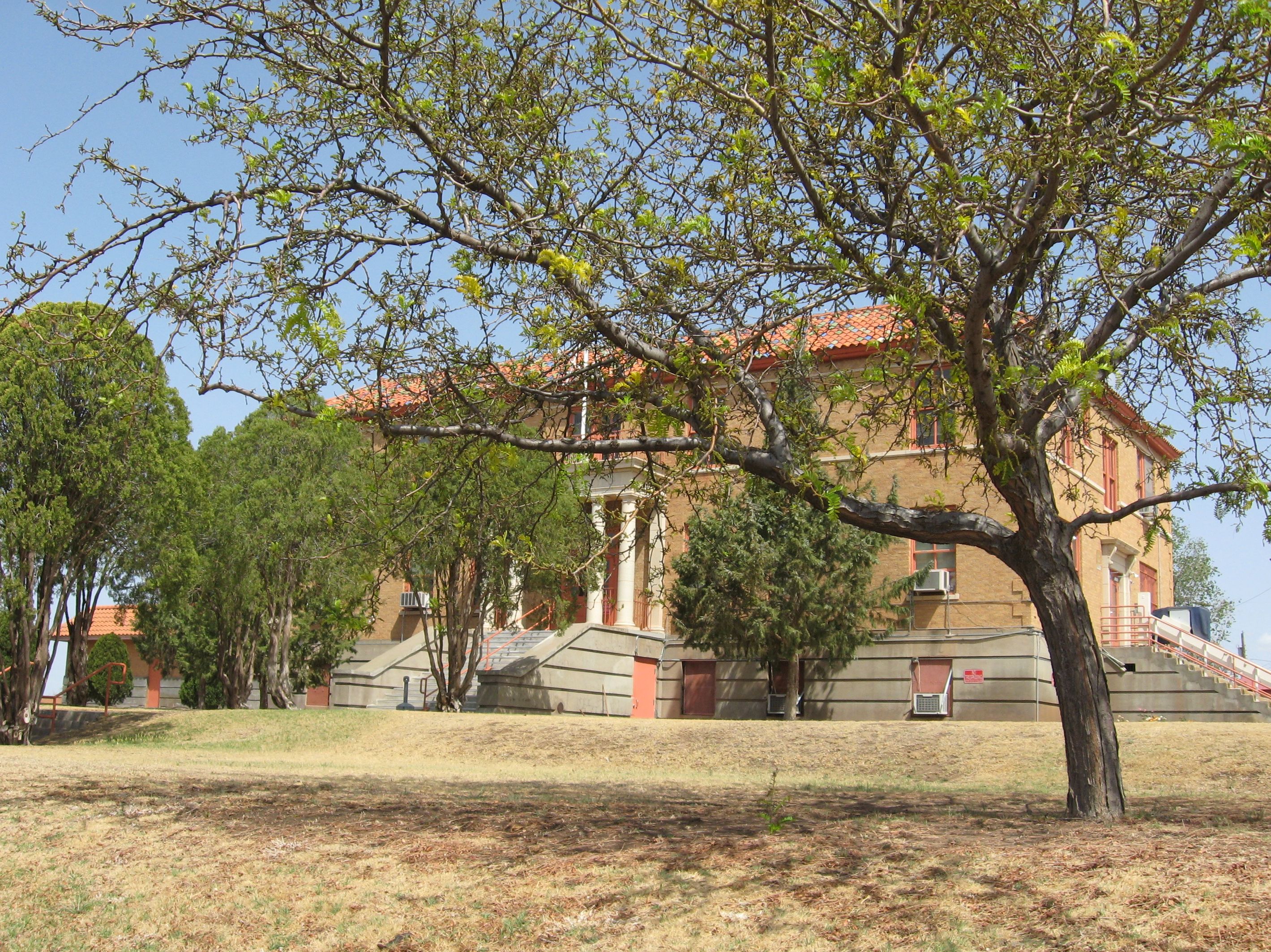
- De Baca County, New Mexico
-
De Baca County, New Mexico 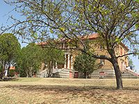

Location in the state of New Mexico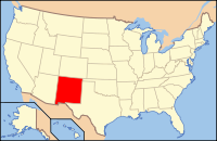
New Mexico's location in the U.S.Founded February 28, 1917 Seat Fort Sumner Largest city Fort Sumner Area
- Total
- Land
- Water
2,334 sq mi (6,045 km²)
2,325 sq mi (6,022 km²)
9 sq mi (23 km²), 0.38%Population
- (2000)
- Density
2,240De Baca County is a county located in the U.S. state of New Mexico. As of 2000, the population was 2,240. Its county seat is Fort Sumner.[1]
Contents
Geography
According to the U.S. Census Bureau, the county has a total area of 2,334 square miles (6,045.0 km2), of which 2,325 square miles (6,021.7 km2) is land and 9 square miles (23.3 km2) (0.38%) is water.
Adjacent counties
- Guadalupe County, New Mexico - north
- Quay County, New Mexico - northeast
- Roosevelt County, New Mexico - east
- Chaves County, New Mexico - south
- Lincoln County, New Mexico - west
Demographics
Historical populations Census Pop. %± 2000 2,240 — 2010 2,022 −9.7% 2010
Whereas according to the 2010 U.S. Census Bureau:
- 87.3% White
- 0.1% Black
- 0.6% Native American
- 0.0% Asian
- 0.0% Native Hawaiian or Pacific Islander
- 3.9% Two or more races
- 8.1% Other races
- 38.5% Hispanic or Latino (of any race)
2000
As of the census[2] of 2000, there were 2,240 people, 922 households, and 614 families residing in the county. The population density was 1 people per square mile (0/km²). There were 1,307 housing units at an average density of 1 per square mile (0/km²). The racial makeup of the county was 84.02% White, 0.04% Black or African American, 0.94% Native American, 0.22% Asian, 12.54% from other races, and 2.23% from two or more races. 35.27% of the population were Hispanic or Latino of any race.
There were 922 households out of which 27.20% had children under the age of 18 living with them, 56.60% were married couples living together, 7.30% had a female householder with no husband present, and 33.30% were non-families. 30.80% of all households were made up of individuals and 18.00% had someone living alone who was 65 years of age or older. The average household size was 2.35 and the average family size was 2.96.
In the county the population was spread out with 24.10% under the age of 18, 5.70% from 18 to 24, 21.70% from 25 to 44, 23.20% from 45 to 64, and 25.40% who were 65 years of age or older. The median age was 44 years. For every 100 females there were 96.00 males. For every 100 females age 18 and over, there were 92.10 males.
The median income for a household in the county was $25,441, and the median income for a family was $32,870. Males had a median income of $25,833 versus $18,487 for females. The per capita income for the county was $14,065. 17.70% of the population and 13.60% of families were below the poverty line. Out of the total people living in poverty, 23.30% are under the age of 18 and 15.00% are 65 or older.
History
- Legendary outlaw Billy the Kid was killed and buried in Fort Sumner.
- On November 9, 2005, Sheriff Gary Graves was recalled from office for professional and financial malfeasance and misfeasance.[3][4][5]
Localities
Village
- Fort Sumner (County seat)
Census-designated place
Other localities
- Agudo
- Buchanon
- Canton
- Cardenas
- Dunlap
- Evanola
- Ingleville
- La Lande
- Largo
- Ricardo
- Taiban
- Tolar
- Yeso
See also
References
- ^ "Find a County". National Association of Counties. http://www.naco.org/Counties/Pages/FindACounty.aspx. Retrieved 2011-06-07.
- ^ "American FactFinder". United States Census Bureau. http://factfinder.census.gov. Retrieved 2008-01-31.
- ^ http://www.supremecourt.nm.org/pastopinion/VIEW/06ca-030.html
- ^ ABQNews - 7:10am - New De Baca Co. Sheriff
- ^ http://www.roswell-record.com/archives/111105/news08.html

Guadalupe County Quay County Lincoln County 
Roosevelt County  De Baca County, New Mexico

Chaves County Municipalities and communities of De Baca County, New Mexico Village 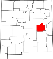
CDP Unincorporated
communitiesTaiban | Yeso
 State of New Mexico
Topics Delegations · Geography · Government · History · Landmarks · Military · Natural history · New Mexicans · Settlements · Transportation · Tribes · Visitor attractions
Society Culture · Demographics · Economy · Education · Politics
Regions Cities Alamogordo · Albuquerque · Artesia · Carlsbad · Clovis · Corrales · Deming · Española · Farmington · Gallup · Grants · Hobbs · Las Cruces · Las Vegas · Los Alamos · Los Lunas · Lovington · Portales · Raton · Rio Rancho · Roswell · Ruidoso · Santa Fe · Silver City · Socorro · Sunland Park · Taos · Tucumcari
Counties Bernalillo · Catron · Chaves · Cibola · Colfax · Curry · De Baca · Doña Ana · Eddy · Grant · Guadalupe · Harding · Hidalgo · Lea · Lincoln · Los Alamos · Luna · McKinley · Mora · Otero · Quay · Rio Arriba · Roosevelt · Sandoval · San Juan · San Miguel · Santa Fe · Sierra · Socorro · Taos · Torrance · Union · Valencia
Coordinates: 34°28′18″N 104°14′44″W / 34.47167°N 104.24556°W
Categories:- New Mexico counties
- De Baca County, New Mexico
- 1917 establishments in the United States
- Populated places established in 1917


Wikimedia Foundation. 2010.