- National Register of Historic Places listings in New Kent County, Virginia
-
This list includes properties and districts listed on the National Register of Historic Places in New Kent County, Virginia. Click the "Map of all coordinates" link to the right to view a Google map of all properties and districts with latitude and longitude coordinates in the table below.[1]
-
- This National Park Service list is complete through NPS recent listings posted November 10, 2011.[2]
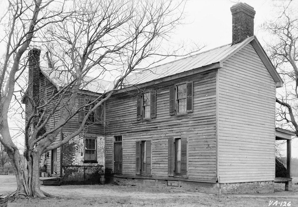
[3] Landmark name [4] Image Date listed Location City or town Summary 1 Cedar Grove 
December 28, 1979 NW of Providence Forge on VA 609
37°29′07″N 77°06′57″W / 37.485278°N 77.115833°WProvidence Forge 2 Criss Cross 
May 11, 1973 SW of New Kent off VA 608
37°30′10″N 77°01′38″W / 37.502778°N 77.027222°WNew Kent 3 Crump's Mill and Millpond September 24, 1999 9065 Crump's Mill Rd.
37°32′16″N 77°05′24″W / 37.537778°N 77.09°WQuinton 4 Emmaus Baptist Church June 10, 1993 VA 106 W side, 0.4 mi. S of I-64
37°29′56″N 77°05′33″W / 37.498889°N 77.0925°WProvidence Forge 5 Foster's Castle April 11, 1973 NE of Tunstall off VA 608
37°35′20″N 77°04′42″W / 37.588889°N 77.078333°WTunstall 6 Hampstead December 18, 1970 1 mi. NW of jct. of Rtes. 606 and 607
37°35′56″N 77°07′20″W / 37.598889°N 77.122222°WTunstall 7 Marl Hill December 21, 1990 VA 642 E of jct. with VA 609
37°32′24″N 77°02′29″W / 37.54°N 77.041389°WTallysville 8 Moysonec June 20, 1975 Address Restricted Toano 9 New Kent School; George W. Watkins School August 7, 2001 New Kent: 11825 New Kent Hwy
37°31′4.4″N 76°58′43.97″W / 37.517889°N 76.9788806°W; Watkins: 6501 New Kent Hwy.
37°31′56″N 77°08′29″W / 37.532353°N 77.141461°WNew Kent and Quinton Pair of schools that represent widespread token desegregation of southern schools in the decade after the 1954 Brown v. Board of Education U.S. Supreme Court decision. Focus of 1968 Green v. County School Board, which was effective in bringing about real desegregation. 10 Olivet Presbyterian Church January 26, 1978 2.7 mi. (4.3 km) NW of Providence Forge on VA 618
37°28′48″N 77°03′50″W / 37.48°N 77.063889°WProvidence Forge 11 Spring Hill November 27, 2002 11221 Carriage Rd.
37°26′04″N 76°59′46″W / 37.434444°N 76.996111°WProvidence Forge 12 St. Peter's Church 
October 1, 1969 CR 642
37°32′25″N 77°03′24″W / 37.540278°N 77.056667°WNew Kent See also
- National Register of Historic Places listings in Virginia
- List of National Historic Landmarks in Virginia
References
- ^ The latitude and longitude information provided in this table was derived originally from the National Register Information System, which has been found to be fairly accurate for about 99% of listings. For about 1% of NRIS original coordinates, experience has shown that one or both coordinates are typos or otherwise extremely far off; some corrections may have been made. A more subtle problem causes many locations to be off by up to 150 yards, depending on location in the country: most NRIS coordinates were derived from tracing out latitude and longitudes off of USGS topographical quadrant maps created under North American Datum of 1927, which differs from the current, highly accurate GPS system used by Google maps. Chicago is about right, but NRIS longitudes in Washington are higher by about 4.5 seconds, and are lower by about 2.0 seconds in Maine. Latitudes differ by about 1.0 second in Florida. Some locations in this table may have been corrected to current GPS standards.
- ^ "National Register of Historic Places: Weekly List Actions". National Park Service, United States Department of the Interior. Retrieved on November 10, 2011.
- ^ Numbers represent an ordering by significant words. Various colorings, defined here, differentiate National Historic Landmark sites and National Register of Historic Places Districts from other NRHP buildings, structures, sites or objects.
- ^ "National Register Information System". National Register of Historic Places. National Park Service. . http://nrhp.focus.nps.gov/natreg/docs/All_Data.html.
U.S. National Register of Historic Places Topics Lists by states Alabama • Alaska • Arizona • Arkansas • California • Colorado • Connecticut • Delaware • Florida • Georgia • Hawaii • Idaho • Illinois • Indiana • Iowa • Kansas • Kentucky • Louisiana • Maine • Maryland • Massachusetts • Michigan • Minnesota • Mississippi • Missouri • Montana • Nebraska • Nevada • New Hampshire • New Jersey • New Mexico • New York • North Carolina • North Dakota • Ohio • Oklahoma • Oregon • Pennsylvania • Rhode Island • South Carolina • South Dakota • Tennessee • Texas • Utah • Vermont • Virginia • Washington • West Virginia • Wisconsin • WyomingLists by territories Lists by associated states Other  Category:National Register of Historic Places •
  Portal:National Register of Historic Places
Municipalities and communities of New Kent County, Virginia County seat: New Kent CDP 
Unincorporated
communitiesBarhamsville | Bottoms Bridge | Browns Corner | Carps Corner | Chickahominy Shores | Crumps Mill | Cumberland Landing | Eltham | Hampstead | Holly Forks | Lanexa | Mountcastle | Orapax Farms | Osborn Landing | Ozenic | Plum Point | Poplar Grove | Potaucao | Providence Forge | Putneys Mill | Quinton | Slaterville | Tallysville | Tunstall | Walkers | Waterloo | White House | White Oak Landing | Wrights Corner
Categories:- New Kent County, Virginia
- National Register of Historic Places in Virginia
- Virginia-related lists
-


Wikimedia Foundation. 2010.