- Twin Groves, Arkansas
Infobox Settlement
official_name = Twin Groves, Arkansas
settlement_type =Town
imagesize =
image_caption =
image_
imagesize =
image_caption =
image_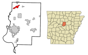
mapsize = 250px
map_caption = Location in Faulkner County and the state ofArkansas
mapsize1 =
map_caption1 =
subdivision_type = Country
subdivision_type1 = State
subdivision_type2 = County
subdivision_name =United States
subdivision_name1 =Arkansas
subdivision_name2 = Faulkner
government_type =
leader_title =
leader_name =
established_date =
area_magnitude =
area_total_km2 = 12.2
area_total_sq_mi = 4.7
area_land_km2 = 12.2
area_land_sq_mi = 4.7
area_water_km2 = 0
area_water_sq_mi = 0
elevation_ft = 371
elevation_m = 113
population_as_of = 2000
population_footnotes =
population_total = 276
population_metro =
population_density_km2 = 22.6
population_density_sq_mi = 58.7
timezone = Central (CST)
utc_offset = -6
latd = 35 |latm = 19 |lats = 0 |latNS = N
longd = 92 |longm = 25 |longs = 27 |longEW = W
timezone_DST = CDT
utc_offset_DST = -5
postal_code_type =ZIP code
postal_code = 72039
area_code = 501
blank_name = FIPS code
blank_info = 05-70540
blank1_name = GNIS feature ID
blank1_info = 1669457
footnotes =
website =Twin Groves is a town in northwestern Faulkner County,
Arkansas ,United States . The name of the town comes from two neighboring communities — Solomon Grove and Zion Grove — which joined to incorporate as a town in 1991. The town's population was 276 at the 2000 census. Twin Groves is part of the Little Rock–North Little Rock–Conway Metropolitan Statistical Area.Geography
Twin Groves is located at coor dms|35|19|0|N|92|25|27|W|city (35.316718, -92.424120)GR|1.
According to the
United States Census Bureau , the town has a total area of 12.1km² (4.7 mi²), all land.Demographics
As of the
census GR|2 of 2000, there were 276 people, 103 households, and 74 families residing in the town. Thepopulation density was 22.7/km² (58.8/mi²). There were 113 housing units at an average density of 9.3/km² (24.1/mi²). The racial makeup of the town was 26.81% White, 72.10% Black or African American, and 1.09% from two or more races. 0.36% of the population were Hispanic or Latino of any race.There were 103 households out of which 27.2% had children under the age of 18 living with them, 58.3% were married couples living together, 9.7% had a female householder with no husband present, and 27.2% were non-families. 25.2% of all households were made up of individuals and 7.8% had someone living alone who was 65 years of age or older. The average household size was 2.68 and the average family size was 3.21.
In the town the population was spread out with 22.5% under the age of 18, 8.0% from 18 to 24, 24.6% from 25 to 44, 27.5% from 45 to 64, and 17.4% who were 65 years of age or older. The median age was 41 years. For every 100 females there were 107.5 males. For every 100 females age 18 and over, there were 103.8 males.
The median income for a household in the town was $34,375, and the median income for a family was $37,222. Males had a median income of $28,929 versus $16,250 for females. The
per capita income for the town was $16,811. None of the families and 3.3% of the population were living below thepoverty line , including no under eighteens and 8.5% of those over 64.References
External links
Wikimedia Foundation. 2010.