- Western Grove, Arkansas
Infobox Settlement
official_name = Western Grove, Arkansas
settlement_type =Town
imagesize =
image_caption =
image_
imagesize =
image_caption =
image_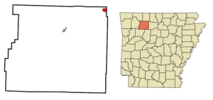
mapsize = 250px
map_caption = Location in Newton County and the state ofArkansas
mapsize1 =
map_caption1 =
subdivision_type = Country
subdivision_type1 = State
subdivision_type2 = County
subdivision_name =United States
subdivision_name1 =Arkansas
subdivision_name2 = Newton
government_type =
leader_title =
leader_name =
established_date =
area_magnitude =
area_total_km2 = 2.8
area_total_sq_mi = 1.1
area_land_km2 = 2.8
area_land_sq_mi = 1.1
area_water_km2 = 0
area_water_sq_mi = 0
elevation_ft = 1073
elevation_m = 327
population_as_of = 2000
population_footnotes =
population_total = 407
population_metro =
population_density_km2 = 145.4
population_density_sq_mi = 370
timezone = Central (CST)
utc_offset = -6
latd = 36 |latm = 6 |lats = 3 |latNS = N
longd = 92 |longm = 57 |longs = 28 |longEW = W
timezone_DST = CDT
utc_offset_DST = -5
postal_code_type =ZIP code
postal_code = 72685
area_code = 870
blank_name = FIPS code
blank_info = 05-74330
blank1_name = GNIS feature ID
blank1_info = 0078733
footnotes =
website =Western Grove is a town in Newton County,
Arkansas ,United States . The population was 407 at the 2000 census. It is part of the Harrison Micropolitan Statistical Area.Geography
Western Grove is located at coor dms|36|6|3|N|92|57|28|W|city (36.100876, -92.957840)GR|1.
According to the
United States Census Bureau , the town has a total area of 2.8km² (1.1 mi²), all land.Demographics
As of the
census GR|2 of 2000, there were 407 people, 169 households, and 126 families residing in the town. Thepopulation density was 145.5/km² (375.1/mi²). There were 193 housing units at an average density of 69.0/km² (177.9/mi²). The racial makeup of the town was 99.51% White, and 0.49% from two or more races.There were 169 households out of which 37.9% had children under the age of 18 living with them, 55.0% were married couples living together, 17.8% had a female householder with no husband present, and 25.4% were non-families. 24.3% of all households were made up of individuals and 11.8% had someone living alone who was 65 years of age or older. The average household size was 2.41 and the average family size was 2.84.
In the town the population was spread out with 27.0% under the age of 18, 9.3% from 18 to 24, 29.7% from 25 to 44, 23.3% from 45 to 64, and 10.6% who were 65 years of age or older. The median age was 34 years. For every 100 females there were 80.1 males. For every 100 females age 18 and over, there were 74.7 males.
The median income for a household in the town was $24,722, and the median income for a family was $30,694. Males had a median income of $25,000 versus $16,375 for females. The
per capita income for the town was $12,731. About 11.2% of families and 14.6% of the population were below thepoverty line , including 27.7% of those under age 18 and 4.2% of those age 65 or over.References
External links
Wikimedia Foundation. 2010.