- Texas State Highway 20
Infobox TX State Highway
type=State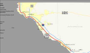
route=20
length_mi=78.06Texas Department of Transportation , [http://www.dot.state.tx.us/tpp/hwy/sh/sh0020.htm] ]
length_km=125.62
formed=1969
dir1=North
dir2=South
from=
junction=
|to=
previous_type=Interstate
previous_route=20
next_type=State
next_route=21State Highway 20, or SH 20, runs from the
Texas /New Mexico boundary at Anthony north of El Paso down to McNary in westTexas . It follows the old path of U.S. Highway 80.History
Current Route
The current SH 20 was created in
1969 when the routing of US 80 was realigned with Interstate 10 in this area. This stretch of highway had been part of SH 1, the "Texarkana-Dallas-Fort Worth-El Paso" highway prior to the creation of US 80. In1917 the current route of SH 20 was mapped as the concurrency of SH 1 and SH 12 (part of the "Jefferson Davis Memorial Highway" and also called the "Orange-El Paso Highway").Previous Routes
SH 20 was one of the original Texas state highways planned in 1917 from Mason through Austin to Houston. In 1919, alternate route SH 20A was routed due west from Austin to Fredericksburg, with a planned extension farther west to Segovia. By 1933, the section from Austin to Mason had been renumbered as part of SH 29, with SH 20" rerouted over SH 20A". In
1935 , a realigned US 290 had shortened SH 20 again, now only a stretch from Austin to near Paige. From 1938 to 1951, SH 20 went from Austin through Elgin and ended near Paige. After1947 , US 290 was shifted north (its former route becoming SH 71) to a straightened route parallel to SH 20. The two routes apparently existed side-by-side for several years until when, in 1951, SH 20 was deleted. As of2005 , portions of the original SH 20 are still open to traffic in Bastrop County. The portion from Loop 223 in McDade to Spur 186 in Paige are signed as "Old Highway 20".ights
Historical Markers
El Paso County
*"Corpus Christi de la Ysleta" mission in the Ysleta area of El Paso
Hudspeth County
*Fort Hancock mercantile, near Spur 148 in Fort Hancock
Counties and junctions
References

Wikimedia Foundation. 2010.