- White Sands, New Mexico
: "For the 1992 motion picture, see
White Sands (film) .Infobox Settlement
official_name = White Sands, New Mexico
settlement_type = CDP
nickname =
motto =
imagesize =
image_caption =
image_
imagesize =
image_caption =
image_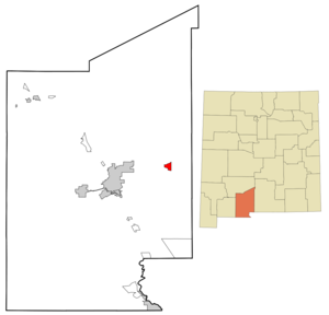
mapsize = 250px
map_caption = Location of White Sands, New Mexico
mapsize1 =
map_caption1 =subdivision_type = Country
subdivision_name =United States
subdivision_type1 = State
subdivision_name1 =New Mexico
subdivision_type2 = County
subdivision_name2 = Dona Ana
government_footnotes =
government_type =
leader_title =
leader_name =
leader_title1 =
leader_name1 =
established_title =
established_date =unit_pref = Imperial
area_footnotes =area_magnitude =
area_total_km2 = 8.0
area_land_km2 = 8.0
area_water_km2 = 0.0
area_total_sq_mi = 3.1
area_land_sq_mi = 3.1
area_water_sq_mi = 0.0population_as_of = 2000
population_footnotes =
population_total = 1323
population_density_km2 = 165.7
population_density_sq_mi = 429.2timezone = Mountain (MST)
utc_offset = -7
timezone_DST = MDT
utc_offset_DST = -6
elevation_footnotes =
elevation_m =
elevation_ft =
latd = 32 |latm = 23 |lats = 3 |latNS = N
longd = 106 |longm = 29 |longs = 52 |longEW = Wpostal_code_type =
ZIP code
postal_code = 88002
area_code = 505
blank_name = FIPS code
blank_info = 35-84845
blank1_name =
blank1_info =
website =
footnotes =White Sands is a
census-designated place (CDP) in Doña Ana County,New Mexico ,United States . The population was 1,323 at the 2000 census. It is part of the Las CrucesMetropolitan Statistical Area . See alsoWhite Sands Missile Range andWhite Sands National Monument .Geography
White Sands is located at coor dms|32|23|3|N|106|29|52|W|city (32.384064, -106.497698)GR|1.
According to the
United States Census Bureau , the CDP has a total area of 3.1square mile s (8.0km² ), all of it land.Demographics
As of the
census GR|2 of 2000, there were 1,323 people, 432 households, and 355 families residing in the CDP. Thepopulation density was 429.2 people per square mile (165.8/km²). There were 667 housing units at an average density of 216.4/sq mi (83.6/km²). The racial makeup of the CDP was 71.43% White, 11.56% African American, 0.98% Native American, 3.70% Asian, 0.08% Pacific Islander, 6.27% from other races, and 5.97% from two or more races. Hispanic or Latino of any race were 17.61% of the population.There were 432 households out of which 56.0% had children under the age of 18 living with them, 72.0% were married couples living together, 6.9% had a female householder with no husband present, and 17.8% were non-families. 16.4% of all households were made up of individuals and none had someone living alone who was 65 years of age or older. The average household size was 3.06 and the average family size was 3.45.
In the CDP the population was spread out with 37.3% under the age of 18, 9.4% from 18 to 24, 39.7% from 25 to 44, 13.0% from 45 to 64, and 0.5% who were 65 years of age or older. The median age was 27 years. For every 100 females there were 105.4 males. For every 100 females age 18 and over, there were 103.7 males.
The median income for a household in the CDP was $43,500, and the median income for a family was $47,750. Males had a median income of $40,402 versus $21,250 for females. The
per capita income for the CDP was $16,186. About 1.5% of families and 2.6% of the population were below thepoverty line , including 3.8% of those under age 18 and none of those age 65 or over.The White Sands of New Mexico=275 square miles.The White Sands
The desert lies under the scorching sun of Tularosa Basin New Mexico, its white sands gleaming like freshly fallen snow. These powdery grains of sand are not composed of quartz, unlike most desert sands, but of soft, chalky
gypsum , orcalcium sulfate . Also, unlike other desert sands, they are cool to the touch, due to the high rate of evaporation of surface moisture and also to the fact that the sands reflect, rather than absorb, the sun's rays. It is the world's largest surface deposit of gypsum, the mineral from which plaster of Paris is made.Gypsum is one of the most common mineral compounds found on Earth but is rarely seen on the surface, as it dissolves easily in water. The origins of this amazing 'desert' dates back to around 100 million years ago, during which it was covered by a shallow sea. As its waters gradually receded, saltwater lakes were left behind, which eventually evaporated in the sun. In addition to salt, gypsum was also laid down in thick deposits on the old seabed.
The Sacramento and San Andreas mountain ranges, with the Tularosa Basin between them, started taking shape 65 million years ago. Giant upheavals in the Earth's crust folded and crumpled the land and the gypsum deposits, thrusting them high into the air.
Constant rainfall and meltwater coming from the mountains caused the gypsum to leach out and concentrated solutions were washed down the mountainsides. The gypsum solution accumulated in Lake Lucero, the lowest part of the Tularosa Basin. Water in the lake does not have any means of escaping except by evaporation, which leaves behind thin layers of crystalised gypsum, or
selenite . Weathering then reduces these crystals to fine, sandy grains. South-westerly winds carry the grains farther up the basin, and the grains pile in steep dunes that are often as high as 15 m (50ft). The winds carve more dunes and, at the same time, carry small amounts of the gypsum grains by distances of up to 9 m (30ft) a year.This constant movement of the sands, added with their alkaline nature and the little amount of rainfall makes it difficult for plants to grow here.
References
External links
Wikimedia Foundation. 2010.