- Pecos, New Mexico
Infobox Settlement
official_name = Pecos, New Mexico
settlement_type = Village
nickname =
motto =
imagesize =
image_caption =
image_
imagesize =
image_caption =
image_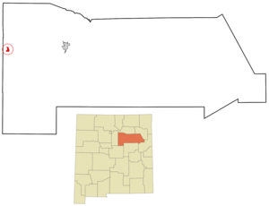
mapsize = 250px
map_caption = Location of Pecos, New Mexico
mapsize1 =
map_caption1 =subdivision_type = Country
subdivision_name =United States
subdivision_type1 = State
subdivision_name1 =New Mexico
subdivision_type2 = County
subdivision_name2 = San Miguel
government_footnotes =
government_type =
leader_title =
leader_name =
leader_title1 =
leader_name1 =
established_title =
established_date =unit_pref = Imperial
area_footnotes =area_magnitude =
area_total_km2 = 4.5
area_land_km2 = 4.5
area_water_km2 = 0.0
area_total_sq_mi = 1.7
area_land_sq_mi = 1.7
area_water_sq_mi = 0.0population_as_of = 2000
population_footnotes =
population_total = 1441
population_density_km2 = 320.6
population_density_sq_mi = 830.3timezone = Mountain (MST)
utc_offset = -7
timezone_DST = MDT
utc_offset_DST = -6
elevation_footnotes =
elevation_m = 2110
elevation_ft = 6923
latd = 35 |latm = 34 |lats = 51 |latNS = N
longd = 105 |longm = 40 |longs = 43 |longEW = Wpostal_code_type =
ZIP code
postal_code = 87552
area_code = 505
blank_name = FIPS code
blank_info = 35-55620
blank1_name = GNIS feature ID
blank1_info = 0915876
website =
footnotes =Pecos is a village in San Miguel County,
New Mexico ,United States . The population was 1,441 at the 2000 census, growing much faster than in other parts of San Miguel County, partly because Pecos is within commuting distance of Santa Fe [http://www.smcounty.net/Web%20Docs/Draft%20Plan%20October%202003%20.pdf] :54. The village is built along thePecos River which flows from the north out of theSanta Fe National Forest . Notable locations nearby includePecos National Historical Park ,Glorieta Pass ,Pecos Benedictine Monastery , and Lisboa Springs Trout Hatchery. It is also an entry point for hunting, fishing, hiking and camping in thePecos Wilderness . The closest metro area (twenty five minutes northwest by car) is Santa Fe.Geography
Pecos is located at coor dms|35|34|51|N|105|40|43|W|city (35.580954, -105.678660)GR|1.
According to the
United States Census Bureau , the village has a total area of 1.7square mile s (4.5km² ), all of it land.Demographics
As of the
census GR|2 of 2000, there were 1,441 people, 542 households, and 383 families residing in the village. Thepopulation density was 830.3 people per square mile (319.8/km²). There were 628 housing units at an average density of 361.9/sq mi (139.4/km²). The racial makeup of the village was 68.91% White, 0.21% African American, 1.39% Native American, 0.21% Pacific Islander, 26.51% from other races, and 2.78% from two or more races. Hispanic or Latino of any race were 80.08% of the population.There were 542 households out of which 39.3% had children under the age of 18 living with them, 49.1% were married couples living together, 14.9% had a female householder with no husband present, and 29.2% were non-families. 24.2% of all households were made up of individuals and 6.1% had someone living alone who was 65 years of age or older. The average household size was 2.63 and the average family size was 3.15.
In the village the population was spread out with 29.7% under the age of 18, 10.1% from 18 to 24, 29.6% from 25 to 44, 21.8% from 45 to 64, and 8.8% who were 65 years of age or older. The median age was 32 years. For every 100 females there were 99.3 males. For every 100 females age 18 and over, there were 99.0 males.
The median income for a household in the village was $30,549, and the median income for a family was $33,828. Males had a median income of $28,625 versus $22,500 for females. The
per capita income for the village was $13,306. About 13.0% of families and 15.9% of the population were below thepoverty line , including 19.2% of those under age 18 and 22.6% of those age 65 or over.Education
Pecos Independent Schools serves the Village of Pecos as well as rural areas in western San Miguel County.References
External links
* [http://www.nps.gov/peco/ National Park Service: Pecos National Historical Park]
* [http://www.swanet.org/2007_pecos_conference/index.html Pecos Conference]
* [http://www.smcounty.net/Web%20Docs/Draft%20Plan%20October%202003%20.pdf San Miguel County Plan]
Wikimedia Foundation. 2010.