- Carson National Forest
Geobox|Protected area
name = Carson National Forest
category =
category_iucn = VI
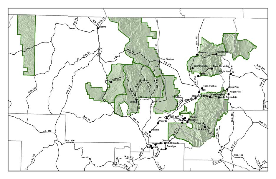
caption = Map of the Carson National Forest
country = United States
country_
state = New Mexico
state_
state_type = State
region =
region_type = County
city_type =
city =
lat_d = 36
lat_m = 31
lat_s = 2
lat_NS = N
long_d = 106
long_m = 4
long_s = 1
long_EW = W
area = 5631.18
established =
map_locator = New Mexico

governing_body =
website =Carson National Forest is a national forest in northern
New Mexico ,United States . It encompasses 6,070 square kilometers (1.5 million acres) and is administered by theUnited States Forest Service . The Forest Service's "mixed use" policy allows for its use for recreation, grazing, and resource extraction.The forest was once inhabited by the Ancient Pueblo (Anasazi) people, who left ruins of
adobe dwellings and other artifacts at an archaeological site now called Pot Creek Cultural Site. Some areas of the forest were formerly lands granted to settlers by theSpanish monarchy and the Mexican government. After theMexican-American War , the national forest was established, and was named for American pioneerKit Carson . In 1967, theAlianza Federal de Mercedes , an organization dedicated to the restoration of Spanish and Mexican land grants, occupied Echo Amphitheater, an area of the forest in an attempt to recreate a historic land grant community. The occupants were evicted for overstaying camping permits. In 1982, the forest grew by 405 square kilometers (100,000 acres) when thePennzoil corporation donated theValle Vidal Unit to the American people.Wheeler Peak, the highest
mountain in New Mexico at convert|13161|ft|m|0, is located in the National Forest.Within the Carson National Forest are four designated and one proposed
wilderness area s, comprising convert|86193|acre|km2|1|sing=off.
*Wheeler Peak Wilderness
*Latir Peak Wilderness
*Pecos Wilderness
*Cruces Basin Wilderness
*Columbine-Hondo Wilderness (proposed)The forest is located overwhelmingly in Rio Arriba (63.4% of acreage) and Taos (34.65%) counties, but smaller areas extend eastward into western Mora and Colfax counties. Forest headquarters are located in
Taos, New Mexico .Carson National Forest was established with the merger of
Taos National Forest and part ofJemez National Forest on July 1, 1908. [citation|title=PDFlink| [http://www.foresthistory.org/Research/usfscoll/places/National%20Forests%20of%20the%20U.S.pdf National Forests of the United States] |341 KB|date=September 29, 2005|author=Davis, Richard C.|publisher=The Forest History Society]References
External links
* [http://www.fs.fed.us/r3/carson Carson National Forest] - US Forest Service

Wikimedia Foundation. 2010.