- Lechee, Arizona
Infobox Settlement
official_name = Lechee, Arizona
settlement_type = CDP
imagesize =
image_caption =
image_
imagesize =
image_caption =
image_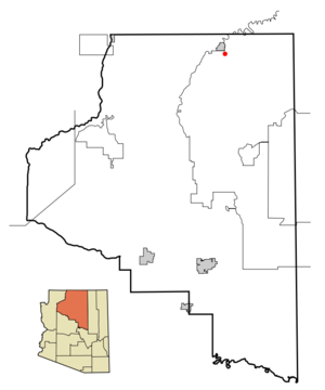
mapsize = 250px
map_caption = Location inCoconino County and the state ofArizona
mapsize1 =
map_caption1 =
subdivision_type = Country
subdivision_type1 = State
subdivision_type2 = County
subdivision_name =United States
subdivision_name1 =Arizona
subdivision_name2 = Coconino
government_type =
leader_title =
leader_name =
established_date =
area_magnitude =
area_total_km2 = 43.8
area_total_sq_mi = 16.9
area_land_km2 = 43.9
area_land_sq_mi = 16.9
area_water_km2 = 0.0
area_water_sq_mi = 0.0
elevation_ft = 4982
elevation_m = 1519
population_as_of = 2000
population_footnotes =
population_total = 1606
population_metro =
population_density_km2 = 36.6
population_density_sq_mi = 94.8
timezone = MST
utc_offset = -7
latd = 36 |latm = 52 |lats = 26 |latNS = N
longd = 111 |longm = 26 |longs = 17 |longEW = W
timezone_DST =
utc_offset_DST =
postal_code_type =
postal_code =
area_code =
blank_name = FIPS code
blank_info = 04-40415
blank1_name = GNIS feature ID
blank1_info = 1853161
footnotes =
website =Lechee ( _nv. Łichíiʼii) is a
census-designated place (CDP) in Coconino County,Arizona ,United States . The population was 1,606 at the 2000 census.Geography
Lechee is located at coor dms|36|52|26|N|111|26|17|W|city (36.873975, -111.437971)GR|1. It lies in the northwest corner of the
Navajo Indian Reservation adjacent to the southeast side of the non-reservation city of Page.According to the
United States Census Bureau , the CDP has a total area of 16.9square mile s (43.8km² ), all of it land.Demographics
As of the
census GR|2 of 2000, there were 1,606 people, 332 households, and 310 families residing in the CDP. Thepopulation density was 94.8 people per square mile (36.6/km²). There were 386 housing units at an average density of 22.8/sq mi (8.8/km²). The racial makeup of the CDP was 98.38% Native American, 0.75% (or 12 people) White, and 0.87% (or 14 people) from two or more races. Fifteen members (or 0.93%) of the population were Hispanic or Latino of any race.There were 332 households out of which 74.1% had children under the age of 18 living with them, 62.7% were married couples living together, 23.8% had a female householder with no husband present, and 6.6% were non-families. 6.0% of all households were made up of individuals and 1.8% had someone living alone who was 65 years of age or older. The average household size was 4.84 and the average family size was 4.95.
In the CDP the population was spread out with 49.9% under the age of 18, 9.7% from 18 to 24, 27.3% from 25 to 44, 10.6% from 45 to 64, and 2.5% who were 65 years of age or older. The median age was 18 years. For every 100 females there were 102.0 males. For every 100 females age 18 and over, there were 98.3 males.
The median income for a household in the CDP was $48,375, and the median income for a family was $42,212. Males had a median income of $31,250 versus $27,188 for females. The
per capita income for the CDP was $10,378. About 16.2% of families and 15.5% of the population were below thepoverty line , including 20.5% of those under age 18 and none of those age 65 or over.Education
Lechee is served by the
Page Unified School District .References
External links
Wikimedia Foundation. 2010.