- Coconino County, Arizona
-
Coconino County, Arizona 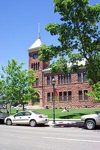

Seal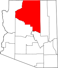
Location in the state of Arizona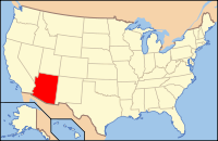
Arizona's location in the U.S.Founded February 18, 1891 Seat Flagstaff Largest city Flagstaff Area
- Total
- Land
- Water
18,661.21 sq mi (48,332 km²)
18,617.42 sq mi (48,219 km²)
43.79 sq mi (113 km²), 0.23%Population
- (2010)
- Density
134,421
7/sq mi (2.7/km²)Website coconino.az.gov 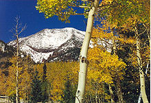
Coconino County is a county located in the north central part of the U.S. state of Arizona. It is part of the Flagstaff, Arizona Metropolitan Statistical Area. The population was 134,421 at the 2010 census. The county seat is Flagstaff.[1] It is the second largest county by land area in the 48 contiguous United States, behind San Bernardino County, California, with its 18,661 square miles (48,300 km2) making it larger than each of the nine smallest states.
Coconino County contains Grand Canyon National Park, the Havasupai Nation, and parts of the Navajo Nation, Hualapai Nation, and Hopi Nation. It takes its name from Cosnino, a name applied to the Havasupai.
Coconino County was the setting for George Herriman's early 20th century Krazy Kat comic strip.
Coconino County has a relatively large Native American population at nearly 30% of the county's total population, being mostly Navajo with smaller numbers of Havasupai, Hopi, and others.
Contents
History
After the building of the Atlantic & Pacific Railroad in 1883 the region of northern Yavapai County began experiencing rapid growth. The people of the northern reaches had tired of the rigors of travelling all the way to Prescott for county business. They also believed that they were a significant enough entity that they should have their own county jurisdiction. Therefore, they decided in 1887 to petition for secession from Yavapai and the creation of a new Frisco County. They remained part of Yavapai, however, until 1891 when Coconino County was formed and its seat declared to be Flagstaff.
Geography
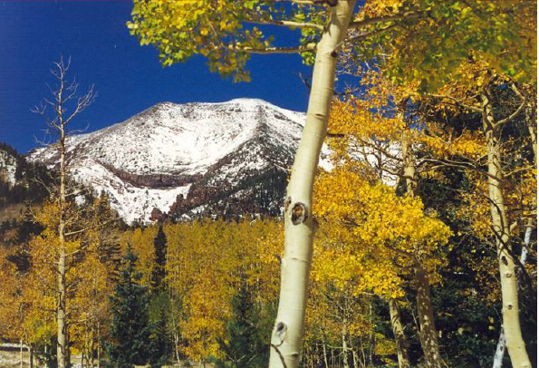
According to the 2000 census, the county has a total area of 18,661.21 square miles (48,332.3 km2), of which 18,617.42 square miles (48,218.9 km2) (or 99.77%) is land and 43.79 square miles (113.4 km2) (or 0.23%) is water.[2] It is the second largest county in the U.S. (excluding boroughs in Alaska) after San Bernardino County in California and is also physically larger than many European nation-states. It has more land area than Connecticut, Delaware, Hawaii, Maryland, Massachusetts, New Hampshire, New Jersey, Rhode Island, or Vermont. The highest natural point in Arizona, Humphreys Peak at 12,637 feet (3,852 m), is located in Coconino County.
Adjacent Counties
- Mohave County, Arizona - west
- Yavapai County, Arizona - south
- Gila County, Arizona - south
- Navajo County, Arizona - east
- San Juan County, Utah - northeast
- Kane County, Utah - north
Indian reservations
Coconino County has 7,142.42 square miles (18,498.8 km2) of federally designated Indian reservation, second only to Apache County, Arizona. In descending order of area within the county, the reservations are the Navajo Indian Reservation, Hualapai Indian Reservation, Hopi Indian Reservation, Havasupai Indian Reservation, and the Kaibab Indian Reservation. The Havasupai Reservation is the only one that lies entirely within the county's borders.
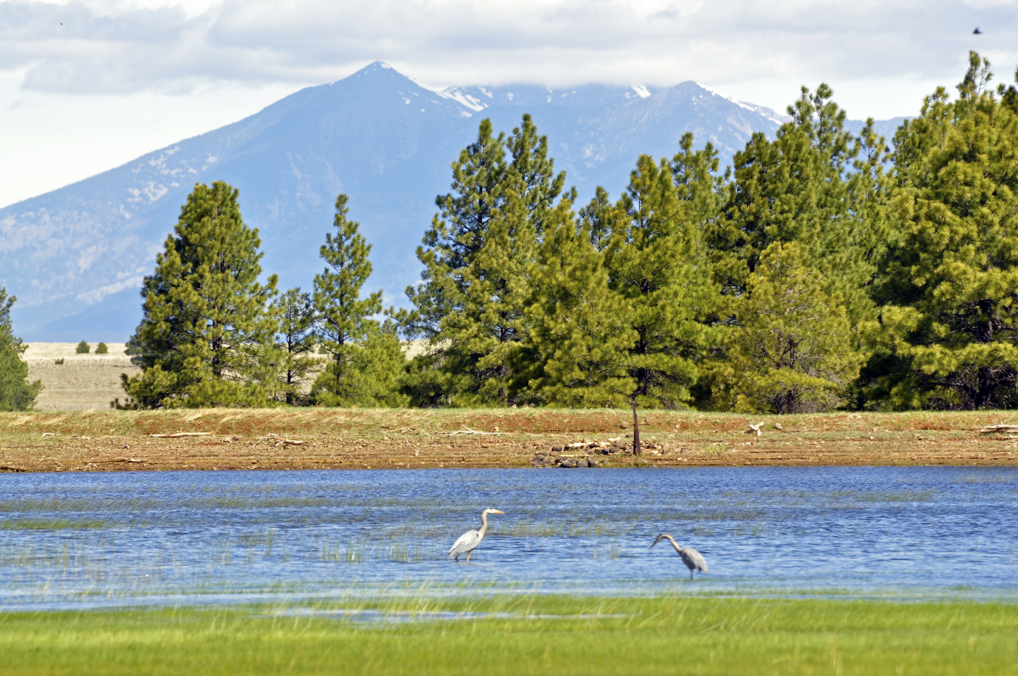
 Great Blue Herons at Tonys Tank (near Mormon Lake), Coconino National Forest. San Francisco Peaks in background.
National protected areas
- Apache-Sitgreaves National Forest (part)
- Coconino National Forest (part)
- Glen Canyon National Recreation Area (part)
- Grand Canyon National Park (part)
- Kaibab National Forest (part)
- Prescott National Forest (part)
- Sunset Crater Volcano National Monument
- Vermilion Cliffs National Monument
- Walnut Canyon National Monument
- Wupatki National Monument
Major Highways
 Interstate 17
 Interstate 40
 U.S. Route 89
 U.S. Route 160
 U.S. Route 180
- Historic Route 66 through Flagstaff, Winslow, Williams, and Peach Springs
 State Route 64
 State Route 87
 State Route 89
 State Route 98
 State Route 99
 State Route 260
 State Route 264
Demographics
Historical populations Census Pop. %± 1900 5,514 — 1910 8,130 47.4% 1920 9,982 22.8% 1930 14,064 40.9% 1940 18,770 33.5% 1950 23,910 27.4% 1960 41,857 75.1% 1970 48,326 15.5% 1980 75,008 55.2% 1990 96,591 28.8% 2000 116,320 20.4% 2010 134,421 15.6% 2010
Whereas according to the 2010 U.S. Census Bureau:
- 61.7% White
- 1.2% Black
- 27.3% Native American
- 1.4% Asian
- 0.1% Native Hawaiian or Pacific Islander
- 3.1% Two or more races
- 5.2% Other races
- 13.5% Hispanic or Latino (of any race)
2000
As of the census[3] of 2000, there were 116,320 people, 40,448 households, and 26,938 families residing in the county. The population density was 6 people per square mile (2/km²). There were 53,443 housing units at an average density of 3 per square mile (1/km²). The racial makeup of the county was 63.09% White, 28.51% Native American, 1.04% Black or African American, 0.78% Asian, 0.09% Pacific Islander, 4.13% from other races, and 2.36% from two or more races. 10.94% of the population were Hispanic or Latino of any race. 18.59% reported speaking Navajo at home, while 6.58% speak Spanish [1].
There were 40,448 households out of which 34.90% had children under the age of 18 living with them, 49.70% were married couples living together, 12.20% had a female householder with no husband present, and 33.40% were non-families. 22.10% of all households were made up of individuals and 4.50% had someone living alone who was 65 years of age or older. The average household size was 2.80 and the average family size was 3.36.
In the county the population was spread out with 28.70% under the age of 18, 14.40% from 18 to 24, 29.20% from 25 to 44, 20.70% from 45 to 64, and 7.00% who were 65 years of age or older. The median age was 30 years. For every 100 females there were 99.70 males. For every 100 females age 18 and over, there were 97.20 males.
The median income for a household in the county was $38,256, and the median income for a family was $45,873. Males had a median income of $32,226 versus $25,055 for females. The per capita income for the county was $17,139. About 13.10% of families and 18.20% of the population were below the poverty line, including 22.30% of those under age 18 and 13.30% of those age 65 or over.
Communities
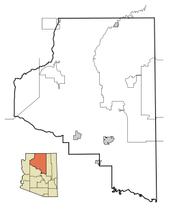 Map showing the borders for incorporated and unincorporated areas in Coconino County. Also shown are borders for Indian reservations.
Cities
- Flagstaff
- Sedona (part of Sedona is in Yavapai County)
- Williams
Towns
Census-designated places
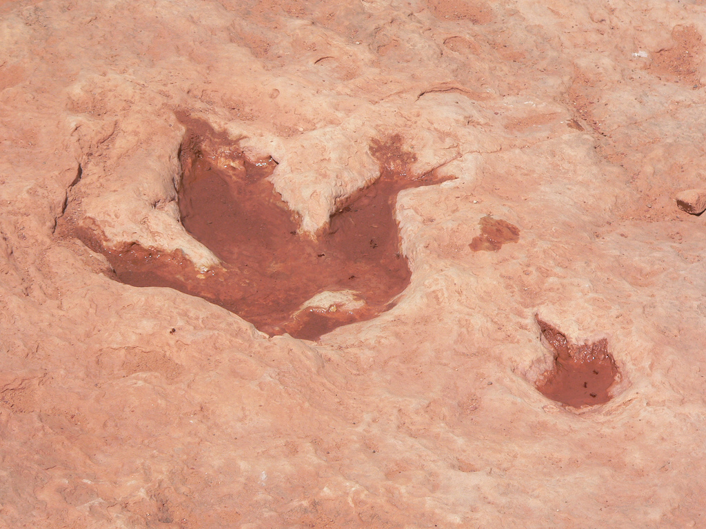
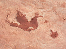 Dinosaur track near Tuba City
- Bitter Springs
- Cameron
- Grand Canyon Village
- Kachina Village
- Kaibab
- Kaibito
- Lechee
- Leupp
- Moenkopi
- Mountainaire
- Munds Park
- Parks
- Supai
- Tonalea
- Tuba City
- Tusayan
- Winslow West
Other communities
Economy
Grand Canyon Airlines and Air Grand Canyon are headquartered on the grounds of Grand Canyon National Park Airport in Tusayan.[4][5][6]
Transportation
Flagstaff in Coconino County is a major highway junction, with Interstate 40 extending to the east and the west (connecting with Williams and Winslow, Arizona, for example), and with Interstate 17 extending south from Flagstaff to Phoenix and Maricopa County. U.S. Routes 89 and 180 extend north from Flagstaff and connect it with the Grand Canyon National Park.
The Grand Canyon National Park Airport is a public airport located in Tusayan.,[5][6] near the South Rim of the Grand Canyon.
Flagstaff Pulliam Airport is a public airport located four miles (6 km) south of the central business district of Flagstaff, it is mostly used for general aviation but is also served by two commercial airlines.
There is a Greyhound Bus Lines station in Flagstaff, with regular service east-west along Interstate 40, and also north-south service to Phoenix along Interstate 17.
AMTRAK has a passenger railroad station in Flagstaff, with daily service to the east towards Chicago, and to the west towards Los Angeles.
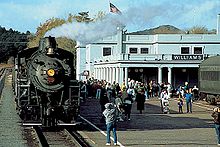
A tourist railroad train links Williams with the canyon's South Rim in the Grand Canyon National Park and has service most days of the week.
The Mountain Line provides public transportation bus service in the Flagstaff area.
See also
- National Register of Historic Places listings in Coconino County, Arizona
- USS Coconino County (LST-603)
References
- ^ "Find a County". National Association of Counties. http://www.naco.org/Counties/Pages/FindACounty.aspx. Retrieved 2011-06-07.
- ^ "Census 2000 U.S. Gazetteer Files: Counties". United States Census. http://www.census.gov/tiger/tms/gazetteer/county2k.txt. Retrieved 2011-02-13.
- ^ "American FactFinder". United States Census Bureau. http://factfinder.census.gov. Retrieved 2008-01-31.
- ^ "Locate Us." Air Grand Canyon. Retrieved on October 3, 2009.
- ^ a b "Our Location." Grand Canyon Airlines. Retrieved on October 3, 2009.
- ^ a b "Tusayan CDP, Arizona." U.S. Census Bureau. Retrieved on October 3, 2009.
External links

Kane County, Utah San Juan County, Utah Mohave County 
Navajo County  Coconino County, Arizona

Yavapai County and Gila County Municipalities and communities of Coconino County, Arizona Cities 
Towns CDPs Bitter Springs | Cameron | Doney Park | Grand Canyon Village | Kachina Village | Kaibab‡ | Kaibito | Lechee | Leupp | Moenkopi | Mountainaire | Munds Park | Parks | Supai | Tonalea | Tuba City | Winslow West‡
Unincorporated
communitiesBellemont | Forest Lakes | Gray Mountain | Happy Jack | Hualapai Hilltop | Jacob Lake | Marble Canyon | North Rim | Valle | Winona
Indian reservations Ghost town Footnotes ‡This populated place also has portions in an adjacent county or counties
 State of Arizona
Topics - Index
- Climate
- Delegations
- Geography
- History
- Museums
- Music
- People
- Transportation
- Visitor Attractions
Society - Culture
- Demographics
- Economy
- Education
- Politics
Regions - Arizona Strip
- Arizona Sun Corridor
- Coconino Plateau
- Colorado Plateau
- Grand Canyon
- Kaibab Plateau
- Mogollon Plateau
- Mogollon Rim
- Mojave Desert
- Monument Valley
- North Central Arizona
- Northeast Arizona
- Northern Arizona
- Oak Creek Canyon
- Phoenix Metropolitan Area
- Safford area
- San Francisco Volcanic Field
- Sonoran Desert
- Southern Arizona
- Verde Valley
- White Mountains
Counties Cities Coordinates: 35°37′43″N 112°05′37″W / 35.62861°N 112.09361°W
Categories:- Arizona counties
- Coconino County, Arizona
- 1891 establishments


Wikimedia Foundation. 2010.