- Wupatki National Monument
Infobox_protected_area | name = Wupatki National Monument
iucn_category = V

caption =
locator_x = 60
locator_y = 103
location =Coconino County, Arizona , USA
nearest_city =Flagstaff, Arizona
lat_degrees = 35
lat_minutes = 33
lat_seconds = 56
lat_direction = N
long_degrees = 111
long_minutes = 23
long_seconds = 13
long_direction = W
area = 35,254 (142 km²)
established =December 9 ,1924
visitation_num = 493,621
visitation_year = 2002
governing_body =National Park Service The Wupatki National Monument is a National Monument located in north-central
Arizona , near Flagstaff. Rich in American Indian ruins, the Monument is administered by theNational Park Service in close conjunction with the nearbySunset Crater Volcano National Monument . Wupatki was listed on theNational Register of Historic Places onOctober 15 ,1966 .The many settlement sites scattered throughout the monument were built by theAncient Pueblo Peoples , more specifically theSinagua , Cohonina, and Kayenta Anasazi. A major population influx began soon after the eruption of Sunset Crater in the 11th century, which blanketed the area with volcanic ash; this improved agricultural productivity and the soil's ability to retain water. Based on a careful survey of archaeological sites conducted in the 1980s, an estimated 2000 immigrants moved into the area during the century following the eruption. Agriculture was based mainly on corn and squash raised from the arid land without irrigation.The dwellings, the walls of many of which still stand, were constructed from flat red stones held together with mortar. Each settlement was constructed as a single building, sometimes with scores of rooms. The largest settlement on monument territory is the Wupatki Ruin, "Big House" in the Hopi language, built around a natural rock outcropping. This ruin is believed to be the area's tallest and largest structure for its time period. The monument also contain ruins identified as a ball court, similar to the courts found in Meso-America and in the
Hohokam ruins of southern Arizona. This is the northernmost example of this kind of structure. This site also contains a geological blowhole. Other major sites are Wukoki and The Citadel.Wupatki is called "Anaasází Bikin" [Wilson, A "Navajo Place Names" Guilford, CT: Audio-Forum, 1995] in Navajo) which translates as "Houses of the Enemies".
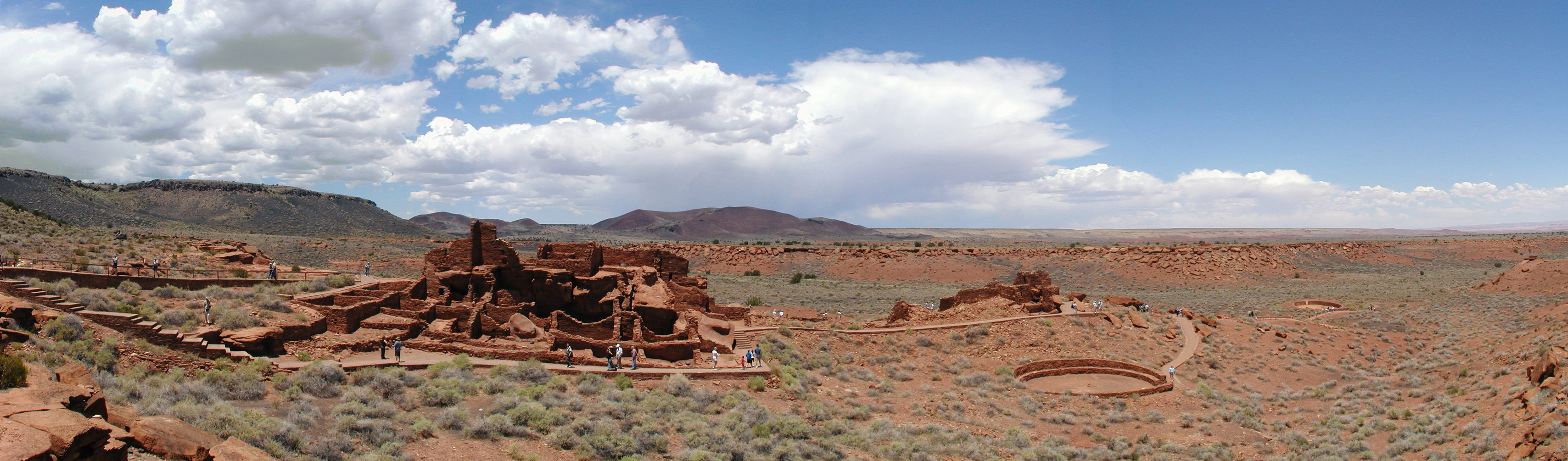
Wupatki_Ruin_ParonamaImage:Wupatki_Ruins_Ball_Court.jpg|Wupatki_Ruin_Ball_CourtImage:box_canyon_ruins.jpg|Box_Canyon_RuinsReferences
External links
* Official NPS website: [http://www.nps.gov/wupa/ Wupatki National Monument]
* [http://www.nps.gov/history/nr/travel/amsw/ American Southwest, a National Park Service "Discover Our Shared Heritage" Travel Itinerary]
Wikimedia Foundation. 2010.