- Yuma County, Arizona
Infobox U.S. County
county = Yuma County
state = Arizona

map size = 150
founded = 1864
seat = Yuma
area_total_sq_mi =5519
area_land_sq_mi =5514
area_water_sq_mi =5
area percentage = 0.09%
census yr = 2007
pop = 190557
density_km2 =11
web = www.co.yuma.az.us
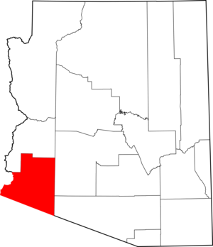
|Yuma County is located in the southwestern corner of the
U.S. state ofArizona . As of 2007, its population was estimated to be 190,557, an increase of 30,531 people since the 2000 census count of 160,026" [http://www.census.gov/population/www/estimates/metro_general/2007/CBSA-EST2007-01.csv] ." "United States Census Bureau ." Retrieved onApril 5 ,2008 ] . Thecounty seat is Yuma.GR|6History
Yuma County was the one of four original Arizona Counties created by the
1st Arizona Territorial Legislature . The county territory was defined as being west of latitude 113° 20' and south of theBill Williams River . [cite book | last = Wagoner | first = Jay J. | title = Arizona Territory 1863-1912: A Political history | publisher = University of Arizona Press | location = Tucson | date = 1970 | isbn=0-8165-0176-9 | pages= p. 58] Its original boundaries remained the same until 1983, whenLa Paz County was created from its northern half.Geography
According to the U.S. Census Bureau, the county has a total area of 5,519
square mile s (14,294km² ), of which, 5,514 square miles (14,281 km²) of it is land and 5 square miles (13 km²) of it (0.09%) is water.Because of its location along the
U.S.-Mexico border , large numbers of illegal aliens entering the United States illegally pass through Yuma county. From October to July 2005, some 124,400 illegal foreign nationals were apprehended in the area, a 46% increase on the previous year ("Economist",August 27 2005 ).Major Highways
*
*Adjacent counties
* Pima County,
Arizona - east
* Maricopa County,Arizona - east
* La Paz County,Arizona - north
* Imperial County,California - westAdjacent municipalities
*
Municipality of Mexicali , Baja California, Mexico - west
* San Luis Rio Colorado, Sonora, Mexico - south
* Puerto Peñasco, Sonora, Mexico - southNational
protected area s*
Cabeza Prieta National Wildlife Refuge (part)
*Imperial National Wildlife Refuge (part)
*Kofa National Wildlife Refuge (part)Demographics
As of the
census GR|2 of 2000, there were 160,026 people, 53,848 households, and 41,678 families residing in the county. Thepopulation density was 29 people per square mile (11/km²). There were 74,140 housing units at an average density of 13 per square mile (5/km²). The racial makeup of the county was 68.28% White, 2.22% Black or African American, 1.64% Native American, 0.93% Asian, 0.12% Pacific Islander, 23.59% from other races, and 3.22% from two or more races. 50.47% of the population were Hispanic or Latino of any race. 43.71% reported speaking Spanish at home [http://www.mla.org/map_data_results&state_id=4&county_id=27&mode=geographic&order=r] .There were 53,848 households out of which 36.90% had children under the age of 18 living with them, 62.30% were married couples living together, 11.20% had a female householder with no husband present, and 22.60% were non-families. 18.50% of all households were made up of individuals and 8.90% had someone living alone who was 65 years of age or older. The average household size was 2.86 and the average family size was 3.27.
In the county the population was spread out with 28.90% under the age of 18, 10.00% from 18 to 24, 25.60% from 25 to 44, 18.90% from 45 to 64, and 16.50% who were 65 years of age or older. The median age was 34 years. For every 100 females there were 102.00 males. For every 100 females age 18 and over, there were 101.10 males.
The median income for a household in the county was $32,182, and the median income for a family was $34,659. Males had a median income of $27,390 versus $22,276 for females. The
per capita income for the county was $14,802. About 15.50% of families and 19.20% of the population were below thepoverty line , including 27.90% of those under age 18 and 8.70% of those age 65 or over.Communities
Cities
Town
* Wellton
Census-designated places
* Fortuna Foothills
* Gadsden
* TacnaOther communities
* Dateland
* Hyder
* Mohawk
* RollMajor highways
*
*
*Adjacent counties
* La Paz County,
Arizona - north
* Maricopa County,Arizona - northeast
* Pima County,Arizona - east
* Baja California, Mexico- west-(State)
* Sonora, Mexico- south-(State)
* Imperial County,California - west
* Riverside County,California - west/northwest
* San Bernardino County,California - northwestReferences
* "Cross-Border, Cross-Purposes". The Economist.August 27 -September 2 2005 .External links
* [http://www.co.yuma.az.us/ Yuma County official web site]
Wikimedia Foundation. 2010.