- San Luis, Arizona
:"For other similarly named towns and cities, see
San Luis ."Infobox Settlement
official_name = City of San Luis, Arizona
other_name =
native_name =
nickname =
motto =
imagesize =
image_caption =
flag_size =
image_
seal_size = 100x100
image_shield =
shield_size =
image_blank_emblem =
blank_emblem_size = 43x41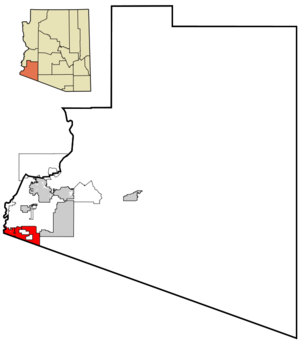
mapsize = 250px
map_caption = Location of San Luis, Arizona
mapsize1 =
map_caption1 =
pushpin_
pushpin_label_position =
subdivision_type = Country
subdivision_name =United States
subdivision_type1 = State
subdivision_name1 =Arizona
subdivision_type2 = County
subdivision_name2 = Yuma
subdivision_type3 =
subdivision_name3 =
subdivision_type4 =
subdivision_name4 =
government_type = Council-Manager
leader_title = Mayor
leader_name = Juan Carlos Escamilla
leader_title1 = Vice-Mayor
leader_name1 = Marco Anonio (Tony) Jr. Reyes
leader_title2 = Actin City Administrator
leader_name2 = Jeff Philpot
leader_title3 = City Clerk
leader_name3 = Sonia Cuello
leader_title4 = City Magistrate
leader_name4 = Rosendo Morales Jr. (Manuel "Manny" Figueroa, Acting)
established_title = Founded
established_date = 1930
established_title2 = Incorporated
established_date2 = 1979
established_title3 =
established_date3 =
area_magnitude =
area_footnotes =
area_total_km2 = 68.5
area_land_km2 = 68.4
area_water_km2 = 0.1
area_total_sq_mi = 26.5
area_land_sq_mi = 26.4
area_water_sq_mi = 0.01
area_water_percent = 0.11
area_urban_km2 =
area_urban_sq_mi =
area_metro_km2 =
area_metro_sq_mi =
population_as_of = 2007
population_note =
settlement_type =City
population_total = 23810population_footnotes = cite web|url=http://www.census.gov/popest/cities/tables/SUB-EST2007-04-04.csv|title=Annual Estimates of the Population for Incorporated Places in Arizona|publisher=
United States Census Bureau |date=2008-07-10|accessdate=2008-07-14]
population_density_km2 = 316.0
population_density_sq_mi = 186.8
population_metro =
population_density_metro_km2 =
population_density_metro_sq_mi =
population_urban =
population_density_urban_km2 =
population_density_urban_sq_mi =
timezone = MST (no DST)
utc_offset = -7
timezone_DST =
utc_offset_DST =
latd = 32 |latm = 29 |lats = 46 |latNS = N
longd = 114 |longm = 46 |longs = 6 |longEW = W
elevation_m = 40
elevation_ft = 130
postal_code_type = ZIP code
postal_code = 85349
area_code = 928
GNIS_id = 43142
website = http://www.cityofsanluis.org
blank_name = FIPS code
blank_info = 04-63470
blank1_name =
blank1_info =
footnotes =San Luis (the
Spanish language name of Saint Louis) is a city in Yuma County,Arizona ,United States . The population was 15,322 at the 2000 census. San Luis was the second fastest-growing place among all cities and towns in Arizona of any size from 1990 and 2000. According to 2006 Census Bureau estimates, the population of the city is 22,634.cite web | url = http://www.census.gov/popest/cities/tables/SUB-EST2006-04-04.csv | title = Annual Estimates of the Population for All Incorporated Places in Arizona|format = CSV | work = 2006 Population Estimates | publisher = U.S. Census Bureau, Population Division]History
The City of San Luis, located in the southwestern end of the state of Arizona, comprises part of an important industrial, agricultural and commercial area together along with
San Luis Río Colorado , Sonora, a zone considered to offer great advantages for the commercial trade between the United States and MexicoFact|date=May 2007.The city was established in 1930 with the opening of a border crossing station. In the last twenty years it has registered an accelerated population increase, going from 1,946 inhabitants in 1980, to approximately 20,000 in the year 2000. The growth is due to a constant migration from Mexico and California, productive activities in the border area and opportunities San Luis has to offerFact|date=May 2007. The City has annexed over convert|16000|acre|km2|0 of land within the past six years, thereby increasing the availability of land for residential, commercial and industrial growth in the eastern part of town where the new commercial port of entry will be constructed.
Geography
San Luis is located at coor dms|32|29|46|N|114|46|6|W|city (32.496116, -114.768327).GR|1 It stands on the
U.S.-Mexico border , oppositeSan Luis Río Colorado, Sonora .According to the
United States Census Bureau , the city has a total area of convert|26.5|sqmi|km2|2, of which, convert|26.4|sqmi|km2|2 of it is land and convert|0.04|sqmi|km2|2 of it (0.11%) is water.The City of San Luis, located in the southwestern end of the state of Arizona, comprises part of an important industrial, agricultural and commercial area together along with San Luis Rio Colorado, Sonora, a zone considered to offer treat advantages for the commercial trade between the United States and MexicoFact|date=May 2007.
Principal Economic Activities
Retail trade, agriculture and manufacturing form a large portion of the local economy. Another significant segment is the light industry located on both sides of the U.S./Mexico border. San Luis is an excellent site for labor intensive manufacturing and assembly plants. A new 40 acre privately owned industrial park and 40 acre commercial area are currently under construction in north San Luis along Highway 95. Parcels and pads are available for purchase and development.
cenic Attractions
Visitor attractions within a 30 minute drive of San Luis include the old Territorial Prison, Fort Yuma and the 16th century Fort Thomas Mission. Laguna, Imperial and Morelos Dams and the California sand dunes are also nearby. Fishing, water skiing and swimming at lakes along the Colorado River attract residents of the area and tourists alike. Located across the border is San Luis, Sonora, Mexico, reputed to be Mexico’s fastest growing city with a population of approximately 200,000. This area has curio shops, night clubs and various other attractions for tourists.
Gulf of Santa Clara
The
Gulf of Santa Clara is located convert|70|mi|km|-1 south of San Luis, and sits on the northernmost point of theSea of Cortez , at its confluence with theColorado River . Large holiday crowds converge here to ride all-terrain vehicles on convert|30|mi|km|-1 of undeveloped beach. In the small village of El Golfo de Santa Clara there are restaurants, an ice house, market and dry goods store and RV spaces with showers. Beach camping is recommended for the experienced camper.Demographics
As of the
census GR|2 of 2000, there were 15,322 people, 3,018 households, and 2,876 families residing in the city. Thepopulation density was 579.5 people per square mile (223.7/km²). There were 3,325 housing units at an average density of 125.8/sq mi (48.6/km²). The racial makeup of the city was 58.78% White, 2.95% Black or African American, 1.46% Native American, 0.16% Asian, 0.02% Pacific Islander, 34.36% from other races, and 2.26% from two or more races. 89.13% of the population were Hispanic or Latino of any race.There were 3,018 households out of which 71.3% had children under the age of 18 living with them, 72.1% were married couples living together, 18.9% had a female householder with no husband present, and 4.7% were non-families. 3.9% of all households were made up of individuals and 1.5% had someone living alone who was 65 years of age or older. The average household size was 4.31 and the average family size was 4.38.
In the city the population was spread out with 35.6% under the age of 18, 12.9% from 18 to 24, 34.1% from 25 to 44, 13.4% from 45 to 64, and 4.0% who were 65 years of age or older. The median age was 26 years. For every 100 females there were 126.5 males. For every 100 females age 18 and over, there were 144.6 males.
The median income for a household in the city was $22,966, and the median income for a family was $22,368. Males had a median income of $20,770 versus $14,149 for females. The
per capita income for the city was $5,377. About 36.3% of families and 35.8% of the population were below thepoverty line , including 38.5% of those under age 18 and 44.3% of those age 65 or over.Prison
The
Arizona State Prison Complex - Yuma is located on the corner of Avenue B and Juan Sanchez Boulevard, in San Luis. ASPC-Yuma provides housing to an average population of 2,279 convicted male felons. ASPC-Yuma is also a major employer in Yuma County, employing 755 full-time employees. ASPC-Yuma is a provider of inmate work crews utilized by members of our local, state and community organizations. Among other duties, ASPC-Yuma has a Wildland Fire Crew that consists of one sergeant, two correctional officers and twenty inmates that assists in fighting fires throughout Arizona.San Luis Detention Facility - Opened in 2007, the facility is owned by the San Luis Detention Facility Development Corporation, a subsidiary of the City, and is currently operated by CEC/Civigenics. The facility is located on the eastern edge of the City near the Arizona State Prison Complex. The facility has 464 beds to hold detainees, primarily for violations of immigration laws, from local federal authorities. The facility employees approximately 80 full-time employees.
Comite de Bienestar
Comite de Bien Estar (Comite) is a membership organization, specifically a land development cooperative. It was started in the border town of San Luis, Arizona in 1981 when 400 families banded together to save enough money to purchase and develop convert|100|acre|km2|1 of land for lots on which they could build their own homes. By the time they accomplished their vision, the families had pooled $1.4 million for the land and infrastructure - with no outside financial assistance.
Comite works to empower Mexican-American residents and immigrants who encounter many barriers, including low wages, little access to conventional financing, and limited political representation. Its development strategy addresses the realities of the bi-national local community.
Marco "Tony" Reyes has been the executive director of the organization since its inception. He also serves as member of the Yuma County Board of Supervisors, having served as the Mayor of San Luis from 1984 to 1994. He is also the chairman of the Enterprise Community Advisory Board.cite web
url=http://www.comiteaz.org/
title=Comite de Bien Estar - San Luis, AZ
accessdate=2007-05-12]Weather
City Hall is located at:
City Administration
P.O. Box 1170
1090 East Union Street
San Luis, AZ 85349
Phone: (928) 341-8520
Fax: (928) 627-3879Media
Newspapers
Bajo el Sol is a major weekly newspaper in the town, published every Friday. The parent company of the Bajo el Sol, Freedom Publishers, Inc., also publishes The Yuma Sun, The Super Shopper and New Homes. The Yuma Sun is also a daily publication available in San Luis, as well as La Prensa, from
San Luis Rio Colorado .Television
San Luis is served by these American TV Stations:
K19CX Channel 19 IndioKSWT Channel 13 -Yuma KYMA Channel 11 -Yuma KECY Channel 9 -Yuma KVYE Channel 7 -El Centro KVFA-LP Channel 6 - IndioKYUM-LP Channel 2 - IndioK19CX Channel 19 IndioK28FM Channel 28 (MTV3) -Yuma KESE-LP Channel 35 (TEL) -Yuma KAJB Cahnnel 54 (TFU) -El Centro Additionally by these
Mexican TV Stations :XHBC Channel 3 (Televisa) -Mexicali XHAQ Channel 5 (TV Azteca 13) -Mexicali
XHBM Channel 14 (Televisa XEW) -Mexicali
XHEXT Channel 20 (TV Azteca 7) -Mexicali
XHMEX Channel 32 (Televisa XHGC) -Mexicali
XHMEE Channel 38 (Televisa XEQ) -Mexicali
XHLRT Channel 44 (Televisa XEW) -San Luis Rio Colorado XHRCS Channel 50 (Telemax) -San Luis Rio Colorado
XHILA Channel 66 (Ind/CNI) -Mexicali Transportation
San Luis is served by Yuma County Area Transit's Yuma-San Luis line, which is operated by the
Yuma Metropolitan Planning Organization WS|ympo.org/ (YMPO )
. The regular fare is $3.00.Also several taxi companies operate within the city boundaries. Taxis are operated by individulas under company concession and under authority of the police department.
References
External links
* [http://www.cityofsanluis.org City of San Luis Official Page]
* [http://www.gesd32.org/ Gadsden School District Page]
* [http://www.comiteaz.org/ Comite de Bienestar]

Wikimedia Foundation. 2010.