- Cochise County, Arizona
-
Cochise County, Arizona 

Seal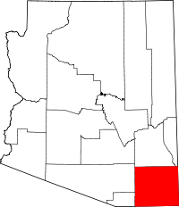
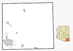
Location in the state of Arizona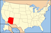
Arizona's location in the U.S.Founded February 1, 1881 Seat Bisbee Largest city Sierra Vista Area
- Total
- Land
- Water
6,218.77 sq mi (16,107 km²)
6,169.45 sq mi (15,979 km²)
49.32 sq mi (128 km²), 0.79%Population
- (2010)
- Density
131,346
21/sq mi (8.2/km²)Time zone Mountain: UTC-7 Website www.cochise.az.gov Cochise County is a county located in the southeastern corner of the U.S. state of Arizona. The population was 131,346 at the 2010 census.[1] The county seat is Bisbee.[2] Cochise County is also considered the Sierra Vista-Douglas Micropolitan Area.
Contents
History
Cochise County was created on February 1, 1881, out of the eastern portion of Pima County. It took its name from the legendary Chiricahua Apache war chief Cochise.[3] The county seat was Tombstone until 1929 when it moved to Bisbee. Notable men who once held the position of County Sheriff were Johnny Behan, who served as the first sheriff of the new county, and who was one of the main characters during the events leading to and following the Gunfight at the O.K. Corral. Later, in 1886, Texas John Slaughter became sheriff. Lawman Jeff Milton and lawman/outlaw Burt Alvord both served as deputies under Slaughter.
A syndicated television series which aired from 1956 to 1958, Sheriff of Cochise starring John Bromfield, was filmed in Bisbee. The Jimmy Stewart movie Broken Arrow and subsequent television show of the same name starring John Lupton, which also aired from 1956 to 1958, took place (but was not filmed) in Cochise County.
J.A. Jance's Joanna Brady mystery series takes place in Cochise County, with Brady being the sheriff.
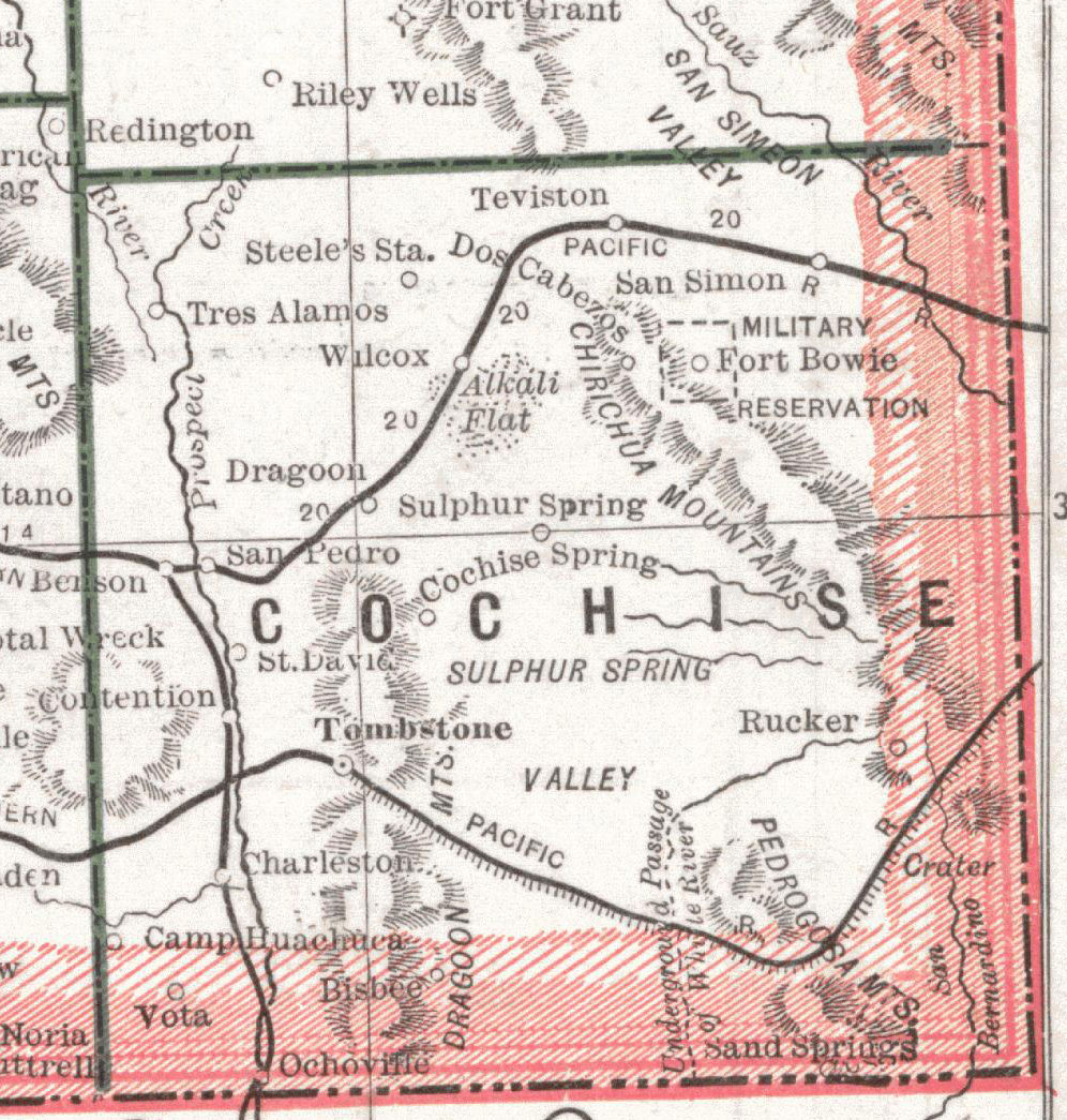
Geography
According to the 2000 census, the county has a total area of 6,218.77 square miles (16,106.5 km2), of which 6,169.45 square miles (15,978.8 km2) (or 99.21%) is land and 49.32 square miles (127.7 km2) (or 0.79%) is water.[4] Cochise County is as big as Rhode Island and Connecticut combined.
Adjacent counties and municipios
- Santa Cruz County, Arizona - southwest
- Pima County, Arizona - west
- Graham County, Arizona - north
- Greenlee County, Arizona - northeast
- Hidalgo County, New Mexico - east
- Agua Prieta, Sonora, Mexico - south
- Cananea, Sonora, Mexico - south
- Naco, Sonora, Mexico - south
- Santa Cruz, Sonora, Mexico - south
Transportation
Major highways
 Interstate 10
 U.S. Route 191
 State Route 80
 State Route 82
 State Route 90
 State Route 92
 State Route 186
Airports
Bisbee Municipal Airport is owned by the City of Bisbee and located five nautical miles (9 km) southeast of its central business district[5]
Demographics
Historical populations Census Pop. %± 1890 6,938 — 1900 9,251 33.3% 1910 34,591 273.9% 1920 46,465 34.3% 1930 40,998 −11.8% 1940 34,627 −15.5% 1950 31,488 −9.1% 1960 55,039 74.8% 1970 61,910 12.5% 1980 85,686 38.4% 1990 97,624 13.9% 2000 117,755 20.6% 2010 131,346 11.5% U.S. Decennial Census 2010
Whereas according to the 2010 U.S. Census Bureau:
- 78.5% White
- 4.2% Black
- 1.2% Native American
- 1.9% Asian
- 0.3% Native Hawaiian or Pacific Islander
- 4.0% Two or more races
- 9.6% Other races
- 32.4% Hispanic or Latino (of any race)
2000
As of the census[6] of 2000, there were 117,755 people, 43,893 households, and 30,768 families residing in the county. The population density was 19 people per square mile (7/km²). There were 51,126 housing units at an average density of 8 per square mile (3/km²). The racial makeup of the county was 76.66% White, 4.52% Black or African American, 1.15% Native American, 1.65% Asian, 0.26% Pacific Islander, 12.05% from other races, and 3.72% from two or more races. 30.69% of the population were Hispanic or Latino of any race. 25.35% reported speaking Spanish at home, while 1.31% speak German [1].
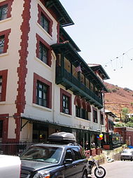 The Copper Queen Hotel in Bisbee
There were 43,893 households out of which 32.00% had children under the age of 18 living with them, 55.10% were married couples living together, 11.10% had a female householder with no husband present, and 29.90% were non-families. 25.30% of all households were made up of individuals and 10.10% had someone living alone who was 65 years of age or older. The average household size was 2.55 and the average family size was 3.07.
In the county the population was spread out with 26.30% under the age of 18, 9.30% from 18 to 24, 26.00% from 25 to 44, 23.70% from 45 to 64, and 14.70% who were 65 years of age or older. The median age was 37 years. For every 100 females there were 101.60 males. For every 100 females age 18 and over, there were 101.20 males.
The median income for a household in the county was $32,105, and the median income for a family was $38,005. Males had a median income of $30,533 versus $22,252 for females. The per capita income for the county was $15,988. About 13.50% of families and 17.70% of the population were below the poverty line, including 25.80% of those under age 18 and 10.40% of those age 65 or over.
In 2000, the largest denominational group was the Catholics (with 25,837 adherents) and Evangelical Protestants (with 12,548 adherents).[7] The largest religious bodies were The Catholic Church (with 25,837 members) and The Southern Baptist Convention (with 5,999 members).[7]
Communities
Cities
Town
Census-designated places
Other places
- Ash Creek
- Amber
- Bowie
- Babocomari
- Cascabel
- Charleston
- Cochise
- Contention City
- Stewart District
- Sunizona
- Sunnyside
- Sunsites
- Tintown
- Tres Alamos
Protected areas
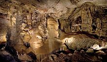 The Big Room in Kartchner Caverns
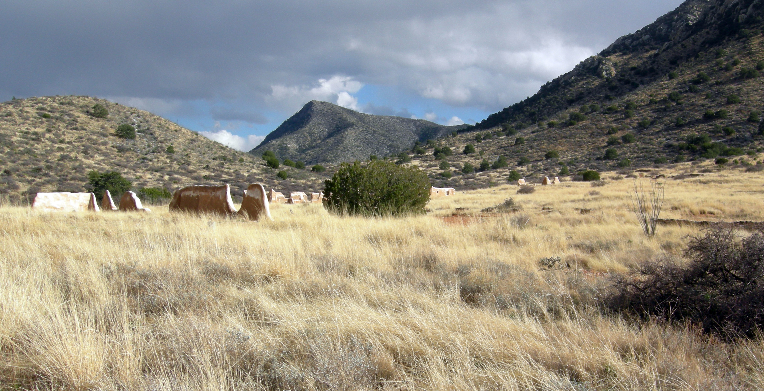
 Fort Bowie site near Apache Pass.
- Chiricahua National Monument
- Coronado National Forest
- Coronado National Memorial
- Fort Bowie National Historic Site
- Kartchner Caverns State Park
- San Pedro Riparian National Conservation Area
Military sites
- Fort Huachuca
- Willcox Playa (proving ground)
See also
References
- ^ http://2010.census.gov/2010census/data/
- ^ "Find a County". National Association of Counties. http://www.naco.org/Counties/Pages/FindACounty.aspx. Retrieved 2011-06-07.
- ^ "Cochise County Arizona". County Website. Cochise County. 2009. http://www.cochise.az.gov/Default.aspx?id=4104. Retrieved 2009-09-25.
- ^ "Census 2000 U.S. Gazetteer Files: Counties". United States Census. http://www.census.gov/tiger/tms/gazetteer/county2k.txt. Retrieved 2011-02-13.
- ^ FAA Airport Master Record for P04 (Form 5010 PDF)
- ^ "American FactFinder". United States Census Bureau. http://factfinder.census.gov. Retrieved 2008-01-31.
- ^ a b "County Membership Reports". thearda.com. http://www.thearda.com/mapsReports/reports/counties/01001_2000.asp. Retrieved 2011-08-22.
External links
Municipalities and communities of Cochise County, Arizona County seat: Bisbee Cities 
Town CDPs Unincorporated
communitiesGhost towns Cascabel | Charleston | Contention City | Fairbank | Gleeson | Paradise | Tres Alamos
 State of Arizona
Phoenix (capital) Topics Index | Climate | Delegations | Geography | History | Museums | Music | People | Transportation | Visitor Attractions
Society Culture · Demographics · Economy · Education · Politics
Regions Arizona Strip | Arizona Sun Corridor | Coconino Plateau | Colorado Plateau | Grand Canyon | Kaibab Plateau | Mogollon Plateau | Mogollon Rim | Mojave Desert | Monument Valley | North Central Arizona | Northeast Arizona | Northern Arizona | Oak Creek Canyon | Phoenix Metropolitan Area | Safford area | San Francisco Volcanic Field | Sonoran Desert | Southern Arizona | Verde Valley | White Mountains
Counties Cities Chandler | Flagstaff | Gilbert | Glendale | Kingman | Lake Havasu City | Mesa | Peoria | Phoenix | Prescott | Scottsdale | Sierra Vista | Tempe | Tucson | Yuma
Cochise County in the Old West Rural outlaw cowboys and allies vs. business owners, townspeople, and the law Supporting Rural Interests LawmenJohnny Behan • Billy Breakenridge • Phin Clanton • Johnny Ringo • Frank Stilwell
Cowboys,
Smugglers,
RanchersFrederick Bode • William "Curly Bill" Brocius • Billy Claiborne • Ike Clanton • Newman "Old Man" Clanton • Phin Clanton • Jim Crane • "Indian Charlie" Cruz • Pony Diehl • Harry "The Kid" Head • Bill Hicks • Milt Hicks • Bill Johnson • Luther King • Bill Leonard • "Buckskin Frank" Leslie • Ed Lyle • Johnny Lyle • Frank McLaury • Tom McLaury • Frank Patterson • Johnny Ringo • Pete Spence • Frank Stilwell
Supporting Town Interests LawmenJohn Clum • Crawley Dake • Wyatt Earp • Warren Earp • Morgan Earp • Virgil Earp • George McKelvey • Bob Paul • Charles A. Shibell • Ben Sippy • John Slaughter • Fred White
Gamblers,
Businessmen,
Cowboys,
RanchersFred Dodge • James Earp • Jack "Turkey Creek" Johnson • Doc Holliday • Henry Hooker • Sherman McMaster • George W. Parsons • Charles "Hairlip Charlie" Smith • John "Texas Jack" Vermillion • Daniel "Tip" Tipton • Marshall Williams
Conflicts and Events Locations Benson • Bisbee • Cerro Colorado • Charleston • Contention • Fairbank • Fort Huachuca • Richmond • Tombstone • Tucson • Yuma
Coordinates: 31°52′50″N 109°45′13″W / 31.88056°N 109.75361°WCategories:- Arizona counties
- Cochise County, Arizona
- 1881 establishments in the United States
- Cochise County conflict
- Populated places established in 1881


Wikimedia Foundation. 2010.