- Chiricahua National Monument
-
Chiricahua National Monument IUCN Category III (Natural Monument)
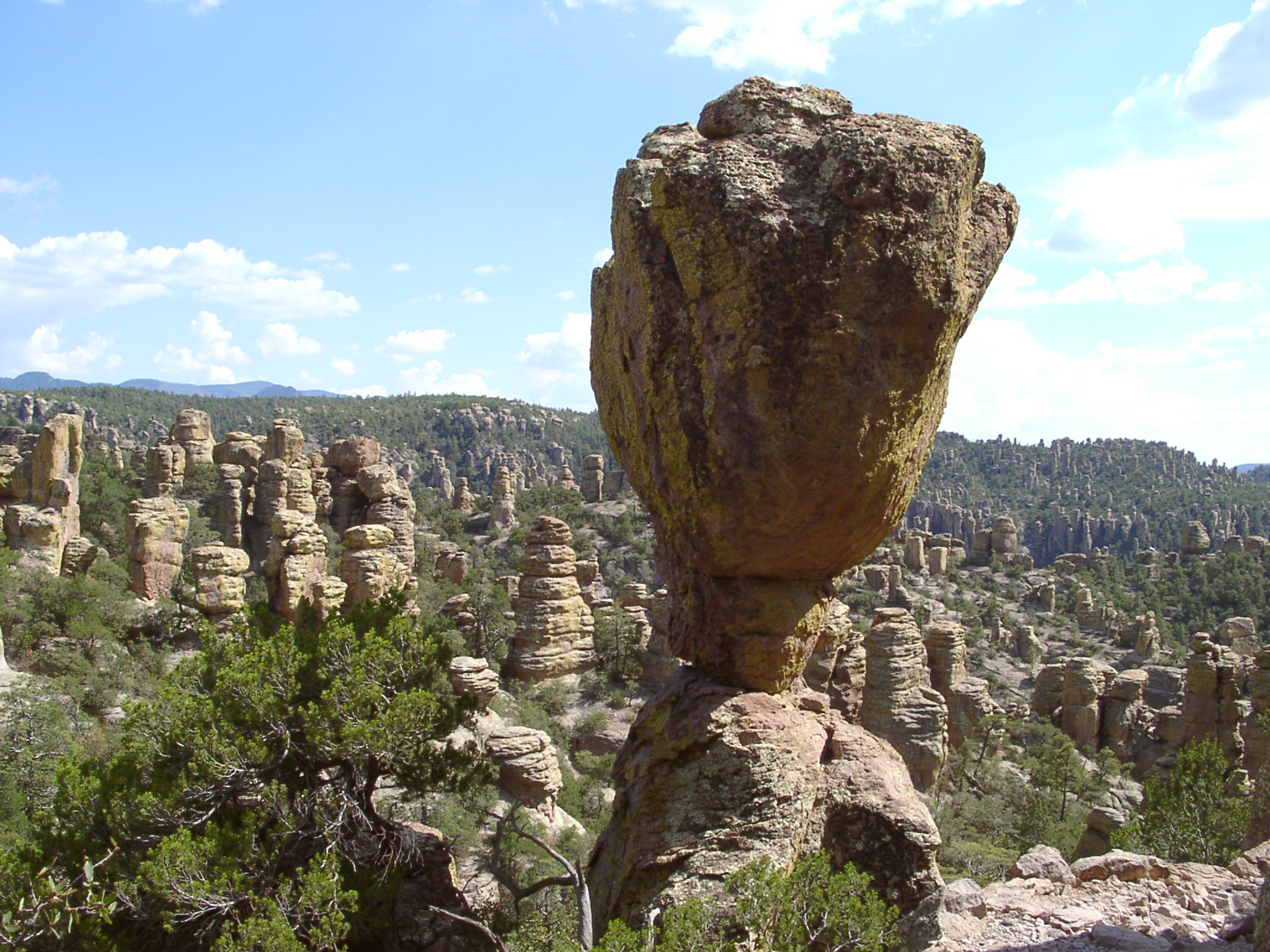
The Balanced Rock formation

Location Cochise County, Arizona, USA Nearest city Willcox, AZ Coordinates 32°00′20″N 109°21′24″W / 32.00569°N 109.35672°WCoordinates: 32°00′20″N 109°21′24″W / 32.00569°N 109.35672°W Area 11,985 acres (4,850 ha)[1] Created April 18, 1924 Visitors 1,253,637 (in 2010)[2] Governing body National Park Service Chiricahua National Monument is a unit of the National Park Service located in the Chiricahua Mountains. It is famous for its extensive vertical rock formations. The monument is located approximately 36 miles (58 km) southeast of Willcox, Arizona. It preserves the remains of an immense volcanic eruption that shook the region some 27 million years ago. Called the Turkey Creek Caldera eruption, it eventually laid down two thousand feet of ash and pumice, highly siliceous in nature. This eventually hardened into rhyolite tuffs, and eroded into the natural features visible at the monument today.[3]
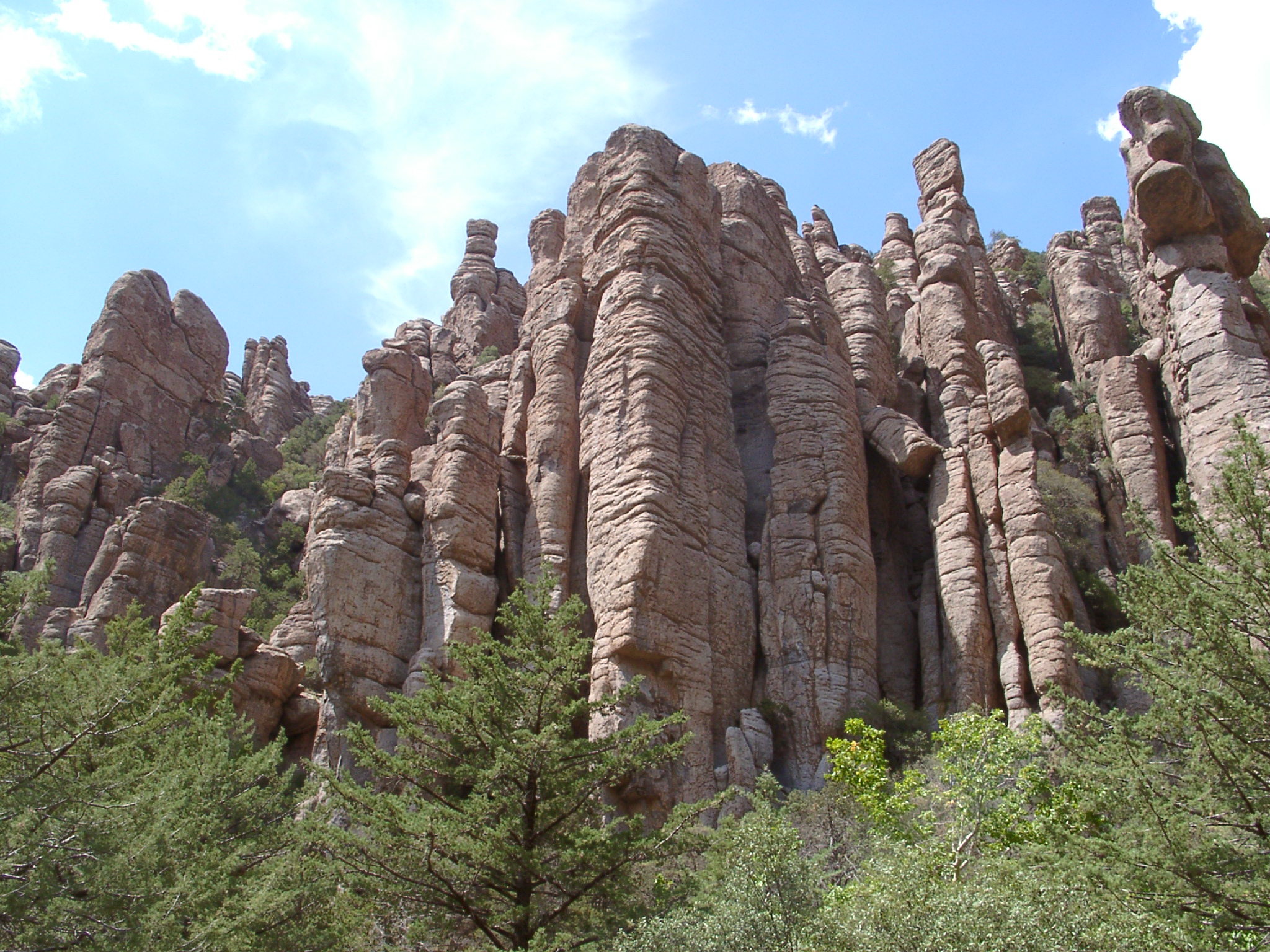
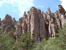 Stone columns are the most common formation in the monument
The National Monument was created on April 18, 1924. The national monument also preserves the Faraway Ranch, owned at one time by Swedish immigrants Neil and Emma Erickson.[4]
In 2008, the Chiricahua National Monument Historic Designed Landscape, covering roughly 80% of the National Monument, was listed on the National Register of Historic Places.[5]
See also
- Chiricahua National Monument Historic Designed Landscape
- Faraway Ranch Historic District
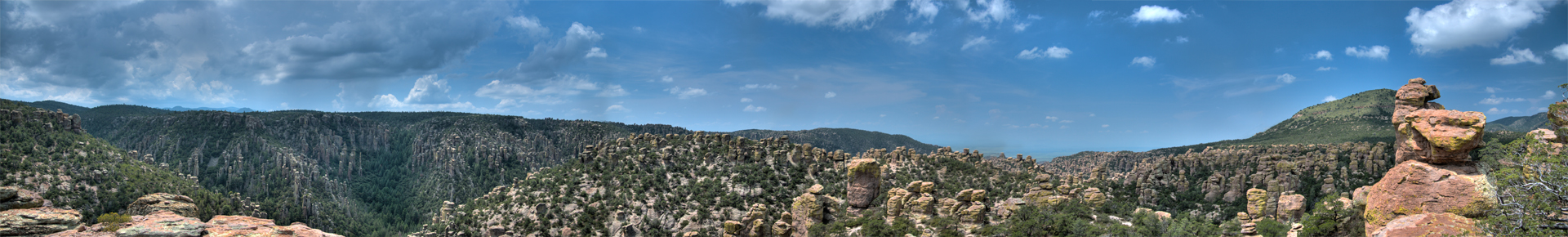
 180° panoramic view from high in the Chiricahua Mountains
References
- ^ "Listing of acreage as of 12/31/2010". Public Use Statistic Office, National Park Service. http://www.nature.nps.gov/stats/Acreage/acrebypark10cy.pdf. Retrieved 2011-07-03.
- ^ "Five Year Annual Recreation Visits Report". Public Use Statistic Office, National Park Service. http://www.nature.nps.gov/stats/viewReport.cfm?selectedReport=SystemComparisonReport.cfm. Retrieved 2011-07-03.
- ^ "Geology Field Notes: Chiricahua National Monument, Arizona". National Park Service. http://www.nature.nps.gov/geology/parks/chir/index.cfm. Retrieved 2011-07-03.
- ^ "Chiricahua National Monument: Nature & Science". National Park Service. http://www.nps.gov/chir/naturescience/index.htm. Retrieved 2011-07-03.
- ^ "National Register Information System". National Register of Historic Places. National Park Service. 2009-03-13. http://nrhp.focus.nps.gov/natreg/docs/All_Data.html.
External links
- "Chiricahua National Monument". National Park Service. http://www.nps.gov/chir/index.htm. Retrieved 2011-07-03.
U.S. National Register of Historic Places Topics Lists by states Alabama • Alaska • Arizona • Arkansas • California • Colorado • Connecticut • Delaware • Florida • Georgia • Hawaii • Idaho • Illinois • Indiana • Iowa • Kansas • Kentucky • Louisiana • Maine • Maryland • Massachusetts • Michigan • Minnesota • Mississippi • Missouri • Montana • Nebraska • Nevada • New Hampshire • New Jersey • New Mexico • New York • North Carolina • North Dakota • Ohio • Oklahoma • Oregon • Pennsylvania • Rhode Island • South Carolina • South Dakota • Tennessee • Texas • Utah • Vermont • Virginia • Washington • West Virginia • Wisconsin • WyomingLists by territories Lists by associated states Other  Category:National Register of Historic Places •
  Portal:National Register of Historic Places
Natural features Chiricahua Peak · Iron Springs · Malpai Borderlands · Miller Peak · Mount Ballard · Mount Glenn · Parker Canyon Lake · San Bernardino Valley · San Pedro River · San Pedro Valley · San Simon Valley · Sulphur Springs Valley · Skeleton Canyon · Texas Canyon · Willcox Playa
Mountain ranges Chiricahua · Dos Cabezas · Dragoon · Guadalupe · Huachuca · Little Dragoon · Little Rincon · Mule · Mustang · Pedrogosa · Perilla · Peloncillo · Swisshelm · Whetstone Mountains
Environment & Protected areas Chiricahua National Monument · Coronado National Memorial · Kartchner Caverns State Park · Lehner Mammoth-Kill Site · Leslie Canyon National Wildlife Refuge · Naco-Mammoth Kill Site · San Bernardino National Wildlife Refuge · San Pedro Riparian Area · Southeastern Arizona Bird Observatory
National Register of Historic
Places listingsChiricahua National Monument Historic Designed Landscape · Faraway Ranch Historic District · Tombstone Courthouse State Historic Park
History: Cochise County in the Old West · Apaches · Battle of Apache Pass · Bird Cage Theatre · William Brocius · Camp Rucker · Charleston, Arizona · Chiricahua · Contention City, Arizona · Ike Clanton · Cochise · Doc Holliday · Gunfight at the O.K. Corral · Earp Vendetta Ride · Virgil Earp · Warren Earp · Wyatt Earp · C. S. Fly · Skeleton Canyon · Tres Alamos, Arizona · Frank Stilwell · Texas Jack Vermillion · Fred White
Categories:- IUCN Category III
- Chiricahua Mountains
- Rock formations in Arizona
- Protected areas of Cochise County, Arizona
- National Park Service National Monuments in Arizona
- Protected areas established in 1924
- Landforms of Cochise County, Arizona
- Arizona geography stubs
- Western United States protected area stubs

Wikimedia Foundation. 2010.