- Dead Horse Ranch State Park
-
Dead Horse Ranch State Park Arizona State Park Dead Horse Ranch State ParkCountry  United States
State  Arizona
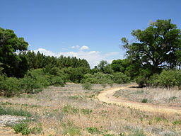
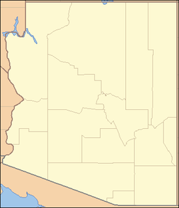
County Yavapai Location Cottonwood - elevation 3,327 ft (1,014 m) [1] - coordinates 34°45′8″N 112°0′44″W / 34.75222°N 112.01222°W Area 423 acres (171.2 ha) Founded 1972 Management Arizona State Parks Dead Horse Ranch State Park is a state park of Arizona, USA, on the Verde River in an area known as the Verde River Greenway.[2] Located at approximately 3,300 feet (1,000 m) elevation, Dead Horse Ranch State Park covers 423 acres (1.71 km2) of land with 10 miles (16 km) of hiking trails, 150 campground sites and several picnic areas, along with 23 group camping sites. It also offers trailhead access to the Dead Horse Trail System, located on adjacent Coconino National Forest land. The ranch was originally named by the Ireys family, who sold the land to the state of Arizona to become a state park.
Special events
The annual Verde Valley Birding and Nature Festival, the "Birdy Verde", with emphasis on birdwatching, is held each April. In 2010, about 70 field trips were offered for the four day event, many led by nationally recognized experts. Headquarters for the festival is at Dead Horse Ranch, but events are held throughout the Verde Valley.[3]
Another popular yearly event at Dead Horse Ranch State Park is Verde River Day, which is held annually in September to celebrate the protection of the river's riparian habitat.
References
- ^ "Dead Horse Ranch State Park". Geographic Names Information System. United States Geological Survey. 1984-06-27. http://geonames.usgs.gov/pls/gnispublic/f?p=gnispq:3:::NO::P3_FID:38397. Retrieved 2011-03-12.
- ^ Arizona State Parks. "Dead Horse Ranch State Park". http://azstateparks.com/Parks/DEHO/index.html.
- ^ Verde Valley Birding & Nature Festival. "Verde Valley Birding & Nature Festival". http://www.birdyverde.org/.
External links
Protected Areas of Arizona Federal Gila Box Riparian · Las Cienegas · San Pedro RiparianArizona National Scenic Trail · Juan Bautista de Anza National Historic Trail · Old Spanish National Historic TrailBill Williams River · Buenos Aires · Cabeza Prieta · Cibola · Havasu · Imperial · Kofa · Leslie Canyon · San BernardinoOtherCoronado National Memorial · Elden Pueblo · Glen Canyon National Recreation Area · Lake Mead National Recreation Area · Palatki Heritage Site · V-Bar-V Heritage SiteState Western RegionAlamo Lake · Buckskin Mountain · Cattail Cove · Lake Havasu · River Island · Yuma Quartermaster Depot · Yuma Territorial PrisonNorthern RegionDead Horse Ranch · Fort Verde · Homolovi · Jerome · Red Rock · Riordan Mansion · Slide Rock · Verde River GreenwayEastern RegionBoyce Thompson Arboretum · Catalina · Fool Hollow Lake · Lost Dutchman · Lyman Lake · McFarland · Oracle · Tonto Natural BridgeSouthern RegionKartchner Caverns · Patagonia Lake · Picacho Peak · Roper Lake · San Rafael · Sonoita Creek · Tombstone Courthouse · Tubac PresidioMunicipal Other See List of National Natural Landmarks in ArizonaArizona State Parks (web) Categories:- Arizona state parks
- Parks in Yavapai County, Arizona
- Protected areas established in 1972
Wikimedia Foundation. 2010.


