- Cottonwood, Arizona
-
Cottonwood, Arizona — City — Location in Yavapai County and the state of Arizona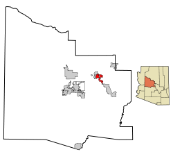
Coordinates: 34°43′56″N 112°1′7″W / 34.73222°N 112.01861°WCoordinates: 34°43′56″N 112°1′7″W / 34.73222°N 112.01861°W Country  United States
State  Arizona
County Yavapai Government - Mayor Diane Joens Area - Total 10.7 sq mi (27.7 km2) - Land 10.7 sq mi (27.6 km2) - Water 0.0 sq mi (0.0 km2) Elevation 3,314 ft (1,010 m) Population (2007)[1] - Total 10,222 - Density 860.3/sq mi (332.2/km2) Time zone MST (UTC-7) ZIP code 86326 Area code(s) 928 FIPS code 04-16410 Website http://www.ci.cottonwood.az.us/ Cottonwood is a city in Yavapai County, Arizona, United States. According to 2006 Census Bureau estimates, the population of the city is 11,171.[2]
Contents
Geography
Cottonwood is located at 34°43′56″N 112°1′7″W / 34.73222°N 112.01861°W (34.732145, -112.018565).[3]
According to the United States Census Bureau, the city has a total area of 10.7 square miles (28 km2), all land.
Climate
Cottonwood has a semi-arid steppe climate. In January the normal high temperature is 55 °F (13 °C) with a low of 26 °F (−3 °C). In July the normal high temperature is 97 °F (36 °C) with a low of 68 °F (20 °C). Annual precipitation is around 13 inches (33 cm).
Demographics
As of the census[4] of 2000, there were 9,179 people, 3,983 households, and 2,369 families residing in the city. The population density was 860.3 people per square mile (332.1/km²). There were 4,427 housing units at an average density of 414.9 per square mile (160.2/km²). The racial makeup of the city was 85.24% White, 0.49% Black or African American, 1.57% Native American, 0.41% Asian, 0.03% Pacific Islander, 9.66% from other races, and 2.59% from two or more races. 20.53% of the population were Hispanic or Latino of any race.
There were 3,983 households out of which 25.3% had children under the age of 18 living with them, 44.5% were married couples living together, 10.8% had a female householder with no husband present, and 40.5% were non-families. 34.4% of all households were made up of individuals and 19.1% had someone living alone who was 65 years of age or older. The average household size was 2.27 and the average family size was 2.90.
In the city the population was spread out with 23.4% under the age of 18, 8.2% from 18 to 24, 23.3% from 25 to 44, 21.4% from 45 to 64, and 23.8% who were 65 years of age or older. The median age was 41 years. For every 100 females there were 86.9 males. For every 100 females age 18 and over, there were 81.4 males.
The median income for a household in the city was $27,444, and the median income for a family was $37,794. Males had a median income of $24,308 versus $19,977 for females. The per capita income for the city was $17,518. About 8.9% of families and 13.5% of the population were below the poverty line, including 19.5% of those under age 18 and 11.3% of those age 65 or over.
References
- ^ "Annual Estimates of the Population for Incorporated Places in Arizona". United States Census Bureau. 2008-07-10. http://www.census.gov/popest/cities/tables/SUB-EST2007-04-04.csv. Retrieved 2008-07-14.
- ^ "Annual Estimates of the Population for All Incorporated Places in Arizona" (CSV). 2006 Population Estimates. U.S. Census Bureau, Population Division. http://www.census.gov/popest/cities/tables/SUB-EST2006-04-04.csv.
- ^ "US Gazetteer files: 2010, 2000, and 1990". United States Census Bureau. 2011-02-12. http://www.census.gov/geo/www/gazetteer/gazette.html. Retrieved 2011-04-23.
- ^ "American FactFinder". United States Census Bureau. http://factfinder.census.gov. Retrieved 2008-01-31.
External links
- Verde Independent - Local newspaper
Municipalities and communities of Yavapai County, Arizona County seat: Prescott Cities 
Towns CDPs Ash Fork | Bagdad | Big Park | Black Canyon City | Congress | Cordes Lakes | Cornville | Lake Montezuma | Mayer | Paulden | Peeples Valley | Seligman | Spring Valley | Verde Village | Wilhoit | Williamson | Yarnell
Unincorporated
communitiesCherry | Cleator | Crown King | Drake | Iron Springs | Kirkland | Red Rock | Skull Valley
Indian reservation Hualapai Indian Reservation
Ghost towns Alexandra | Big Bug | Bradshaw City | Bumble Bee | Catoctin | Cordes | Jerome Junction | Octave | Piedmont | Stanton | Tip Top | Weaver
Footnotes ‡This populated place also has portions in an adjacent county or counties
Categories:- Cities in Arizona
- Populated places in Yavapai County, Arizona


Wikimedia Foundation. 2010.