- Clarkdale, Arizona
-
Clarkdale, Arizona — Town — Location in Yavapai County and the state of Arizona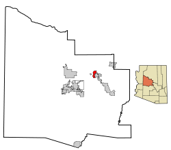
Coordinates: 34°45′40″N 112°3′17″W / 34.76111°N 112.05472°WCoordinates: 34°45′40″N 112°3′17″W / 34.76111°N 112.05472°W Country United States State Arizona County Yavapai Government - Mayor Doug Von Gausig Area - Total 7.5 sq mi (19.4 km2) - Land 7.3 sq mi (19.0 km2) - Water 0.1 sq mi (0.4 km2) Elevation 3,545 ft (1,081 m) Population (2007)[1] - Total 4,188 - Density 466.9/sq mi (180.3/km2) Time zone MST (UTC-7) ZIP code 86324 Area code(s) 928 FIPS code 04-13890 Website http://www.clarkdale.az.us/ Clarkdale is a town in Yavapai County, Arizona, United States. According to 2006 Census Bureau estimates, the population of the town is 3,836.[2]
Clarkdale, formerly a mining town, is now largely a retirement community with an eye for the arts.
Contents
History
Tuzigoot National Monument, a large Sinagua pueblo ruin, is located between Clarkdale and Cottonwood, Arizona, on land donated to the National Park Service by Phelps Dodge in 1938.
Clarkdale was founded in 1912 as a company smelter town by William A. Clark, for his United Verde copper mine in nearby Jerome, Arizona. Clarkdale was built to be one of the most modern mining towns in the world, including telephone, telegraph, electrical, sewer and spring water services, and was an early example of a planned community.[3] The Clark Mansion, a Clarkdale landmark since the United Verde Copper Company heir William Clark III, grandson of Clarkdale's founder William Andrews Clark, built it in the late 1920s, east of town across the Verde River near Pecks Lake. It was destroyed by a suspicious fire June 25, 2010 after setting vacant for years still owned by the Phelps Dodge Corporation.
The town center and business district were built in Spanish Colonial style, and feature the Clark Memorial Clubhouse and Memorial Library, both still in use. The Clubhouse is listed on the National Register of Historic Places. The entire original town site is also on the National Register as the Clarkdale Historic District.[3]
The mine and smelter closed in 1953, and Clarkdale entered hard times. Clarkdale was bought and sold by several different companies. In 1957, Clarkdale was incorporated as a town. The 1959 construction of the Phoenix Cement plant restored a modest prosperity to Clarkdale.[3]
Clarkdale was a segregated town for much of its early history. Mexican and Mexican-American laborers were restricted to living in Patio Town (see neighborhoods), with a separate swimming pool and park; the town swimming pool was marked "whites only." Additionally, Upper Clarkdale was designated for engineers and executives, while Lower Clarkdale was for the "working class."[4]
A portion of the Yavapai-Apache Nation is within Clarkdale's boundaries.[5]
Commerce
The Phoenix Cement plant is Clarkdale's only major industry. The cement plant was built in 1959 to supply Portland cement for the construction of Glen Canyon Dam and is owned by the Salt River Pima-Maricopa Indian Community. Clarkdale is home to the Verde Canyon Railroad, a scenic excursion train that follows part of the route of the Verde Valley Railroad, constructed in 1911-1912 to serve Senator Clark's United Verde Copper Company to Drake and Perkinsville, now ghost towns.[6] Yavapai College also has a campus in Clarkdale.
Several motion pictures have been shot in Clarkdale, including Desert Fury, Midnight Run, Universal Soldier, Benefit of the Doubt and Brothel.[7]
Arts
Clarkdale hosts an annual invitational craft fair each December, Made in Clarkdale, held in the historic Clark Memorial Clubhouse. The Verde Valley Theatre performs community theatre in Clark Memorial Clubhouse, and free concerts are offered in the nearly two-acre Clarkdale Park from May through October.
Neighborhoods
Clarkdale's neighborhoods are not strictly defined, but include:
- Upper Clarkdale, the oldest part of the historic section of town, from 9th Street/Miller's Hill west to 16th Street.
- Lower Clarkdale, east of 9th Street/Miller's Hill, along Main Street to 4th Street and the railroad tracks.
- Riverfront, between 4th Street/railroad and the Verde River (sometimes included in Lower Clarkdale).
- Patio Town, across Bitter Creek between the train depot area and the river.[3]
- Centerville, the oldest development not in the historic site, along Avenida Centerville off of Arizona State Route 89A. Said to be named for its location at the geographical center of Arizona.[3]
- Foothills Terrace, a development west of Arizona State Route 89A along Lisa Street and Lanny Lane.
- Black Hills, north of Black Hills Drive and west of Old Jerome Highway. Site of Yavapai College's Clarkdale campus.
- Bent River, east of Broadway (Historic US Route 89A) along Bent River Road and Old Clarkdale Highway.
- Verde Palisades, west of Broadway along Palisade Drive.
- Giant's Grave, on a bluff north of Arizona State Route 89A along Panorama Way.
- Newer developments, including Lampliter Village, Pine Shadows, Mingus Shadows, Mingus View Estates and Mountain Gate.
- Individual homes in unsubdivided areas, including Haskell Springs, Hawk Hollow Way and Mescal Wash/Tavasci Road.
Education
Clarkdale is the home of Clarkdale-Jerome School District, a one-school district that encompasses both Clarkdale and Jerome. The public school has enrollment from kindergarten to eighth grade.
Mingus Union High School in Cottonwood encompasses Clarkdale for high school students. There are also charter schools in Cottonwood.
Historically, Clarkdale had an elementary school, located in Lower Clarkdale, a junior high school, located at the top of Miller's Hill in Upper Clarkdale, and a high school, next to the junior high school. Clarkdale High School combined with Mingus High School in Jerome in 1960 to form Mingus Union High School, then located in Jerome. The combined high school adopted the name of the Jerome school and the colors of the Clarkdale school. The school then moved to Cottonwood in 1972.[8] In 1985, the junior high school burned down, and a new elementary school was built, becoming the K-8 school at 16th and Main Streets in Upper Clarkdale.
Geography
Clarkdale is located at 34°45′40″N 112°3′17″W / 34.76111°N 112.05472°W (34.761214, -112.054835).[9]
According to the United States Census Bureau, the town has a total area of 7.5 square miles (19 km2), of which, 7.3 square miles (19 km2) of it is land and 0.2 square miles (0.52 km2) of it (2.01%) is water.
Sycamore Canyon Wilderness is located a few miles north of Clarkdale.
Demographics
As of the census[10] of 2000, there were 3,422 people, 1,433 households, and 994 families residing in the town. The population density was 466.9 people per square mile (180.3/km²). There were 1,546 housing units at an average density of 210.9 per square mile (81.4/km²). The racial makeup of the town was 84.51% White, 0.29% Black or African American, 6.81% Native American, 0.35% Asian, 0.06% Pacific Islander, 5.41% from other races, and 2.57% from two or more races. 11.81% of the population were Hispanic or Latino of any race.
There were 1,433 households out of which 22.7% had children under the age of 18 living with them, 58.2% were married couples living together, 7.1% had a female householder with no husband present, and 30.6% were non-families. 25.3% of all households were made up of individuals and 14.0% had someone living alone who was 65 years of age or older. The average household size was 2.39 and the average family size was 2.82.
In the town the population was spread out with 21.5% under the age of 18, 6.2% from 18 to 24, 20.4% from 25 to 44, 26.0% from 45 to 64, and 25.9% who were 65 years of age or older. The median age was 46 years. For every 100 females there were 93.1 males. For every 100 females age 18 and over, there were 89.6 males.
The median income for a household in the town was $34,911, and the median income for a family was $41,250. Males had a median income of $28,824 versus $21,811 for females. The per capita income for the town was $18,441. About 7.4% of families and 10.3% of the population were below the poverty line, including 10.9% of those under age 18 and 7.0% of those age 65 or over.
See also
- William A. Clark
- Phelps Dodge Corporation
- Yavapai-Apache Nation
References
- ^ "Annual Estimates of the Population for Incorporated Places in Arizona". United States Census Bureau. 2008-07-10. http://www.census.gov/popest/cities/tables/SUB-EST2007-04-04.csv. Retrieved 2008-07-14.
- ^ "Annual Estimates of the Population for All Incorporated Places in Arizona" (CSV). 2006 Population Estimates. U.S. Census Bureau, Population Division. http://www.census.gov/popest/cities/tables/SUB-EST2006-04-04.csv.
- ^ a b c d e Clarkdale's history
- ^ About the Town of Clarkdale
- ^ Clarkdale website, "...trust lands of the Yavapai-Apache Nation are located within the town boundary." Last accessed 20 April 2009
- ^ Filled Stopes - Mining Methods of Verde District, Arizona
- ^ Titles with locations including Clarkdale, Arizona, USA, Internet Movie Database
- ^ Mingus Union High School moves from Jerome, Verde News
- ^ "US Gazetteer files: 2010, 2000, and 1990". United States Census Bureau. 2011-02-12. http://www.census.gov/geo/www/gazetteer/gazette.html. Retrieved 2011-04-23.
- ^ "American FactFinder". United States Census Bureau. http://factfinder.census.gov. Retrieved 2008-01-31.
External links
- Official Clarkdale website
- Clarkdale's history
- Clarkdale photo gallery
- Clarkdale community profile, from Arizona Department of Commerce
Municipalities and communities of Yavapai County, Arizona County seat: Prescott Cities Cottonwood | Peoria‡ | Prescott | Sedona‡

Towns Camp Verde | Chino Valley | Clarkdale | Dewey-Humboldt | Jerome | Prescott Valley
CDPs Ash Fork | Bagdad | Big Park | Black Canyon City | Congress | Cordes Lakes | Cornville | Lake Montezuma | Mayer | Paulden | Peeples Valley | Seligman | Spring Valley | Verde Village | Wilhoit | Williamson | Yarnell
Unincorporated
communitiesCherry | Cleator | Crown King | Drake | Iron Springs | Kirkland | Red Rock | Skull Valley
Indian reservation Hualapai Indian Reservation
Ghost towns Alexandra | Big Bug | Bradshaw City | Bumble Bee | Catoctin | Cordes | Jerome Junction | Octave | Piedmont | Stanton | Tip Top | Weaver
Footnotes ‡This populated place also has portions in an adjacent county or counties
Categories:- Towns in Arizona
- Populated places in Yavapai County, Arizona
- Company towns in Arizona


Wikimedia Foundation. 2010.